
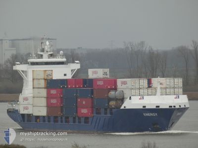
ENERGY
Container Ship
Current Trip
| Trip Time | 15 h, 11 mins |
|---|---|
| Trip Distance | 203.52 nm |
| AVG Speed | 11.7 Knots |
| MAX Speed | 15.9 Knots |
| Draught | 6.6 m |
| AVG Wind | 5.1 knots |
| MAX Wind | 11.4 knots |
| MIN Temp | 10.7°C / 51.26°F |
| MAX Temp | 14.9°C / 58.82°F |
| Position Received | 3 m ago |
Current Position
| Longitude | 4.39844° |
|---|---|
| Latitude | 51.88119° |
| Status | Moored |
| Speed | |
| Course | 262° |
| Area | North Sea |
| Station | T-AIS |
| Position Received | 3 m ago |
Info
Information
The current position of ENERGY is in North Sea with coordinates 51.88119° / 4.39844° as reported on 2024-05-18 00:54 by AIS to our vessel tracker app. The vessel's current speed is 0 Knots and is currently inside the port of ROTTERDAM PERNIS.
The vessel ENERGY (IMO: 9255787, MMSI: 255806300) is a Container Ship that was built in 2004 ( 20 years old ). It's sailing under the flag of [PT] Portugal.
In this page you can find informations about the vessels current position, last detected port calls, and current voyage information. If the vessels is not in coverage by AIS you will find the latest position.
The current position of ENERGY is detected by our AIS receivers and we are not responsible for the reliability of the data. The last position was recorded while the vessel was in Coverage by the Ais receivers of our vessel tracking app.
The current draught of ENERGY as reported by AIS is 6.6 meters
Weather
| Temperature | 13.2°C / 55.76°F |
|---|---|
| Wind Speed | 5 knots |
| Direction | 325° NW |
| Pressure | 1009.5 hPa |
| Humidity | 96.9 % |
| Cloud Coverage | 100 % |
Featured Company
Last Port Calls
| Port | Arrival | Departure | Time In Port |
|---|---|---|---|
| 2024-05-17 04:59 | |||
| 2024-05-16 01:29 | 2024-05-16 13:48 | 12 h | |
| 2024-05-13 10:39 | 2024-05-13 14:03 | 3 h | |
| 2024-05-12 23:26 | 2024-05-13 08:04 | 8 h | |
| 2024-05-10 19:01 | 2024-05-11 06:21 | 11 h | |
| 2024-05-08 19:54 | 2024-05-09 22:44 | 1 d | |
| 2024-05-06 14:31 | 2024-05-06 21:07 | 6 h | |
| 2024-05-05 18:55 | 2024-05-06 11:51 | 16 h | |
| 2024-05-03 22:56 | 2024-05-03 23:05 | 8 m | |
| 2024-05-03 05:56 | 2024-05-03 22:55 | 16 h |
Last Trips
| Origin | Departure | Destination | Arrival | Distance | |
|---|---|---|---|---|---|
| 2024-05-16 14:48 | 2024-05-17 06:59 | 203.52 nm | |||
| 2024-05-13 16:03 | 2024-05-16 02:29 | 552.18 nm | |||
| 2024-05-13 10:04 | 2024-05-13 12:39 | 35.27 nm | |||
| 2024-05-11 08:21 | 2024-05-13 01:26 | 552.47 nm | |||
| 2024-05-10 01:44 | 2024-05-10 21:01 | 128.83 nm | |||
| 2024-05-06 23:07 | 2024-05-08 22:54 | 564.07 nm | |||
| 2024-05-06 13:51 | 2024-05-06 16:31 | 35.35 nm | |||
| 2024-05-04 01:05 | 2024-05-05 20:55 | 559.21 nm | |||
| 2024-05-04 00:55 | 2024-05-04 00:56 | 0.04 nm | |||
| 2024-05-02 16:06 | 2024-05-03 07:56 | 202.88 nm |
Events
| Time | Event | Details | Position / Dest | Info |
|---|---|---|---|---|
| 2024-05-17 05:36 | Status Changed | Moored Under way using engine |
51.88112 / 4.39847
[NL] ROTTERDAM PERNIS
|
Speed: Course: 262° |
| 2024-05-17 05:01 | STOP Moving |
51.88106 / 4.39930
[NL] ROTTERDAM PERNIS
|
Speed: 0.3 kn Course: 253° |
|
| 2024-05-17 04:59 | PORT ARRIVAL |
|
51.88104 / 4.39952
[NL] ROTTERDAM PERNIS
|
Speed: 0.6 kn Course: 262° |
| 2024-05-17 00:23 | Change Sea Area | Dutch part of the North Sea United Kingdom part of the North Sea |
52.23614 / 3.14654
North Sea
NLRTM
|
Speed: 14.8 kn Course: 129.6° |
| 2024-05-17 00:21 | Status Changed | Under way using engine Default |
52.23980 / 3.13932
NLRTM
|
Speed: 14.9 kn Course: 129° |
| 2024-05-17 00:08 | IN Coverage |
52.23614 / 3.14654
North Sea
NLRTM
|
Speed: 14.8 kn Course: 129.6° |
|
| 2024-05-16 22:52 | Status Changed | Default Under way using engine |
52.46537 / 2.65627
NLRTM
|
Speed: 14.8 kn Course: 125.4° |
| 2024-05-16 22:46 | OUT of Coverage |
52.48019 / 2.62155
North Sea
NLRTM
|
Speed: 14.8 kn Course: 125.4° |
|
| 2024-05-16 22:45 | Status Changed | Under way using engine Default |
52.48378 / 2.61328
NLRTM
|
Speed: 14.8 kn Course: 127° |
| 2024-05-16 22:33 | Status Changed | Default Under way using engine |
52.51358 / 2.54882
NLRTM
|
Speed: 14.8 kn Course: 132.7° |