
ENGAGE_RIVAL
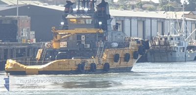
Tug
Current Trip
| Time Travelled | 7 days |
|---|---|
| Remaining Time | --- |
| Distance Travelled | 70.93 nm |
| Remaining Distance | --- |
| AVG Speed | 10.3 Knots |
| MAX Speed | 12.1 Knots |
| AVG Wind | 4.6 knots |
| MAX Wind | 8.6 knots |
| MIN Temp | 7.2°C / 44.96°F |
| MAX Temp | 12.2°C / 53.96°F |
| Draught | 4.2 m |
| Position Received | 2 m ago |
Current Position
| Longitude | 146.82437° |
|---|---|
| Latitude | -41.14991° |
| Status | Under way using engine |
| Speed | |
| Course | --- |
| Area | Bass Strait |
| Station | T-AIS |
| Position Received | 2 m ago |
Info
Information
The current position of ENGAGE_RIVAL is in Bass Strait with coordinates -41.14991° / 146.82437° as reported on 2024-06-24 13:18 by AIS to our vessel tracker app. The vessel's current speed is 0 Knots
The vessel ENGAGE_RIVAL (IMO: 9012197, MMSI: 503000192) is a Tug It's sailing under the flag of [AU] Australia.
In this page you can find informations about the vessels current position, last detected port calls, and current voyage information. If the vessels is not in coverage by AIS you will find the latest position.
The current position of ENGAGE_RIVAL is detected by our AIS receivers and we are not responsible for the reliability of the data. The last position was recorded while the vessel was in Coverage by the Ais receivers of our vessel tracking app.
The current draught of ENGAGE_RIVAL as reported by AIS is 4.2 meters
Weather
| Temperature | 5.4°C / 41.72°F |
|---|---|
| Wind Speed | 2 knots |
| Direction | 113° ESE |
| Pressure | 1016 hPa |
| Humidity | 96.3 % |
| Cloud Coverage | 100 % |
Featured Company
Last Port Calls
| Port | Arrival | Departure | Time In Port |
|---|---|---|---|
| 2024-06-16 23:16 | 2024-06-16 23:52 | 36 m | |
| 2024-06-16 22:27 | 2024-06-16 22:48 | 20 m | |
| 2024-06-15 06:36 | 2024-06-15 07:42 | 1 h | |
| 2024-06-08 14:21 | 2024-06-08 14:58 | 36 m | |
| 2024-06-07 05:56 | 2024-06-07 06:59 | 1 h | |
| 2024-06-07 04:32 | 2024-06-07 04:48 | 16 m | |
| 2024-05-28 09:24 | 2024-05-28 10:22 | 57 m | |
| 2024-05-26 21:40 | 2024-05-26 22:46 | 1 h | |
| 2024-05-23 11:47 | 2024-05-23 12:04 | 16 m | |
| 2024-05-21 21:43 | 2024-05-21 22:48 | 1 h |
Most Visited Ports (Last year)
| Port | Arrivals | |
|---|---|---|
| 80 | ||
| 19 | ||
| 2 | ||
| 2 | ||
| 1 |
Last Trips
| Origin | Departure | Destination | Arrival | Distance | |
|---|---|---|---|---|---|
| 2024-06-17 08:48 | 2024-06-17 09:16 | 0.22 nm | |||
| 2024-06-15 17:42 | 2024-06-17 08:27 | 2.34 nm | |||
| 2024-06-09 00:58 | 2024-06-15 16:36 | 146.64 nm | |||
| 2024-06-07 16:59 | 2024-06-09 00:21 | 4.93 nm | |||
| 2024-06-07 14:48 | 2024-06-07 15:56 | 4.44 nm | |||
| 2024-05-28 20:22 | 2024-06-07 14:32 | 142.68 nm | |||
| 2024-05-27 08:46 | 2024-05-28 19:24 | 2.40 nm | |||
| 2024-05-23 22:04 | 2024-05-27 07:40 | 146.24 nm | |||
| 2024-05-22 08:48 | 2024-05-23 21:47 | 3.09 nm | |||
| 2024-05-02 08:10 | 2024-05-22 07:43 | 158.84 nm |
Events
| Time | Event | Details | Position / Dest | Info |
|---|---|---|---|---|
| 2024-06-24 08:01 | Status Changed | Under way using engine Default |
-41.14992 / 146.82433
BELL BAY
|
Speed: Course: 350° |
| 2024-06-24 08:00 | Status Changed | Default Under way using engine |
-41.14991 / 146.82434
BELL BAY
|
Speed: Course: 348° |
| 2024-06-24 05:05 | IN Coverage |
-41.14993 / 146.82434
Bass Strait
|
Speed: Course: 62.9° |
|
| 2024-06-24 02:14 | OUT of Coverage |
-41.14990 / 146.82434
Bass Strait
|
Speed: Course: 164° |
|
| 2024-06-23 21:44 | IN Coverage |
-41.14990 / 146.82430
Bass Strait
|
Speed: Course: 131.1° |
|
| 2024-06-17 06:48 | OUT of Coverage |
-41.14989 / 146.82437
Bass Strait
BELL BAY
|
Speed: Course: 225.9° |
|
| 2024-06-17 06:46 | STOP Moving | 1.81 nm, South West of BELL BAY |
-41.14990 / 146.82431
BELL BAY
|
Speed: 0.3 kn Course: 336° |
| 2024-06-17 06:09 | Status Changed | Under way using engine Default |
-41.06116 / 146.77635
BELL BAY
|
Speed: 11 kn Course: 128° |
| 2024-06-17 06:08 | Status Changed | Default Under way using engine |
-41.05966 / 146.77376
BELL BAY
|
Speed: 9.9 kn Course: 125° |
| 2024-06-17 05:30 | Status Changed | Under way using engine Default |
-41.01227 / 146.64743
BELL BAY
|
Speed: 10.3 kn Course: 103° |