
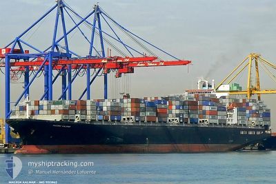
EPAMINONDAS
Container Ship
Current Trip
| Time Travelled | 5 days |
|---|---|
| Remaining Time | 5 days |
| Distance Travelled | 2215.14 nm |
| Remaining Distance | 2337.50 nm |
| AVG Speed | 17.5 Knots |
| MAX Speed | 21 Knots |
| AVG Wind | 13.2 knots |
| MAX Wind | 26 knots |
| MIN Temp | 16.8°C / 62.24°F |
| MAX Temp | 29.3°C / 84.74°F |
| Draught | 10.4 m |
| Position Received | 4 d ago |
Current Position
| Longitude | 153.94591° |
|---|---|
| Latitude | -27.43722° |
| Status | Under way using engine |
| Speed | 17.2 Knots |
| Course | 3.1° |
| Area | Coral Sea |
| Station | T-AIS |
| Position Received | 4 d ago |
Info
Information
The current position of EPAMINONDAS is in Coral Sea with coordinates -27.43722° / 153.94591° as reported on 2024-05-29 03:05 by AIS to our vessel tracker app. The vessel's current speed is 17.2 Knots and is heading at the port of BUSAN. The estimated time of arrival as calculated by vessel tracking app is 2024-06-07 12:48 LT
The vessel EPAMINONDAS (IMO: 9153862, MMSI: 636020350) is a Container Ship that was built in 1998 ( 26 years old ). It's sailing under the flag of [LR] Liberia.
In this page you can find informations about the vessels current position, last detected port calls, and current voyage information. If the vessels is not in coverage by AIS you will find the latest position.
The current position of EPAMINONDAS is detected by our AIS receivers and we are not responsible for the reliability of the data. The last position was recorded while the vessel was in Coverage by the Ais receivers of our vessel tracking app.
The current draught of EPAMINONDAS as reported by AIS is 10.4 meters
Weather
| Temperature | 29°C / 84.2°F |
|---|---|
| Wind Speed | 4 knots |
| Direction | 134° SE |
| Pressure | 1008.6 hPa |
| Humidity | 73.7 % |
| Cloud Coverage | 33 % |
Featured Company
Last Port Calls
| Port | Arrival | Departure | Time In Port |
|---|---|---|---|
| 2024-05-26 05:31 | 2024-05-28 01:20 | 1 d | |
| 2024-05-21 10:39 | 2024-05-23 02:35 | 1 d | |
| 2024-05-16 19:41 | 2024-05-18 09:04 | 1 d | |
| 2024-05-06 06:12 | 2024-05-07 04:44 | 22 h | |
| 2024-05-04 05:28 | 2024-05-04 19:19 | 13 h | |
| 2024-05-03 02:13 | 2024-05-03 10:56 | 8 h | |
| 2024-04-25 16:19 | 2024-04-26 17:04 | 1 d | |
| 2024-04-21 13:39 | 2024-04-22 00:16 | 10 h | |
| 2024-04-19 17:44 | |||
| 2024-04-07 23:57 | 2024-04-09 07:26 | 1 d |
Last Trips
| Origin | Departure | Destination | Arrival | Distance | |
|---|---|---|---|---|---|
| 2024-05-23 12:35 | 2024-05-26 15:31 | 648.63 nm | |||
| 2024-05-18 19:04 | 2024-05-21 20:39 | 1109.75 nm | |||
| 2024-05-07 12:44 | 2024-05-17 05:41 | 4071.36 nm | |||
| 2024-05-05 03:19 | 2024-05-06 14:12 | 61.48 nm | |||
| 2024-05-03 18:56 | 2024-05-04 13:28 | 96.96 nm | |||
| 2024-04-27 01:04 | 2024-05-03 10:13 | 1049.07 nm | |||
| 2024-04-22 08:16 | 2024-04-26 00:19 | 514.48 nm | |||
| 2024-04-20 02:44 | 2024-04-21 21:39 | 498.33 nm | |||
| 2024-04-07 02:28 | 2024-04-08 09:57 | 547.83 nm | |||
| 2024-04-03 07:21 | 2024-04-05 03:58 | 594.03 nm |
Events
| Time | Event | Details | Position / Dest | Info |
|---|---|---|---|---|
| 2024-05-29 03:13 | Status Changed | Default Under way using engine |
-27.39806 / 153.94948
KRPUS
|
Speed: 17.2 kn Course: 3.1° |
| 2024-05-29 03:05 | OUT of Coverage |
-27.43722 / 153.94591
Coral Sea
KRPUS
|
Speed: 17.2 kn Course: 3.1° |
|
| 2024-05-29 03:01 | Status Changed | Under way using engine Default |
-27.45545 / 153.94470
KRPUS
|
Speed: 17.2 kn Course: 4° |
| 2024-05-29 02:45 | Status Changed | Default Under way using engine |
-27.53175 / 153.93866
KRPUS
|
Speed: 17.2 kn Course: 5° |
| 2024-05-29 02:27 | Status Changed | Under way using engine Default |
-27.61564 / 153.93063
KRPUS
|
Speed: 17.1 kn Course: 5° |
| 2024-05-29 02:21 | Status Changed | Default Under way using engine |
-27.64654 / 153.92734
KRPUS
|
Speed: 16.8 kn Course: 6.4° |
| 2024-05-29 01:50 | Change Sea Area | Australian part of the Coral Sea Australian part of the Tasman Sea |
-27.79055 / 153.91239
Coral Sea
KRPUS
|
Speed: 16.9 kn Course: 5.3° |
| 2024-05-29 01:50 | Status Changed | Under way using engine Default |
-27.79055 / 153.91239
KRPUS
|
Speed: 16.9 kn Course: 6° |
| 2024-05-29 01:50 | IN Coverage |
-27.79055 / 153.91239
Coral Sea
KRPUS
|
Speed: 16.9 kn Course: 5.3° |
|
| 2024-05-28 08:50 | OUT of Coverage |
-32.53529 / 152.70397
Tasman Sea
KRPUS
|
Speed: 17.5 kn Course: 16.5° |