
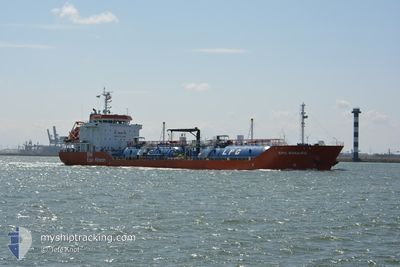
EPIC BONAIRE
Tanker B
Current Trip
| Time Travelled | 3 days |
|---|---|
| Remaining Time | --- |
| Distance Travelled | 1004.77 nm |
| Remaining Distance | --- |
| AVG Speed | 11.4 Knots |
| MAX Speed | 13.9 Knots |
| AVG Wind | 14.9 knots |
| MAX Wind | 26.1 knots |
| MIN Temp | 12.4°C / 54.32°F |
| MAX Temp | 16.5°C / 61.7°F |
| Draught | 6.9 m |
| Position Received | 8 m ago |
Current Position
| Longitude | -8.84085° |
|---|---|
| Latitude | 40.65675° |
| Status | At anchor |
| Speed | |
| Course | 344° |
| Area | North Atlantic Ocean |
| Station | T-AIS |
| Position Received | 8 m ago |
Info
Information
The current position of EPIC BONAIRE is in North Atlantic Ocean with coordinates 40.65675° / -8.84085° as reported on 2024-06-20 09:40 by AIS to our vessel tracker app. The vessel's current speed is 0 Knots
The vessel EPIC BONAIRE (IMO: 9743253, MMSI: 566017000) is a Tanker B It's sailing under the flag of [SG] Singapore.
In this page you can find informations about the vessels current position, last detected port calls, and current voyage information. If the vessels is not in coverage by AIS you will find the latest position.
The current position of EPIC BONAIRE is detected by our AIS receivers and we are not responsible for the reliability of the data. The last position was recorded while the vessel was in Coverage by the Ais receivers of our vessel tracking app.
The current draught of EPIC BONAIRE as reported by AIS is 6.9 meters
Weather
| Temperature | 16.5°C / 61.7°F |
|---|---|
| Wind Speed | 6 knots |
| Direction | 346° NNW |
| Pressure | 1019.1 hPa |
| Humidity | 78.7 % |
| Cloud Coverage | 63 % |
Featured Company
Last Port Calls
| Port | Arrival | Departure | Time In Port |
|---|---|---|---|
| 2024-06-14 23:14 | 2024-06-16 16:37 | 1 d | |
| 2024-06-10 11:30 | 2024-06-11 13:40 | 1 d | |
| 2024-06-04 04:02 | 2024-06-05 14:35 | 1 d | |
| 2024-05-30 08:46 | 2024-05-31 09:22 | 1 d | |
| 2024-05-22 21:16 | 2024-05-24 10:54 | 1 d | |
| 2024-05-18 07:16 | 2024-05-19 13:34 | 1 d | |
| 2024-05-12 18:41 | 2024-05-14 07:50 | 1 d | |
| 2024-05-08 10:05 | 2024-05-09 11:11 | 1 d | |
| 2024-05-03 00:56 | 2024-05-04 14:11 | 1 d | |
| 2024-04-28 18:14 | 2024-04-29 17:17 | 23 h |
Most Visited Ports (Last year)
| Port | Arrivals | |
|---|---|---|
| 28 | ||
| 28 | ||
| 1 |
Last Trips
| Origin | Departure | Destination | Arrival | Distance | |
|---|---|---|---|---|---|
| 2024-06-11 14:40 | 2024-06-15 01:14 | 998.64 nm | |||
| 2024-06-05 16:35 | 2024-06-10 12:30 | 1011.70 nm | |||
| 2024-05-31 10:22 | 2024-06-04 06:02 | 1000.24 nm | |||
| 2024-05-24 12:54 | 2024-05-30 09:46 | 1013.07 nm | |||
| 2024-05-19 14:34 | 2024-05-22 23:16 | 998.87 nm | |||
| 2024-05-14 09:50 | 2024-05-18 08:16 | 1009.39 nm | |||
| 2024-05-09 12:11 | 2024-05-12 20:41 | 997.67 nm | |||
| 2024-05-04 16:11 | 2024-05-08 11:05 | 1011.11 nm | |||
| 2024-04-29 18:17 | 2024-05-03 02:56 | 998.20 nm | |||
| 2024-04-25 03:17 | 2024-04-28 19:14 | 1009.01 nm |
Events
| Time | Event | Details | Position / Dest | Info |
|---|---|---|---|---|
| 2024-06-20 08:37 | Status Changed | At anchor Default |
40.65671 / -8.84093
NLRTM>PTAVE
|
Speed: Course: 350° |
| 2024-06-20 08:27 | Status Changed | Default At anchor |
40.65672 / -8.84086
NLRTM>PTAVE
|
Speed: Course: 351° |
| 2024-06-20 05:10 | Status Changed | At anchor Under way using engine |
40.65726 / -8.84096
NLRTM>PTAVE
|
Speed: 0.6 kn Course: 353° |
| 2024-06-20 05:08 | STOP Moving | 5.33 nm, North West of GAFANHA DA ENCARNACA |
40.65745 / -8.84112
NLRTM>PTAVE
|
Speed: 0.3 kn Course: 352° |
| 2024-06-20 05:02 | Status Changed | Under way using engine Default |
40.65828 / -8.84135
NLRTM>PTAVE
|
Speed: 7.4 kn Course: 134° |
| 2024-06-20 05:02 | IN Coverage |
40.65780 / -8.84132
North Atlantic Ocean
NLRTM>PTAVE
|
Speed: 0.7 kn Course: 181.8° |
|
| 2024-06-20 03:52 | Status Changed | Default Under way using engine |
40.76954 / -8.93672
NLRTM>PTAVE
|
Speed: 12.3 kn Course: 154.7° |
| 2024-06-20 03:47 | OUT of Coverage |
40.78376 / -8.94628
North Atlantic Ocean
NLRTM>PTAVE
|
Speed: 12.3 kn Course: 154.7° |
|
| 2024-06-20 02:02 | Draught Changed | 6.9 7.1 |
41.09518 / -9.15071
NLRTM>PTAVE
|
Speed: 12.3 kn Course: 154.4° |
| 2024-06-20 02:02 | ETA Changed | 2024/06/20 04:30 2024/06/20 03:30 |
41.09518 / -9.15071
NLRTM>PTAVE
|
Speed: 12.3 kn Course: 154.4° |