
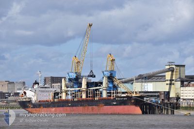
EQUATOR
Bulk Carrier
Current Trip
| Time Travelled | 21 h, 10 mins |
|---|---|
| Remaining Time | 3 days |
| Distance Travelled | 234.08 nm |
| Remaining Distance | 1158.03 nm |
| AVG Speed | 10.3 Knots |
| MAX Speed | 13.4 Knots |
| AVG Wind | 6.1 knots |
| MAX Wind | 10.8 knots |
| MIN Temp | 14.1°C / 57.38°F |
| MAX Temp | 16.1°C / 60.98°F |
| Draught | 5.2 m |
| Position Received | 1 m ago |
Current Position
| Longitude | 5.01348° |
|---|---|
| Latitude | 53.88445° |
| Status | Under way using engine |
| Speed | 11.4 Knots |
| Course | 20° |
| Area | North Sea |
| Station | T-AIS |
| Position Received | 1 m ago |
Info
Information
The current position of EQUATOR is in North Sea with coordinates 53.88445° / 5.01348° as reported on 2024-06-21 20:26 by AIS to our vessel tracker app. The vessel's current speed is 11.4 Knots and is heading at the port of ST PETERSBURG. The estimated time of arrival as calculated by vessel tracking app is 2024-06-25 16:21 LT
The vessel EQUATOR (IMO: 9363766, MMSI: 538003141) is a Bulk Carrier that was built in 2008 ( 16 years old ). It's sailing under the flag of [MH] Marshall Is.
In this page you can find informations about the vessels current position, last detected port calls, and current voyage information. If the vessels is not in coverage by AIS you will find the latest position.
The current position of EQUATOR is detected by our AIS receivers and we are not responsible for the reliability of the data. The last position was recorded while the vessel was in Coverage by the Ais receivers of our vessel tracking app.
The current draught of EQUATOR as reported by AIS is 5.2 meters
Weather
| Temperature | 14.6°C / 58.28°F |
|---|---|
| Wind Speed | 7 knots |
| Direction | 333° NNW |
| Pressure | 1010 hPa |
| Humidity | 77.9 % |
| Cloud Coverage | 100 % |
Featured Company
Most Visited Ports (Last year)
| Port | Arrivals | |
|---|---|---|
| 4 | ||
| 2 | ||
| 2 | ||
| 2 | ||
| 2 | ||
| 1 |
Events
| Time | Event | Details | Position / Dest | Info |
|---|---|---|---|---|
| 2024-06-21 17:26 | Draught Changed | 5.2 5 |
53.30925 / 4.63818
RU LED
|
Speed: 13 kn Course: 25° |
| 2024-06-21 17:26 | ETA Changed | 2024/06/27 12:09 |
53.30925 / 4.63818
RU LED
|
Speed: 13 kn Course: 25° |
| 2024-06-21 17:08 | Draught Changed | 5 5.2 |
53.25083 / 4.58892
RU LED
|
Speed: 13 kn Course: 28° |
| 2024-06-21 15:22 | Status Changed | Under way using engine Default |
52.92065 / 4.29298
RU LED
|
Speed: 12.4 kn Course: 26° |
| 2024-06-21 15:17 | Status Changed | Default Under way using engine |
52.90638 / 4.28082
RU LED
|
Speed: 12.6 kn Course: 22° |
| 2024-06-21 13:41 | Status Changed | Under way using engine Default |
52.63948 / 3.97218
RU LED
|
Speed: 12.4 kn Course: 41° |
| 2024-06-21 13:37 | Status Changed | Default Under way using engine |
52.62687 / 3.95463
RU LED
|
Speed: 12.1 kn Course: 51° |
| 2024-06-21 13:20 | Status Changed | Under way using engine Default |
52.59232 / 3.88583
RU LED
|
Speed: 12.1 kn Course: 43° |
| 2024-06-21 13:13 | Status Changed | Default Under way using engine |
52.57532 / 3.85788
RU LED
|
Speed: 12.2 kn Course: 43° |
| 2024-06-21 13:09 | Status Changed | Under way using engine Default |
52.56573 / 3.84258
RU LED
|
Speed: 12.4 kn Course: 41° |