
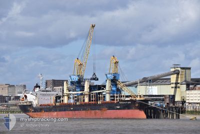
EQUATOR
Bulk Carrier
Current Trip
| Time Travelled | 50 days |
|---|---|
| Remaining Time | 1 day |
| Distance Travelled | 4302.02 nm |
| Remaining Distance | 393.52 nm |
| AVG Speed | 9.6 Knots |
| MAX Speed | 9.6 Knots |
| AVG Wind | 11.3 knots |
| MAX Wind | 33.8 knots |
| MIN Temp | 12.3°C / 54.14°F |
| MAX Temp | 35.3°C / 95.54°F |
| Draught | 8.3 m |
| Position Received | 3 m ago |
Current Position
| Longitude | -5.03787° |
|---|---|
| Latitude | 48.96898° |
| Status | Under way using engine |
| Speed | 9.2 Knots |
| Course | 63° |
| Area | Celtic Sea |
| Station | T-AIS |
| Position Received | 3 m ago |
Info
Information
The current position of EQUATOR is in Celtic Sea with coordinates 48.96898° / -5.03787° as reported on 2024-06-16 03:54 by AIS to our vessel tracker app. The vessel's current speed is 9.2 Knots and is heading at the port of GENT. The estimated time of arrival as calculated by vessel tracking app is 2024-06-17 20:34 LT
The vessel EQUATOR (IMO: 9363766, MMSI: 538003141) is a Bulk Carrier that was built in 2008 ( 16 years old ). It's sailing under the flag of [MH] Marshall Is.
In this page you can find informations about the vessels current position, last detected port calls, and current voyage information. If the vessels is not in coverage by AIS you will find the latest position.
The current position of EQUATOR is detected by our AIS receivers and we are not responsible for the reliability of the data. The last position was recorded while the vessel was in Coverage by the Ais receivers of our vessel tracking app.
The current draught of EQUATOR as reported by AIS is 8.3 meters
Weather
| Temperature | 13.9°C / 57.02°F |
|---|---|
| Wind Speed | 15 knots |
| Direction | 280° W |
| Pressure | 1003.7 hPa |
| Humidity | 81.5 % |
| Cloud Coverage | 99 % |
Featured Company
Most Visited Ports (Last year)
| Port | Arrivals | |
|---|---|---|
| 4 | ||
| 2 | ||
| 2 | ||
| 2 | ||
| 2 | ||
| 1 |
Last Trips
| Origin | Departure | Destination | Arrival | Distance | |
|---|---|---|---|---|---|
| 2024-04-12 21:27 | 2024-04-22 08:23 | 1774.25 nm | |||
| 2024-03-30 03:33 | 2024-04-09 22:45 | 1890.01 nm |
Events
| Time | Event | Details | Position / Dest | Info |
|---|---|---|---|---|
| 2024-06-16 03:29 | Status Changed | Under way using engine Default |
48.94000 / -5.12610
BE GNE
|
Speed: 9.4 kn Course: 63° |
| 2024-06-16 03:29 | IN Coverage |
48.94042 / -5.12488
Celtic Sea
|
Speed: 9.2 kn Course: 62° |
|
| 2024-06-16 00:24 | Status Changed | Default Under way using engine |
48.67798 / -5.70805
BE GNE
|
Speed: 9.4 kn Course: 22° |
| 2024-06-16 00:12 | Status Changed | Under way using engine Default |
48.64737 / -5.72802
BE GNE
|
Speed: 9.4 kn Course: 25° |
| 2024-06-16 00:12 | OUT of Coverage |
48.64737 / -5.72802
Celtic Sea
|
Speed: 9.4 kn Course: 22° |
|
| 2024-06-15 23:44 | Status Changed | Default Under way using engine |
48.58142 / -5.78245
BE GNE
|
Speed: 9.8 kn Course: 27° |
| 2024-06-15 22:53 | Status Changed | Under way using engine Default |
48.46505 / -5.88993
BE GNE
|
Speed: 9.6 kn Course: 31° |
| 2024-06-15 22:43 | Status Changed | Default Under way using engine |
48.44132 / -5.91078
BE GNE
|
Speed: 9.7 kn Course: 30° |
| 2024-06-15 22:37 | Status Changed | Under way using engine Default |
48.42883 / -5.92262
BE GNE
|
Speed: 9.8 kn Course: 31° |
| 2024-06-15 22:28 | Status Changed | Default Under way using engine |
48.40640 / -5.94383
BE GNE
|
Speed: 9.9 kn Course: 31° |