
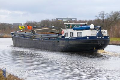
ERATO
Not available
Current Trip
TRIERVELD
| Time Travelled | 3 days |
|---|---|
| Remaining Time | --- |
| Distance Travelled | 31.77 nm |
| Remaining Distance | --- |
| AVG Speed | 6 Knots |
| MAX Speed | 6.9 Knots |
| AVG Wind | 4.3 knots |
| MAX Wind | 7 knots |
| MIN Temp | 21.8°C / 71.24°F |
| MAX Temp | 28.8°C / 83.84°F |
| Draught | 1 m |
| Position Received | 2 d ago |
Current Position
| Longitude | 5.81137° |
|---|---|
| Latitude | 51.22025° |
| Status | Under way using engine |
| Speed | 6.4 Knots |
| Course | 149.6° |
| Area | North Sea |
| Station | T-AIS |
| Position Received | 2 d ago |
Info
Information
The current position of ERATO is in North Sea with coordinates 51.22025° / 5.81137° as reported on 2024-06-26 16:21 by AIS to our vessel tracker app. The vessel's current speed is 6.4 Knots
The vessel ERATO (MMSI: 244700644) is a Not available It's sailing under the flag of [NL] Netherlands.
In this page you can find informations about the vessels current position, last detected port calls, and current voyage information. If the vessels is not in coverage by AIS you will find the latest position.
The current position of ERATO is detected by our AIS receivers and we are not responsible for the reliability of the data. The last position was recorded while the vessel was in Coverage by the Ais receivers of our vessel tracking app.
The current draught of ERATO as reported by AIS is 1 meters
Weather
| Temperature | 28.5°C / 83.3°F |
|---|---|
| Wind Speed | 2 knots |
| Direction | 239° WSW |
| Pressure | 1008.8 hPa |
| Humidity | 47 % |
| Cloud Coverage | 33 % |
Featured Company
Last Port Calls
| Port | Arrival | Departure | Time In Port |
|---|---|---|---|
| 2024-06-25 15:40 | 2024-06-26 06:57 | 15 h | |
| 2024-06-21 05:27 | |||
| 2024-06-12 13:00 | 2024-06-13 12:25 | 23 h | |
| 2024-06-11 10:09 | 2024-06-11 13:20 | 3 h | |
| 2024-06-06 09:15 | 2024-06-10 12:44 | 4 d | |
| 2024-06-05 10:52 | 2024-06-05 13:15 | 2 h | |
| 2024-06-03 14:03 | 2024-06-04 06:29 | 16 h | |
| 2024-05-30 07:07 | 2024-05-30 11:53 | 4 h | |
| 2024-05-29 12:23 | 2024-05-29 13:00 | 36 m | |
| 2024-05-28 17:05 | 2024-05-29 10:00 | 16 h |
Last Trips
| Origin | Departure | Destination | Arrival | Distance | |
|---|---|---|---|---|---|
| 2024-06-21 07:27 | 2024-06-25 17:40 | 65.67 nm | |||
| 2024-06-11 15:20 | 2024-06-12 15:00 | 67.63 nm | |||
| 2024-06-10 14:44 | 2024-06-11 12:09 | 44.99 nm | |||
| 2024-06-05 15:15 | 2024-06-06 11:15 | 42.18 nm | |||
| 2024-06-04 08:29 | 2024-06-05 12:52 | 70.86 nm | |||
| 2024-05-30 13:53 | 2024-06-03 16:03 | 69.33 nm | |||
| 2024-05-29 15:00 | 2024-05-30 09:07 | 41.29 nm | |||
| 2024-05-29 12:00 | 2024-05-29 14:23 | 4.62 nm | |||
| 2024-05-28 17:28 | 2024-05-28 19:05 | 8.03 nm | |||
| 2024-05-22 13:15 | 2024-05-28 17:11 | 127.84 nm |
Events
| Time | Event | Details | Position / Dest | Info |
|---|---|---|---|---|
| 2024-06-26 16:21 | OUT of Coverage |
51.22025 / 5.81137
North Sea
TRIERVELD
|
Speed: 6.4 kn Course: 149.6° |
|
| 2024-06-26 15:08 | START Moving | 9.45 nm, South of HELMOND |
51.32804 / 5.74704
TRIERVELD
|
Speed: 4.7 kn Course: 174.4° |
| 2024-06-26 14:57 | STOP Moving | 9.32 nm, South of HELMOND |
51.33025 / 5.74671
TRIERVELD
|
Speed: Course: 511° |
| 2024-06-26 14:44 | Draught Changed | 1 1.9 |
51.34484 / 5.74425
TRIERVELD
|
Speed: 5.1 kn Course: 174.2° |
| 2024-06-26 14:44 | Destination Changed | TRIERVELD DEN BOSCH |
51.34484 / 5.74425
TRIERVELD
|
Speed: 5.1 kn Course: 174.2° |
| 2024-06-26 14:44 | ETA Changed | 2024/06/27 10:00 2024/06/26 10:00 |
51.34484 / 5.74425
TRIERVELD
|
Speed: 5.1 kn Course: 174.2° |
| 2024-06-26 14:42 | START Moving | 8.28 nm, South East of HELMOND |
51.34818 / 5.74363
DEN BOSCH
|
Speed: 4.5 kn Course: 173.2° |
| 2024-06-26 14:31 | STOP Moving | 8.17 nm, South East of HELMOND |
51.35017 / 5.74336
DEN BOSCH
|
Speed: Course: 511° |
| 2024-06-26 14:24 | IN Coverage |
51.35524 / 5.74252
North Sea
DEN BOSCH
|
Speed: 5 kn Course: 173.8° |
|
| 2024-06-26 12:58 | OUT of Coverage |
51.44313 / 5.69224
North Sea
DEN BOSCH
|
Speed: 6.7 kn Course: 179.7° |