
ERGE
General Cargo
Current Trip
| Time Travelled | 4 h, 9 mins |
|---|---|
| Remaining Time | 4 days |
| Distance Travelled | 34.70 nm |
| Remaining Distance | 904.61 nm |
| AVG Speed | 9.2 Knots |
| MAX Speed | 10 Knots |
| AVG Wind | 7.3 knots |
| MAX Wind | 9 knots |
| MIN Temp | 18.8°C / 65.84°F |
| MAX Temp | 22°C / 71.6°F |
| Draught | 6.6 m |
| Position Received | 1 m ago |
Current Position
| Longitude | 21.94560° |
|---|---|
| Latitude | 38.35030° |
| Status | Under way using engine |
| Speed | 8.9 Knots |
| Course | 274.2° |
| Area | Ionian Sea |
| Station | T-AIS |
| Position Received | 1 m ago |
Info
Information
The current position of ERGE is in Ionian Sea with coordinates 38.35030° / 21.94560° as reported on 2024-05-29 10:26 by AIS to our vessel tracker app. The vessel's current speed is 8.9 Knots and is heading at the port of MARSEILLE. The estimated time of arrival as calculated by vessel tracking app is 2024-06-02 13:13 LT
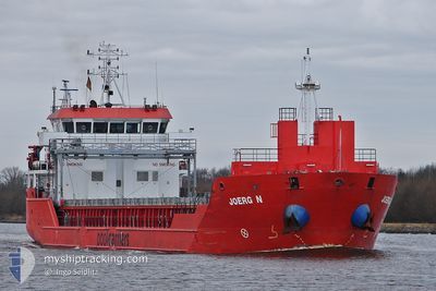
The vessel ERGE (IMO: 9508603, MMSI: 351429000) is a General Cargo that was built in 2010 ( 14 years old ). It's sailing under the flag of [PA] Panama.
In this page you can find informations about the vessels current position, last detected port calls, and current voyage information. If the vessels is not in coverage by AIS you will find the latest position.
The current position of ERGE is detected by our AIS receivers and we are not responsible for the reliability of the data. The last position was recorded while the vessel was in Coverage by the Ais receivers of our vessel tracking app.
The current draught of ERGE as reported by AIS is 6.6 meters
Weather
| Temperature | 22°C / 71.6°F |
|---|---|
| Wind Speed | 7 knots |
| Direction | 297° WNW |
| Pressure | 1012.9 hPa |
| Humidity | 47.2 % |
| Cloud Coverage | 78 % |
Featured Company
Last Port Calls
| Port | Arrival | Departure | Time In Port |
|---|---|---|---|
| 2024-05-29 06:18 | |||
| 2024-05-20 04:51 | 2024-05-24 07:16 | 4 d | |
| 2024-05-12 14:52 | 2024-05-14 13:11 | 1 d | |
| 2024-05-08 14:29 | 2024-05-10 08:28 | 1 d | |
| 2024-04-27 21:11 | 2024-04-30 15:41 | 2 d | |
| 2024-04-23 05:51 | 2024-04-25 12:36 | 2 d | |
| 2024-04-11 15:16 | 2024-04-15 18:30 | 4 d | |
| 2024-04-10 05:59 | 2024-04-10 16:52 | 10 h | |
| 2024-03-28 18:13 | 2024-03-30 06:24 | 1 d | |
| 2024-03-16 06:08 | 2024-03-21 16:42 | 5 d |
Last Trips
| Origin | Departure | Destination | Arrival | Distance | |
|---|---|---|---|---|---|
| 2024-05-14 16:11 | 2024-05-20 06:51 | 1225.61 nm | |||
| 2024-05-10 11:28 | 2024-05-12 17:52 | 298.83 nm | |||
| 2024-04-30 17:41 | 2024-05-08 17:29 | 1748.63 nm | |||
| 2024-04-25 13:36 | 2024-04-27 23:11 | 630.11 nm | |||
| 2024-04-15 19:30 | 2024-04-23 06:51 | 1356.56 nm | |||
| 2024-04-10 17:52 | 2024-04-11 16:16 | 39.87 nm | |||
| 2024-03-30 09:24 | 2024-04-10 06:59 | 2404.30 nm | |||
| 2024-03-21 18:42 | 2024-03-28 21:13 | 546.89 nm | |||
| 2024-03-14 00:57 | 2024-03-16 08:08 | 568.36 nm | |||
| 2024-02-20 14:43 | 2024-03-13 05:39 | 3011.55 nm |
Events
| Time | Event | Details | Position / Dest | Info |
|---|---|---|---|---|
| 2024-05-29 09:27 | Draught Changed | 6.6 3.5 |
38.30912 / 22.12901
FRMRS
|
Speed: 9.2 kn Course: 294.5° |
| 2024-05-29 09:27 | Destination Changed | FRMRS GRSTR |
38.30912 / 22.12901
FRMRS
|
Speed: 9.2 kn Course: 294.5° |
| 2024-05-29 09:27 | ETA Changed | 2024/06/02 06:00 2024/05/26 21:00 |
38.30912 / 22.12901
FRMRS
|
Speed: 9.2 kn Course: 294.5° |
| 2024-05-29 09:07 | Status Changed | Under way using engine Default |
38.29582 / 22.19045
GRSTR
|
Speed: 9 kn Course: 273° |
| 2024-05-29 09:07 | IN Coverage |
38.29582 / 22.19045
Ionian Sea
|
Speed: 9.1 kn Course: 279.1° |
|
| 2024-05-29 06:57 | Status Changed | Default Under way using engine |
38.27334 / 22.60833
GRSTR
|
Speed: 9.9 kn Course: 223.9° |
| 2024-05-29 06:54 | OUT of Coverage |
38.28064 / 22.61646
Ionian Sea
|
Speed: 9.9 kn Course: 223.9° |
|
| 2024-05-29 06:28 | IN Coverage |
38.34226 / 22.66189
Ionian Sea
|
Speed: 9.7 kn Course: 199.2° |
|
| 2024-05-29 06:18 | PORT DEPARTURE |
|
38.34226 / 22.66189
GRSTR
|
Speed: Course: 355° |
| 2024-05-26 18:28 | OUT of Coverage |
38.34616 / 22.65408
Ionian Sea
GRSTR
|
Speed: 5.6 kn Course: 20.2° |