
ERNE
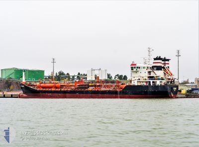
Oil/Chemical Tanker
Current Trip
| Time Travelled | 1 day |
|---|---|
| Remaining Time | 1 day |
| Distance Travelled | 99.46 nm |
| Remaining Distance | 286.64 nm |
| AVG Speed | 9.3 Knots |
| MAX Speed | 13.4 Knots |
| AVG Wind | 16 knots |
| MAX Wind | 26.9 knots |
| MIN Temp | 13.4°C / 56.12°F |
| MAX Temp | 15.4°C / 59.72°F |
| Draught | 6 m |
| Position Received | 2 m ago |
Current Position
| Longitude | 7.37105° |
|---|---|
| Latitude | 54.33027° |
| Status | Under way using engine |
| Speed | 10.1 Knots |
| Course | 335.6° |
| Area | North Sea |
| Station | T-AIS |
| Position Received | 2 m ago |
Info
Information
The current position of ERNE is in North Sea with coordinates 54.33027° / 7.37105° as reported on 2024-06-16 17:50 by AIS to our vessel tracker app. The vessel's current speed is 10.1 Knots and is heading at the port of SKAGEN. The estimated time of arrival as calculated by vessel tracking app is 2024-06-17 22:04 LT
The vessel ERNE (IMO: 9393072, MMSI: 249706000) is a Oil/Chemical Tanker that was built in 2009 ( 15 years old ). It's sailing under the flag of [MT] Malta.
In this page you can find informations about the vessels current position, last detected port calls, and current voyage information. If the vessels is not in coverage by AIS you will find the latest position.
The current position of ERNE is detected by our AIS receivers and we are not responsible for the reliability of the data. The last position was recorded while the vessel was in Coverage by the Ais receivers of our vessel tracking app.
The current draught of ERNE as reported by AIS is 6 meters
Weather
| Temperature | 14.3°C / 57.74°F |
|---|---|
| Wind Speed | 13 knots |
| Direction | 222° SW |
| Pressure | 1004 hPa |
| Humidity | 84.3 % |
| Cloud Coverage | 100 % |
Featured Company
Last Port Calls
| Port | Arrival | Departure | Time In Port |
|---|---|---|---|
| 2024-06-13 15:19 | 2024-06-15 03:09 | 1 d | |
| 2024-06-12 11:22 | 2024-06-12 12:08 | 46 m | |
| 2024-06-10 05:13 | 2024-06-12 10:05 | 2 d | |
| 2024-06-07 05:08 | 2024-06-08 17:36 | 1 d | |
| 2024-06-05 13:08 | 2024-06-06 15:05 | 1 d | |
| 2024-06-01 03:21 | 2024-06-03 13:32 | 2 d | |
| 2024-05-24 22:27 | 2024-05-30 18:08 | 5 d | |
| 2024-05-23 13:55 | 2024-05-24 22:18 | 1 d | |
| 2024-05-19 11:32 | 2024-05-21 04:19 | 1 d | |
| 2024-05-13 16:07 | 2024-05-18 00:08 | 4 d |
Last Trips
| Origin | Departure | Destination | Arrival | Distance | |
|---|---|---|---|---|---|
| 2024-06-12 14:08 | 2024-06-13 17:19 | 256.09 nm | |||
| 2024-06-12 12:05 | 2024-06-12 13:22 | 5.58 nm | |||
| 2024-06-08 19:36 | 2024-06-10 07:13 | 245.47 nm | |||
| 2024-06-06 17:05 | 2024-06-07 07:08 | 127.84 nm | |||
| 2024-06-03 15:32 | 2024-06-05 15:08 | 439.28 nm | |||
| 2024-05-30 20:08 | 2024-06-01 05:21 | 284.63 nm | |||
| 2024-05-25 00:18 | 2024-05-25 00:27 | 0.54 nm | |||
| 2024-05-21 06:19 | 2024-05-23 15:55 | 268.29 nm | |||
| 2024-05-18 02:08 | 2024-05-19 13:32 | 339.57 nm | |||
| 2024-04-27 15:08 | 2024-05-13 18:07 | 2979.92 nm |
Events
| Time | Event | Details | Position / Dest | Info |
|---|---|---|---|---|
| 2024-06-16 17:35 | Status Changed | Under way using engine Default |
54.29245 / 7.40266
DKSKA
|
Speed: 9 kn Course: 335° |
| 2024-06-16 17:17 | Status Changed | Default Under way using engine |
54.24581 / 7.43936
DKSKA
|
Speed: 10.3 kn Course: 334.4° |
| 2024-06-16 17:15 | Status Changed | Under way using engine Default |
54.24107 / 7.44306
DKSKA
|
Speed: 10.3 kn Course: 335° |
| 2024-06-16 16:57 | IN Coverage |
54.24107 / 7.44306
North Sea
DKSKA
|
Speed: 10.3 kn Course: 334.4° |
|
| 2024-06-16 15:48 | Status Changed | Default Under way using engine |
54.06558 / 7.70466
DKSKA
|
Speed: 9.6 kn Course: 310.7° |
| 2024-06-16 15:47 | OUT of Coverage |
54.06326 / 7.70909
North Sea
DKSKA
|
Speed: 9.6 kn Course: 310.7° |
|
| 2024-06-16 15:04 | Destination Changed | DKSKA ORDER |
53.97411 / 7.82557
DKSKA
|
Speed: 10.2 kn Course: 343.7° |
| 2024-06-16 15:04 | ETA Changed | 2024/06/18 10:30 2024/06/15 06:30 |
53.97411 / 7.82557
DKSKA
|
Speed: 10.2 kn Course: 343.7° |
| 2024-06-16 14:48 | Status Changed | Under way using engine At anchor |
53.93425 / 7.85060
ORDER
|
Speed: 8.1 kn Course: 321.6° |
| 2024-06-16 14:39 | START Moving | 8.75 nm, North of WANGEROOGE |
53.91943 / 7.86946
ORDER
|
Speed: 3.6 kn Course: 309° |