
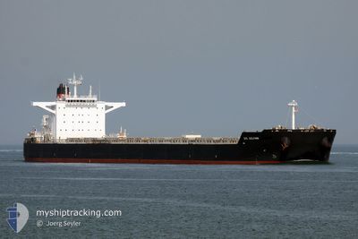
ESL DOLPHIN
Bulk Carrier
Current Trip
| Time Travelled | 11 days |
|---|---|
| Remaining Time | --- |
| Distance Travelled | 3242.68 nm |
| Remaining Distance | 615.63 nm |
| AVG Speed | 11.9 Knots |
| MAX Speed | 15.1 Knots |
| AVG Wind | 11.2 knots |
| MAX Wind | 27.8 knots |
| MIN Temp | 19.9°C / 67.82°F |
| MAX Temp | 30.6°C / 87.08°F |
| Draught | 8.5 m |
| Position Received | 10 h, 19 m ago |
Current Position
| Longitude | 115.64151° |
|---|---|
| Latitude | -9.06417° |
| Status | Under way using engine |
| Speed | 13.3 Knots |
| Course | 170.3° |
| Area | Indian Ocean |
| Station | T-AIS |
| Position Received | 10 h, 19 m ago |
Info
Information
The current position of ESL DOLPHIN is in Indian Ocean with coordinates -9.06417° / 115.64151° as reported on 2024-06-28 14:32 by AIS to our vessel tracker app. The vessel's current speed is 13.3 Knots and is heading at the port of DAMPIER. The estimated time of arrival as calculated by vessel tracking app is 2024-07-01 14:00 LT
The vessel ESL DOLPHIN (IMO: 9520716, MMSI: 636019420) is a Bulk Carrier that was built in 2011 ( 13 years old ). It's sailing under the flag of [LR] Liberia.
In this page you can find informations about the vessels current position, last detected port calls, and current voyage information. If the vessels is not in coverage by AIS you will find the latest position.
The current position of ESL DOLPHIN is detected by our AIS receivers and we are not responsible for the reliability of the data. The last position was recorded while the vessel was in Coverage by the Ais receivers of our vessel tracking app.
The current draught of ESL DOLPHIN as reported by AIS is 8.5 meters
Weather
| Temperature | 26.4°C / 79.52°F |
|---|---|
| Wind Speed | 11 knots |
| Direction | 117° ESE |
| Pressure | 1013 hPa |
| Humidity | 80.1 % |
| Cloud Coverage | 37 % |
Featured Company
Events
| Time | Event | Details | Position / Dest | Info |
|---|---|---|---|---|
| 2024-06-28 14:33 | Status Changed | Default Under way using engine |
-9.06917 / 115.64213
DAMPIER AU
|
Speed: 13.3 kn Course: 170.3° |
| 2024-06-28 14:32 | OUT of Coverage |
-9.06417 / 115.64151
Indian Ocean
DAMPIER AU
|
Speed: 13.3 kn Course: 170.3° |
|
| 2024-06-28 13:55 | Destination Changed | DAMPIER AU PORT WALCOTT AU |
-8.93125 / 115.63048
DAMPIER AU
|
Speed: 12.4 kn Course: 187.9° |
| 2024-06-28 13:55 | ETA Changed | 2024/07/01 14:00 2024/07/01 08:00 |
-8.93125 / 115.63048
DAMPIER AU
|
Speed: 12.4 kn Course: 187.9° |
| 2024-06-28 13:32 | Change Sea Area | Indonesian part of the Indian Ocean Indonesian part of the Bali Sea |
-8.85642 / 115.66005
Indian Ocean
PORT WALCOTT AU
|
Speed: 13 kn Course: 210.1° |
| 2024-06-28 13:32 | Status Changed | Under way using engine Default |
-8.85642 / 115.66005
PORT WALCOTT AU
|
Speed: 13.7 kn Course: 187° |
| 2024-06-28 13:32 | IN Coverage |
-8.85642 / 115.66005
Indian Ocean
PORT WALCOTT AU
|
Speed: 13 kn Course: 210.1° |
|
| 2024-06-28 12:28 | Status Changed | Default Under way using engine |
-8.63496 / 115.71888
PORT WALCOTT AU
|
Speed: 11.7 kn Course: 200.9° |
| 2024-06-28 12:28 | OUT of Coverage |
-8.63343 / 115.71945
Bali Sea
PORT WALCOTT AU
|
Speed: 11.7 kn Course: 200.9° |
|
| 2024-06-28 12:24 | Change Sea Area | Indonesian part of the Bali Sea Taiwanese part of the Philippine Sea |
-8.62283 / 115.72355
Bali Sea
PORT WALCOTT AU
|
Speed: 11.6 kn Course: 200.7° |