
ETE N
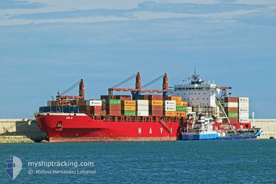
Container Ship
Current Trip
CONAKRY
| Time Travelled | 5 days |
|---|---|
| Remaining Time | --- |
| Distance Travelled | 1541.98 nm |
| Remaining Distance | --- |
| AVG Speed | 12.6 Knots |
| MAX Speed | 16.2 Knots |
| AVG Wind | 13.8 knots |
| MAX Wind | 26 knots |
| MIN Temp | 14°C / 57.2°F |
| MAX Temp | 27.9°C / 82.22°F |
| Draught | 11.6 m |
| Position Received | 2 d ago |
Current Position
| Longitude | -13.88180° |
|---|---|
| Latitude | 27.61217° |
| Status | Under way using engine |
| Speed | 15.7 Knots |
| Course | 212.8° |
| Area | North Atlantic Ocean |
| Station | T-AIS |
| Position Received | 2 d ago |
Info
Information
The current position of ETE N is in North Atlantic Ocean with coordinates 27.61217° / -13.88180° as reported on 2024-06-18 14:49 by AIS to our vessel tracker app. The vessel's current speed is 15.7 Knots
The vessel ETE N (IMO: 9509126, MMSI: 636019197) is a Container Ship that was built in 2012 ( 12 years old ). It's sailing under the flag of [LR] Liberia.
In this page you can find informations about the vessels current position, last detected port calls, and current voyage information. If the vessels is not in coverage by AIS you will find the latest position.
The current position of ETE N is detected by our AIS receivers and we are not responsible for the reliability of the data. The last position was recorded while the vessel was in Coverage by the Ais receivers of our vessel tracking app.
The current draught of ETE N as reported by AIS is 11.6 meters
Weather
| Temperature | 24.4°C / 75.92°F |
|---|---|
| Wind Speed | 14 knots |
| Direction | 311° NW |
| Pressure | 1011.7 hPa |
| Humidity | 80.3 % |
| Cloud Coverage | 13 % |
Featured Company
Last Port Calls
| Port | Arrival | Departure | Time In Port |
|---|---|---|---|
| 2024-06-15 14:25 | |||
| 2024-06-15 13:42 | |||
| 2024-06-15 00:04 | 2024-06-15 12:05 | 12 h | |
| 2024-06-01 14:17 | 2024-06-02 10:01 | 19 h | |
| 2024-05-26 07:27 | 2024-05-27 21:11 | 1 d | |
| 2024-05-07 12:13 | 2024-05-08 03:01 | 14 h | |
| 2024-04-29 06:51 | 2024-04-30 03:44 | 20 h | |
| 2024-04-17 13:24 | |||
| 2024-04-05 18:45 | 2024-04-06 20:49 | 1 d | |
| 2024-04-02 14:33 | 2024-04-03 03:13 | 12 h |
Last Trips
| Origin | Departure | Destination | Arrival | Distance | |
|---|---|---|---|---|---|
| 2024-06-15 14:05 | 2024-06-15 16:25 | 6.95 nm | |||
| 2024-06-02 12:01 | 2024-06-15 02:04 | 4518.57 nm | |||
| 2024-05-27 23:11 | 2024-06-01 16:17 | 1233.35 nm | |||
| 2024-05-08 04:01 | 2024-05-26 09:27 | 2104.51 nm | |||
| 2024-04-30 04:44 | 2024-05-07 13:13 | 1366.01 nm | |||
| 2024-04-06 21:49 | 2024-04-17 14:24 | 371.34 nm | |||
| 2024-04-03 04:13 | 2024-04-05 19:45 | 78.60 nm | |||
| 2024-03-26 11:01 | 2024-04-02 15:33 | 409.03 nm |
Events
| Time | Event | Details | Position / Dest | Info |
|---|---|---|---|---|
| 2024-06-18 14:52 | Status Changed | Default Under way using engine |
27.60045 / -13.89040
CONAKRY
|
Speed: 15.7 kn Course: 212.8° |
| 2024-06-18 14:49 | Detected in Sea | Western Saharan part of the North Atlantic Ocean |
27.61217 / -13.88181
North Atlantic Ocean
|
Speed: 15.7 kn Course: 212.8° |
| 2024-06-18 14:49 | Status Changed | Under way using engine Default |
27.61217 / -13.88181
CONAKRY
|
Speed: 15.7 kn Course: 214° |
| 2024-06-18 14:49 | OUT of Coverage |
27.61217 / -13.88181
North Atlantic Ocean
|
Speed: 15.7 kn Course: 212.8° |
|
| 2024-06-18 14:06 | Status Changed | Default Under way using engine |
27.76686 / -13.76827
CONAKRY
|
Speed: 15.5 kn Course: 212.9° |
| 2024-06-18 13:49 | Status Changed | Under way using engine Default |
27.83067 / -13.72136
CONAKRY
|
Speed: 15.6 kn Course: 213° |
| 2024-06-18 13:05 | Status Changed | Default Under way using engine |
27.98924 / -13.60477
CONAKRY
|
Speed: 15.7 kn Course: 213.2° |
| 2024-06-18 12:46 | Status Changed | Under way using engine Default |
28.05757 / -13.55444
CONAKRY
|
Speed: 15.7 kn Course: 214° |
| 2024-06-18 12:31 | IN Coverage |
28.05757 / -13.55444
North Atlantic Ocean
|
Speed: 15.7 kn Course: 213.2° |
|
| 2024-06-18 08:33 | OUT of Coverage |
28.96144 / -12.88738
North Atlantic Ocean
|
Speed: 15.2 kn Course: 212° |