
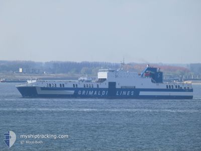
EUROCARGO BARI
Ro-Ro Cargo
Current Trip
| Time Travelled | 4 days |
|---|---|
| Remaining Time | --- |
| Distance Travelled | 2078.85 nm |
| Remaining Distance | 18.80 nm |
| AVG Speed | 20.3 Knots |
| MAX Speed | 24.8 Knots |
| AVG Wind | 13.2 knots |
| MAX Wind | 21 knots |
| MIN Temp | 11.6°C / 52.88°F |
| MAX Temp | 27.1°C / 80.78°F |
| Draught | 7 m |
| Position Received | 2 d ago |
Current Position
| Longitude | -79.85223° |
|---|---|
| Latitude | 27.05843° |
| Status | Under way using engine |
| Speed | 23.9 Knots |
| Course | 23.3° |
| Area | North Atlantic Ocean |
| Station | T-AIS |
| Position Received | 2 d ago |
Info
Information
The current position of EUROCARGO BARI is in North Atlantic Ocean with coordinates 27.05843° / -79.85223° as reported on 2024-05-07 04:32 by AIS to our vessel tracker app. The vessel's current speed is 23.9 Knots and is heading at the port of DAVISVILLE. The estimated time of arrival as calculated by vessel tracking app is 2024-05-09 00:00 LT
The vessel EUROCARGO BARI (IMO: 9471082, MMSI: 247320400) is a Ro-Ro Cargo that was built in 2012 ( 12 years old ). It's sailing under the flag of [IT] Italy.
In this page you can find informations about the vessels current position, last detected port calls, and current voyage information. If the vessels is not in coverage by AIS you will find the latest position.
The current position of EUROCARGO BARI is detected by our AIS receivers and we are not responsible for the reliability of the data. The last position was recorded while the vessel was in Coverage by the Ais receivers of our vessel tracking app.
The current draught of EUROCARGO BARI as reported by AIS is 7 meters
Weather
| Temperature | 13.1°C / 55.58°F |
|---|---|
| Wind Speed | 6 knots |
| Direction | 342° NNW |
| Pressure | 1007 hPa |
| Humidity | 73.4 % |
| Cloud Coverage | 75 % |
Featured Company
Last Port Calls
| Port | Arrival | Departure | Time In Port |
|---|---|---|---|
| 2024-05-04 07:20 | 2024-05-04 21:50 | 14 h | |
| 2024-04-28 15:14 | 2024-04-29 03:42 | 12 h | |
| 2024-04-27 09:33 | 2024-04-27 18:04 | 8 h | |
| 2024-04-20 02:30 | 2024-04-20 12:58 | 10 h | |
| 2024-04-13 15:53 | 2024-04-13 23:29 | 7 h | |
| 2024-04-12 01:22 | 2024-04-12 23:09 | 21 h | |
| 2024-04-05 23:35 | 2024-04-06 10:42 | 11 h | |
| 2024-03-27 14:21 | 2024-03-28 12:20 | 21 h | |
| 2024-03-26 10:33 | 2024-03-26 19:16 | 8 h | |
| 2024-03-21 00:12 | 2024-03-21 10:46 | 10 h |
Most Visited Ports (Last year)
| Port | Arrivals | |
|---|---|---|
| 21 | ||
| 20 | ||
| 19 | ||
| 1 |
Last Trips
| Origin | Departure | Destination | Arrival | Distance | |
|---|---|---|---|---|---|
| 2024-04-28 23:42 | 2024-05-04 02:20 | 2025.15 nm | |||
| 2024-04-27 14:04 | 2024-04-28 11:14 | 184.53 nm | |||
| 2024-04-20 07:58 | 2024-04-27 05:33 | 2194.33 nm | |||
| 2024-04-13 19:29 | 2024-04-19 21:30 | 2010.64 nm | |||
| 2024-04-12 19:09 | 2024-04-13 11:53 | 162.59 nm | |||
| 2024-04-06 04:42 | 2024-04-11 21:22 | 2107.68 nm | |||
| 2024-03-28 08:20 | 2024-04-05 17:35 | 2025.04 nm | |||
| 2024-03-26 15:16 | 2024-03-27 10:21 | 163.45 nm | |||
| 2024-03-21 04:46 | 2024-03-26 06:33 | 2166.80 nm | |||
| 2024-03-15 15:38 | 2024-03-20 18:12 | 1997.37 nm |
Events
| Time | Event | Details | Position / Dest | Info |
|---|---|---|---|---|
| 2024-05-09 02:42 | STOP Moving | 8.85 nm, South of NEWPORT (RI) |
41.33711 / -71.32337
MX ATM>US DVV
|
Speed: 0.3 kn Course: 69° |
| 2024-05-07 04:37 | Status Changed | Default Under way using engine |
27.08667 / -79.83667
MX ATM>US DVV
|
Speed: 23.9 kn Course: 23.3° |
| 2024-05-07 04:32 | OUT of Coverage |
27.05843 / -79.85223
North Atlantic Ocean
MX ATM>US DVV
|
Speed: 23.9 kn Course: 23.3° |
|
| 2024-05-06 23:58 | Status Changed | Under way using engine Default |
25.24260 / -80.08463
MX ATM>US DVV
|
Speed: 22 kn Course: 23° |
| 2024-05-06 23:24 | Status Changed | Default Under way using engine |
25.05384 / -80.19156
MX ATM>US DVV
|
Speed: 21.6 kn Course: 39.5° |
| 2024-05-06 21:45 | Change Sea Area | United States part of the North Atlantic Ocean Mexican part of the Gulf of Mexico |
24.68353 / -80.67765
North Atlantic Ocean
MX ATM>US DVV
|
Speed: 21 kn Course: 54.6° |
| 2024-05-06 21:45 | Status Changed | Under way using engine Default |
24.68353 / -80.67765
MX ATM>US DVV
|
Speed: 21 kn Course: 54° |
| 2024-05-06 21:28 | IN Coverage |
24.68353 / -80.67765
North Atlantic Ocean
MX ATM>US DVV
|
Speed: 21 kn Course: 54.6° |
|
| 2024-05-04 23:09 | Status Changed | Default Under way using engine |
22.54108 / -97.46496
MX ATM>US DVV
|
Speed: 19.3 kn Course: 78.5° |
| 2024-05-04 23:07 | OUT of Coverage |
22.53900 / -97.47653
Gulf of Mexico
MX ATM>US DVV
|
Speed: 19.3 kn Course: 78.5° |