
EUROPA
Passengers Ship
Current Trip
| Time Travelled | 12 days |
|---|---|
| Remaining Time | 9 h, 11 mins |
| Distance Travelled | 5405.34 nm |
| Remaining Distance | 169.15 nm |
| AVG Speed | 17.8 Knots |
| MAX Speed | 20.1 Knots |
| AVG Wind | 13.8 knots |
| MAX Wind | 24.9 knots |
| MIN Temp | 13.3°C / 55.94°F |
| MAX Temp | 29.1°C / 84.38°F |
| Draught | 6.3 m |
| Position Received | 23 h, 1 m ago |
Current Position
| Longitude | -13.56882° |
|---|---|
| Latitude | 29.72312° |
| Status | Under way using engine |
| Speed | 17.8 Knots |
| Course | 47.2° |
| Area | North Atlantic Ocean |
| Station | T-AIS |
| Position Received | 23 h, 1 m ago |
Info
Information
The current position of EUROPA is in North Atlantic Ocean with coordinates 29.72312° / -13.56882° as reported on 2024-05-17 09:41 by AIS to our vessel tracker app. The vessel's current speed is 17.8 Knots and is heading at the port of GIBRALTAR. The estimated time of arrival as calculated by vessel tracking app is 2024-05-18 17:53 LT
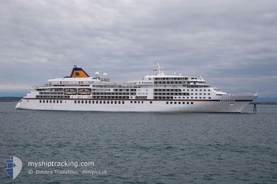
The vessel EUROPA (IMO: 9183855, MMSI: 215767000) is a Passengers Ship that was built in 1999 ( 25 years old ). It's sailing under the flag of [MT] Malta.
In this page you can find informations about the vessels current position, last detected port calls, and current voyage information. If the vessels is not in coverage by AIS you will find the latest position.
The current position of EUROPA is detected by our AIS receivers and we are not responsible for the reliability of the data. The last position was recorded while the vessel was in Coverage by the Ais receivers of our vessel tracking app.
The current draught of EUROPA as reported by AIS is 6.3 meters
Weather
| Temperature | 17.5°C / 63.5°F |
|---|---|
| Wind Speed | 7 knots |
| Direction | 357° N |
| Pressure | 1014.9 hPa |
| Humidity | 74.6 % |
| Cloud Coverage | 100 % |
Featured Company
Last Port Calls
| Port | Arrival | Departure | Time In Port |
|---|---|---|---|
| 2024-05-05 05:38 | 2024-05-05 17:54 | 12 h | |
| 2024-04-19 23:12 | 2024-04-20 13:24 | 14 h | |
| 2024-04-17 04:59 | 2024-04-18 10:18 | 1 d | |
| 2024-04-13 21:17 | 2024-04-14 16:38 | 19 h | |
| 2024-04-09 06:41 | 2024-04-09 15:14 | 8 h | |
| 2024-04-04 23:28 | 2024-04-07 02:56 | 2 d | |
| 2024-03-26 22:17 | 2024-03-27 08:36 | 10 h | |
| 2024-03-22 19:37 | 2024-03-24 08:37 | 1 d | |
| 2024-03-20 22:09 | 2024-03-21 05:00 | 6 h | |
| 2024-03-16 21:37 | 2024-03-18 09:49 | 1 d |
Last Trips
| Origin | Departure | Destination | Arrival | Distance | |
|---|---|---|---|---|---|
| 2024-04-20 21:24 | 2024-05-05 07:38 | 5508.93 nm | |||
| 2024-04-18 18:18 | 2024-04-20 07:12 | 199.15 nm | |||
| 2024-04-14 23:38 | 2024-04-17 12:59 | 642.55 nm | |||
| 2024-04-09 22:14 | 2024-04-14 04:17 | 974.26 nm | |||
| 2024-04-07 10:56 | 2024-04-09 13:41 | 774.41 nm | |||
| 2024-03-27 17:36 | 2024-04-05 07:28 | 1838.58 nm | |||
| 2024-03-24 17:37 | 2024-03-27 07:17 | 635.49 nm | |||
| 2024-03-21 14:00 | 2024-03-23 04:37 | 599.28 nm | |||
| 2024-03-18 18:49 | 2024-03-21 07:09 | 666.99 nm | |||
| 2024-03-15 19:14 | 2024-03-17 06:37 | 418.80 nm |
Events
| Time | Event | Details | Position / Dest | Info |
|---|---|---|---|---|
| 2024-05-17 09:49 | Status Changed | Default Under way using engine |
29.75077 / -13.53583
GIGIB
|
Speed: 17.8 kn Course: 47.2° |
| 2024-05-17 09:41 | Status Changed | Under way using engine Default |
29.72312 / -13.56882
GIGIB
|
Speed: 17.8 kn Course: 46° |
| 2024-05-17 09:41 | OUT of Coverage |
29.72312 / -13.56882
North Atlantic Ocean
GIGIB
|
Speed: 17.8 kn Course: 47.2° |
|
| 2024-05-17 09:34 | IN Coverage |
29.72312 / -13.56882
North Atlantic Ocean
GIGIB
|
Speed: 17.8 kn Course: 47.2° |
|
| 2024-05-17 08:38 | Status Changed | Default Under way using engine |
29.49378 / -13.79887
GIGIB
|
Speed: 17.7 kn Course: 37.4° |
| 2024-05-17 08:33 | OUT of Coverage |
29.47483 / -13.81573
North Atlantic Ocean
GIGIB
|
Speed: 17.7 kn Course: 37.4° |
|
| 2024-05-17 08:30 | Status Changed | Under way using engine Default |
29.46283 / -13.82650
GIGIB
|
Speed: 17.2 kn Course: 38° |
| 2024-05-17 08:18 | Status Changed | Default Under way using engine |
29.41642 / -13.86758
GIGIB
|
Speed: 17.6 kn Course: 35.9° |
| 2024-05-17 08:10 | Status Changed | Under way using engine Default |
29.38808 / -13.89265
GIGIB
|
Speed: 17.6 kn Course: 37° |
| 2024-05-17 07:17 | Status Changed | Default Under way using engine |
29.18193 / -14.07472
GIGIB
|
Speed: 17.9 kn Course: 36.8° |