
Unkown Name
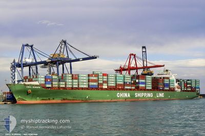
Container Ship
Current Trip
| Trip Time | 32 days |
|---|---|
| Trip Distance | 14426.48 nm |
| AVG Speed | 18.4 Knots |
| MAX Speed | 24.2 Knots |
| Draught | 11.3 m |
| AVG Wind | 12.3 knots |
| MAX Wind | 38 knots |
| MIN Temp | 11.3°C / 52.34°F |
| MAX Temp | 30.4°C / 86.72°F |
| Position Received | 15 h, 10 m ago |
Current Position
| Longitude | 114.40780° |
|---|---|
| Latitude | 22.52820° |
| Status | Under way using engine |
| Speed | 14.5 Knots |
| Course | 316° |
| Area | South China Sea |
| Station | T-AIS |
| Position Received | 15 h, 10 m ago |
Info
Information
The current position of Unkown Name is in South China Sea with coordinates 22.52820° / 114.40780° as reported on 2024-06-17 22:32 by AIS to our vessel tracker app. The vessel's current speed is 14.5 Knots and is currently inside the port of YANTIAN.
The vessel Unkown Name (IMO: 9285988, MMSI: 212175000) is a Container Ship that was built in 2004 ( 20 years old ). It's sailing under the flag of [CY] Cyprus.
In this page you can find informations about the vessels current position, last detected port calls, and current voyage information. If the vessels is not in coverage by AIS you will find the latest position.
The current position of Unkown Name is detected by our AIS receivers and we are not responsible for the reliability of the data. The last position was recorded while the vessel was in Coverage by the Ais receivers of our vessel tracking app.
The current draught of Unkown Name as reported by AIS is 11.3 meters
Weather
| Temperature | 27.4°C / 81.32°F |
|---|---|
| Wind Speed | 4 knots |
| Direction | 163° SSE |
| Pressure | 1006.5 hPa |
| Humidity | 83.9 % |
| Cloud Coverage | 100 % |
Featured Company
Most Visited Ports (Last year)
| Port | Arrivals | |
|---|---|---|
| 10 | ||
| 9 | ||
| 7 | ||
| 6 | ||
| 6 | ||
| 5 |
Last Trips
| Origin | Departure | Destination | Arrival | Distance | |
|---|---|---|---|---|---|
| 2024-05-15 23:46 | 2024-06-18 07:20 | 14426.48 nm | |||
| 2024-05-08 04:52 | 2024-05-14 07:34 | 612.39 nm | |||
| 2024-05-03 18:58 | 2024-05-07 06:44 | 510.54 nm | |||
| 2024-04-24 21:06 | 2024-05-02 01:18 | 1632.37 nm | |||
| 2024-03-31 15:32 | 2024-04-24 03:26 | 8697.85 nm |
Events
| Time | Event | Details | Position / Dest | Info |
|---|---|---|---|---|
| 2024-06-17 23:39 | STOP Moving |
22.57107 / 114.26060
[CN] YANTIAN
|
Speed: 0.2 kn Course: 49° |
|
| 2024-06-17 23:20 | PORT ARRIVAL |
|
22.56298 / 114.26677
[CN] YANTIAN
|
Speed: 4.8 kn Course: 292° |
| 2024-06-17 22:37 | Status Changed | Default Under way using engine |
22.53937 / 114.39263
CNYTN
|
Speed: 14.5 kn Course: 316° |
| 2024-06-17 22:32 | Status Changed | Under way using engine Default |
22.52820 / 114.40780
CNYTN
|
Speed: 12.3 kn Course: 316° |
| 2024-06-17 22:32 | OUT of Coverage |
22.52820 / 114.40780
South China Sea
[CN] YANTIAN
|
Speed: 14.5 kn Course: 316° |
|
| 2024-06-17 22:01 | Status Changed | Default Under way using engine |
22.46140 / 114.46098
CNYTN
|
Speed: 10.9 kn Course: 335° |
| 2024-06-17 19:41 | Status Changed | Under way using engine Default |
22.18435 / 114.85293
CNYTN
|
Speed: 14.4 kn Course: 287° |
| 2024-06-17 19:25 | Status Changed | Default Under way using engine |
22.16483 / 114.91535
CNYTN
|
Speed: 14.7 kn Course: 297° |
| 2024-06-17 19:18 | Status Changed | Under way using engine Default |
22.15253 / 114.94380
CNYTN
|
Speed: 14.7 kn Course: 298° |
| 2024-06-17 19:01 | IN Coverage |
22.15407 / 114.94080
South China Sea
CNYTN
|
Speed: 14.7 kn Course: 297° |