
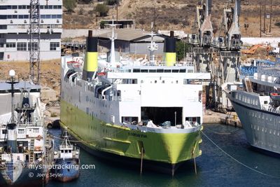
EUROPEAN STAR
Ro-Ro/Passenger Ship
Current Trip
Current Position
| Longitude | 18.80372° |
|---|---|
| Latitude | 40.55735° |
| Status | Under way using engine |
| Speed | 14.5 Knots |
| Course | 105.5° |
| Area | Adriatic Sea |
| Station | T-AIS |
| Position Received | 3 h, 52 m ago |
Info
Information
The current position of EUROPEAN STAR is in Adriatic Sea with coordinates 40.55735° / 18.80372° as reported on 2024-06-27 02:42 by AIS to our vessel tracker app. The vessel's current speed is 14.5 Knots and is currently inside the port of VLORE.
The vessel EUROPEAN STAR (IMO: 7813949, MMSI: 374081000) is a Ro-Ro/Passenger Ship that was built in 1981 ( 43 years old ). It's sailing under the flag of [PA] Panama.
In this page you can find informations about the vessels current position, last detected port calls, and current voyage information. If the vessels is not in coverage by AIS you will find the latest position.
The current position of EUROPEAN STAR is detected by our AIS receivers and we are not responsible for the reliability of the data. The last position was recorded while the vessel was in Coverage by the Ais receivers of our vessel tracking app.
The current draught of EUROPEAN STAR as reported by AIS is 5 meters
Weather
| Temperature | 24.3°C / 75.74°F |
|---|---|
| Wind Speed | 11 knots |
| Direction | 192° SSW |
| Pressure | 1010.1 hPa |
| Humidity | 83.3 % |
| Cloud Coverage | --- |
Featured Company
Last Port Calls
| Port | Arrival | Departure | Time In Port |
|---|---|---|---|
| 2024-06-27 05:00 | |||
| 2024-06-26 05:08 | 2024-06-27 00:01 | 18 h | |
| 2024-06-25 05:12 | 2024-06-26 00:02 | 18 h | |
| 2024-06-24 04:52 | 2024-06-25 00:08 | 19 h | |
| 2024-06-23 05:05 | 2024-06-23 23:10 | 18 h | |
| 2024-06-22 17:51 | 2024-06-22 23:50 | 5 h | |
| 2024-06-22 07:12 | 2024-06-22 13:00 | 5 h | |
| 2024-06-21 04:15 | 2024-06-22 02:06 | 21 h | |
| 2024-06-20 05:40 | 2024-06-20 22:46 | 17 h | |
| 2024-06-19 23:35 | 2024-06-20 00:40 | 1 h |
Last Trips
| Origin | Departure | Destination | Arrival | Distance | |
|---|---|---|---|---|---|
| 2024-06-26 02:02 | 2024-06-26 07:08 | 65.55 nm | |||
| 2024-06-25 02:08 | 2024-06-25 07:12 | 71.33 nm | |||
| 2024-06-24 01:10 | 2024-06-24 06:52 | 69.12 nm | |||
| 2024-06-23 01:50 | 2024-06-23 07:05 | 71.32 nm | |||
| 2024-06-22 15:00 | 2024-06-22 19:51 | 68.43 nm | |||
| 2024-06-22 04:06 | 2024-06-22 09:12 | 70.79 nm | |||
| 2024-06-21 00:46 | 2024-06-21 06:15 | 68.38 nm | |||
| 2024-06-20 02:40 | 2024-06-20 07:40 | 71.18 nm | |||
| 2024-06-20 01:20 | 2024-06-20 01:35 | 0.90 nm | |||
| 2024-06-19 01:05 | 2024-06-19 06:32 | 68.39 nm |
Events
| Time | Event | Details | Position / Dest | Info |
|---|---|---|---|---|
| 2024-06-27 05:00 | PORT ARRIVAL |
|
40.44939 / 19.48218
[AL] VLORE
|
Speed: 7.4 kn Course: 88° |
| 2024-06-27 03:13 | Status Changed | Default Under way using engine |
40.52390 / 18.96264
ALVOA
|
Speed: 14.5 kn Course: 105.5° |
| 2024-06-27 02:42 | OUT of Coverage |
40.55735 / 18.80372
Adriatic Sea
ALVOA
|
Speed: 14.5 kn Course: 105.5° |
|
| 2024-06-27 02:37 | Change Sea Area | Albanian part of the Adriatic Sea Italian part of the Adriatic Sea |
40.56204 / 18.78067
Adriatic Sea
ALVOA
|
Speed: 14.5 kn Course: 104.8° |
| 2024-06-27 01:36 | Destination Changed | ALVOA ITBDS |
40.62695 / 18.46446
ALVOA
|
Speed: 14.5 kn Course: 104.8° |
| 2024-06-27 01:36 | ETA Changed | 2024/06/27 07:00 2024/06/26 07:00 |
40.62695 / 18.46446
ALVOA
|
Speed: 14.5 kn Course: 104.8° |
| 2024-06-27 00:43 | IN Coverage |
40.68741 / 18.19790
Adriatic Sea
|
Speed: 15.1 kn Course: 108° |
|
| 2024-06-27 00:01 | PORT DEPARTURE |
|
40.68848 / 18.19362
ITBDS
|
Speed: Course: 74° |
| 2024-06-26 14:37 | Status Changed | Default Under way using engine |
40.64775 / 17.96440
[IT] BRINDISI
|
Speed: Course: 73° |
| 2024-06-26 14:34 | OUT of Coverage |
40.64775 / 17.96440
Adriatic Sea
[IT] BRINDISI
|
Speed: Course: 8.3° |