
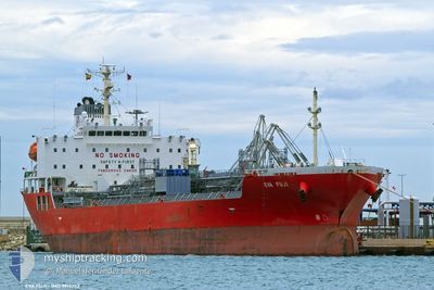
EVA FUJI
Tanker
Current Trip
| Trip Time | 13 days |
|---|---|
| Trip Distance | 1317.43 nm |
| AVG Speed | 9.7 Knots |
| MAX Speed | 15.5 Knots |
| Draught | 5.6 m |
| AVG Wind | 13.4 knots |
| MAX Wind | 26 knots |
| MIN Temp | 15.1°C / 59.18°F |
| MAX Temp | 21.6°C / 70.88°F |
| Position Received | 7 h, 0 m ago |
Current Position
| Longitude | -9.25122° |
|---|---|
| Latitude | 32.31186° |
| Status | Under way using engine |
| Speed | 1.1 Knots |
| Course | 145° |
| Area | North Atlantic Ocean |
| Station | T-AIS |
| Position Received | 7 h, 0 m ago |
Info
Information
The current position of EVA FUJI is in North Atlantic Ocean with coordinates 32.31186° / -9.25122° as reported on 2024-05-28 22:41 by AIS to our vessel tracker app. The vessel's current speed is 1.1 Knots and is currently inside the port of SAFI.
The vessel EVA FUJI (IMO: 9914242, MMSI: 548843000) is a Tanker It's sailing under the flag of [PH] Philippines.
In this page you can find informations about the vessels current position, last detected port calls, and current voyage information. If the vessels is not in coverage by AIS you will find the latest position.
The current position of EVA FUJI is detected by our AIS receivers and we are not responsible for the reliability of the data. The last position was recorded while the vessel was in Coverage by the Ais receivers of our vessel tracking app.
The current draught of EVA FUJI as reported by AIS is 5.6 meters
Weather
| Temperature | 17.4°C / 63.32°F |
|---|---|
| Wind Speed | 9 knots |
| Direction | 33° NNE |
| Pressure | 1013.6 hPa |
| Humidity | 86.7 % |
| Cloud Coverage | --- |
Featured Company
Most Visited Ports (Last year)
| Port | Arrivals | |
|---|---|---|
| 2 | ||
| 2 | ||
| 2 | ||
| 2 | ||
| 2 | ||
| 1 |
Last Trips
| Origin | Departure | Destination | Arrival | Distance | |
|---|---|---|---|---|---|
| 2024-05-15 21:22 | 2024-05-28 23:36 | 1317.43 nm | |||
| 2024-04-18 07:54 | 2024-05-14 09:01 | 2459.41 nm | |||
| 2024-03-14 11:07 | 2024-04-17 18:53 | 9785.25 nm | |||
| 2024-03-02 20:49 | 2024-03-12 21:19 | 274.13 nm | |||
| 2024-02-13 14:17 | 2024-03-01 18:39 | 2801.04 nm |
Events
| Time | Event | Details | Position / Dest | Info |
|---|---|---|---|---|
| 2024-05-28 22:53 | STOP Moving |
32.31258 / -9.25002
[MA] SAFI
|
Speed: 0.3 kn Course: 260° |
|
| 2024-05-28 22:48 | Status Changed | Default Under way using engine |
32.31202 / -9.25031
[MA] SAFI
|
Speed: 1.1 kn Course: 145° |
| 2024-05-28 22:41 | OUT of Coverage |
32.31186 / -9.25122
North Atlantic Ocean
[MA] SAFI
|
Speed: 1.1 kn Course: 127.5° |
|
| 2024-05-28 22:36 | PORT ARRIVAL |
|
32.31419 / -9.25365
[MA] SAFI
|
Speed: 4.3 kn Course: 135° |
| 2024-05-28 22:33 | Status Changed | Under way using engine Default |
32.31633 / -9.25720
SAFI MOROCCO
|
Speed: 4.7 kn Course: 100° |
| 2024-05-28 22:20 | Status Changed | Default Under way using engine |
32.31706 / -9.27480
SAFI MOROCCO
|
Speed: 3.4 kn Course: 73° |
| 2024-05-28 22:04 | START Moving | 2.57 nm, West of SAFI |
32.31567 / -9.30100
SAFI MOROCCO
|
Speed: 3.3 kn Course: 66° |
| 2024-05-28 21:52 | Status Changed | Under way using engine Default |
32.31386 / -9.29255
SAFI MOROCCO
|
Speed: 2.4 kn Course: 47° |
| 2024-05-28 21:42 | IN Coverage |
32.31386 / -9.29255
North Atlantic Ocean
|
Speed: 1.5 kn Course: 278.9° |
|
| 2024-05-28 06:16 | OUT of Coverage |
32.29312 / -9.30859
North Atlantic Ocean
|
Speed: 0.1 kn Course: 234.7° |