
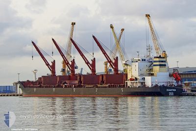
EVANTHIA
Bulk Carrier
Current Trip
| Time Travelled | 11 days |
|---|---|
| Remaining Time | 14 h, 54 mins |
| Distance Travelled | 2970.27 nm |
| Remaining Distance | 192.02 nm |
| AVG Speed | 10.5 Knots |
| MAX Speed | 13 Knots |
| AVG Wind | 12.4 knots |
| MAX Wind | 24.1 knots |
| MIN Temp | 27.7°C / 81.86°F |
| MAX Temp | 34.9°C / 94.82°F |
| Draught | 12.8 m |
| Position Received | 4 d ago |
Current Position
| Longitude | 77.35748° |
|---|---|
| Latitude | 7.52198° |
| Status | Under way using engine |
| Speed | 10.8 Knots |
| Course | 121.6° |
| Area | Laccadive Sea |
| Station | T-AIS |
| Position Received | 4 d ago |
Info
Information
The current position of EVANTHIA is in Laccadive Sea with coordinates 7.52198° / 77.35748° as reported on 2024-06-05 12:16 by AIS to our vessel tracker app. The vessel's current speed is 10.8 Knots and is heading at the port of CHITTAGONG. The estimated time of arrival as calculated by vessel tracking app is 2024-06-10 21:50 LT
The vessel EVANTHIA (IMO: 9308106, MMSI: 352027000) is a Bulk Carrier that was built in 2005 ( 19 years old ). It's sailing under the flag of [PA] Panama.
In this page you can find informations about the vessels current position, last detected port calls, and current voyage information. If the vessels is not in coverage by AIS you will find the latest position.
The current position of EVANTHIA is detected by our AIS receivers and we are not responsible for the reliability of the data. The last position was recorded while the vessel was in Coverage by the Ais receivers of our vessel tracking app.
The current draught of EVANTHIA as reported by AIS is 12.8 meters
Weather
| Temperature | 29.5°C / 85.1°F |
|---|---|
| Wind Speed | 11 knots |
| Direction | 247° WSW |
| Pressure | 1003.8 hPa |
| Humidity | 84.7 % |
| Cloud Coverage | 100 % |
Featured Company
Events
| Time | Event | Details | Position / Dest | Info |
|---|---|---|---|---|
| 2024-06-05 12:23 | Status Changed | Default Under way using engine |
7.51167 / 77.37334
BDCGP
|
Speed: 10.8 kn Course: 121.6° |
| 2024-06-05 12:16 | Status Changed | Under way using engine Default |
7.52198 / 77.35748
BDCGP
|
Speed: 10 kn Course: 118° |
| 2024-06-05 12:16 | OUT of Coverage |
7.52198 / 77.35748
Laccadive Sea
BDCGP
|
Speed: 10.8 kn Course: 121.6° |
|
| 2024-06-05 11:47 | Status Changed | Default Under way using engine |
7.56500 / 77.27834
BDCGP
|
Speed: 11 kn Course: 117.6° |
| 2024-06-05 10:52 | Status Changed | Under way using engine Default |
7.64224 / 77.12993
BDCGP
|
Speed: 10 kn Course: 128° |
| 2024-06-05 10:44 | Status Changed | Default Under way using engine |
7.65833 / 77.10833
BDCGP
|
Speed: 10.9 kn Course: 129.8° |
| 2024-06-05 09:05 | Status Changed | Under way using engine Default |
7.84797 / 76.87363
BDCGP
|
Speed: 10 kn Course: 126° |
| 2024-06-05 08:59 | Status Changed | Default Under way using engine |
7.85833 / 76.85667
BDCGP
|
Speed: 10.5 kn Course: 126.6° |
| 2024-06-05 08:13 | Destination Changed | BDCGP CHATTOGRAM |
7.94029 / 76.74649
BDCGP
|
Speed: 10.4 kn Course: 127° |
| 2024-06-05 08:13 | ETA Changed | 2024/06/10 16:00 2024/05/10 02:00 |
7.94029 / 76.74649
BDCGP
|
Speed: 10.4 kn Course: 127° |