
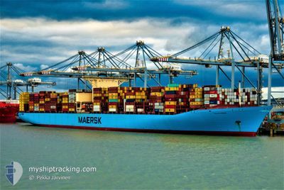
EVELYN MAERSK
Container Ship
Current Trip
| Time Travelled | 10 days |
|---|---|
| Remaining Time | --- |
| Distance Travelled | 4811.80 nm |
| Remaining Distance | --- |
| AVG Speed | 18.3 Knots |
| MAX Speed | 21.5 Knots |
| AVG Wind | 5.9 knots |
| MAX Wind | 15 knots |
| MIN Temp | 27.5°C / 81.5°F |
| MAX Temp | 32.2°C / 89.96°F |
| Draught | 11 m |
| Position Received | 2 d ago |
Current Position
| Longitude | 104.25114° |
|---|---|
| Latitude | 1.26412° |
| Status | Under way using engine |
| Speed | 15.7 Knots |
| Course | 84.4° |
| Area | Singapore Strait |
| Station | T-AIS |
| Position Received | 2 d ago |
Info
Information
The current position of EVELYN MAERSK is in Singapore Strait with coordinates 1.26412° / 104.25114° as reported on 2024-05-15 08:33 by AIS to our vessel tracker app. The vessel's current speed is 15.7 Knots and is heading at the port of NINGBO. The estimated time of arrival as calculated by vessel tracking app is 2024-05-20 09:00 LT
The vessel EVELYN MAERSK (IMO: 9321512, MMSI: 220496000) is a Container Ship that was built in 2007 ( 17 years old ). It's sailing under the flag of [DK] Denmark.
In this page you can find informations about the vessels current position, last detected port calls, and current voyage information. If the vessels is not in coverage by AIS you will find the latest position.
The current position of EVELYN MAERSK is detected by our AIS receivers and we are not responsible for the reliability of the data. The last position was recorded while the vessel was in Coverage by the Ais receivers of our vessel tracking app.
The current draught of EVELYN MAERSK as reported by AIS is 11 meters
Weather
| Temperature | 28.6°C / 83.48°F |
|---|---|
| Wind Speed | 1 knots |
| Direction | 86° E |
| Pressure | 1009 hPa |
| Humidity | 76.5 % |
| Cloud Coverage | 37 % |
Featured Company
Last Port Calls
| Port | Arrival | Departure | Time In Port |
|---|---|---|---|
| 2024-05-04 05:36 | 2024-05-07 14:31 | 3 d | |
| 2024-05-02 13:56 | 2024-05-04 00:48 | 1 d | |
| 2024-04-08 23:05 | 2024-04-09 17:34 | 18 h | |
| 2024-04-02 08:54 | 2024-04-03 11:56 | 1 d | |
| 2024-03-30 05:16 | 2024-04-01 01:33 | 1 d | |
| 2024-03-27 14:59 | 2024-03-29 14:12 | 1 d | |
| 2024-03-22 01:28 | 2024-03-24 06:28 | 2 d | |
| 2024-03-19 06:59 | 2024-03-20 22:10 | 1 d |
Most Visited Ports (Last year)
| Port | Arrivals | |
|---|---|---|
| 5 | ||
| 4 | ||
| 4 | ||
| 4 | ||
| 4 | ||
| 4 |
Last Trips
| Origin | Departure | Destination | Arrival | Distance | |
|---|---|---|---|---|---|
| 2024-05-04 04:48 | 2024-05-04 09:36 | 45.78 nm | |||
| 2024-04-09 17:34 | 2024-05-02 17:56 | 10318.94 nm | |||
| 2024-04-03 13:56 | 2024-04-08 23:05 | 1727.17 nm | |||
| 2024-04-01 02:33 | 2024-04-02 10:54 | 262.41 nm | |||
| 2024-03-29 15:12 | 2024-03-30 05:16 | 182.73 nm | |||
| 2024-03-24 07:28 | 2024-03-27 15:59 | 453.51 nm | |||
| 2024-03-20 22:10 | 2024-03-22 02:28 | 396.34 nm | |||
| 2024-02-23 03:53 | 2024-03-19 06:59 | 10881.85 nm |
Events
| Time | Event | Details | Position / Dest | Info |
|---|---|---|---|---|
| 2024-05-15 08:40 | Status Changed | Default Under way using engine |
1.26719 / 104.28431
AEJAL>CNNPO
|
Speed: 15.7 kn Course: 84.4° |
| 2024-05-15 08:33 | OUT of Coverage |
1.26412 / 104.25114
Singapore Strait
AEJAL>CNNPO
|
Speed: 15.7 kn Course: 84.4° |
|
| 2024-05-15 08:17 | Change Sea Area | Malaysian part of the Singapore Strait Indonesian part of the Singapore Strait |
1.25643 / 104.18241
Singapore Strait
AEJAL>CNNPO
|
Speed: 16.3 kn Course: 82.6° |
| 2024-05-15 07:58 | Status Changed | Under way using engine Default |
1.25179 / 104.09565
AEJAL>CNNPO
|
Speed: 15.1 kn Course: 84° |
| 2024-05-15 07:50 | Status Changed | Default Under way using engine |
1.24733 / 104.06298
AEJAL>CNNPO
|
Speed: 15.1 kn Course: 79.5° |
| 2024-05-15 04:47 | Change Sea Area | Indonesian part of the Singapore Strait Indonesian part of the Malacca Strait |
1.17527 / 103.42715
Singapore Strait
AEJAL>CNNPO
|
Speed: 14.9 kn Course: 120.7° |
| 2024-05-15 04:35 | Change Sea Area | Indonesian part of the Malacca Strait Indian part of the Laccadive Sea |
1.20153 / 103.38597
Malacca Strait
AEJAL>CNNPO
|
Speed: 14.8 kn Course: 126° |
| 2024-05-15 04:35 | Status Changed | Under way using engine Default |
1.20230 / 103.38492
AEJAL>CNNPO
|
Speed: 15 kn Course: 129° |
| 2024-05-15 04:29 | IN Coverage |
1.20153 / 103.38597
Malacca Strait
AEJAL>CNNPO
|
Speed: 14.8 kn Course: 126° |
|
| 2024-05-11 11:09 | OUT of Coverage |
7.52855 / 76.87745
Laccadive Sea
AEJAL>CNNPO
|
Speed: 20.3 kn Course: 127.1° |