
EVENTUS
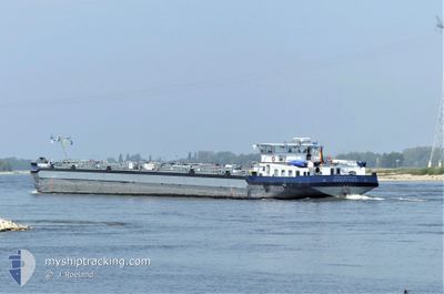
Tanker
Current Trip
| Time Travelled | 1 day |
|---|---|
| Remaining Time | 1 day |
| Distance Travelled | 238.57 nm |
| Remaining Distance | 325.35 nm |
| AVG Speed | 11.1 Knots |
| MAX Speed | 13 Knots |
| AVG Wind | 4.3 knots |
| MAX Wind | 7.9 knots |
| MIN Temp | 12°C / 53.6°F |
| MAX Temp | 20.2°C / 68.36°F |
| Draught | 0 m |
| Position Received | 52 m ago |
Current Position
| Longitude | 5.06411° |
|---|---|
| Latitude | 52.12093° |
| Status | Under way using engine |
| Speed | 9.2 Knots |
| Course | 312.1° |
| Area | North Sea |
| Station | T-AIS |
| Position Received | 52 m ago |
Info
Information
The current position of EVENTUS is in North Sea with coordinates 52.12093° / 5.06411° as reported on 2024-05-16 02:15 by AIS to our vessel tracker app. The vessel's current speed is 9.2 Knots and is heading at the port of KARLSRUHE. The estimated time of arrival as calculated by vessel tracking app is 2024-05-17 14:32 LT
The vessel EVENTUS (MMSI: 211840920) is a Tanker It's sailing under the flag of [DE] Germany.
In this page you can find informations about the vessels current position, last detected port calls, and current voyage information. If the vessels is not in coverage by AIS you will find the latest position.
The current position of EVENTUS is detected by our AIS receivers and we are not responsible for the reliability of the data. The last position was recorded while the vessel was in Coverage by the Ais receivers of our vessel tracking app.
Weather
| Temperature | 13.8°C / 56.84°F |
|---|---|
| Wind Speed | 1 knots |
| Direction | 55° NE |
| Pressure | 1005.5 hPa |
| Humidity | 97.8 % |
| Cloud Coverage | 100 % |
Featured Company
Last Port Calls
| Port | Arrival | Departure | Time In Port |
|---|---|---|---|
| 2024-05-14 22:14 | 2024-05-14 23:39 | 1 h | |
| 2024-05-13 10:37 | 2024-05-13 11:31 | 53 m | |
| 2024-05-08 09:23 | 2024-05-11 00:43 | 2 d | |
| 2024-05-05 12:51 | 2024-05-06 18:30 | 1 d | |
| 2024-05-05 00:36 | 2024-05-05 01:38 | 1 h | |
| 2024-05-03 23:42 | 2024-05-04 11:18 | 11 h | |
| 2024-05-03 06:15 | 2024-05-03 06:31 | 16 m | |
| 2024-05-01 20:00 | 2024-05-02 14:18 | 18 h | |
| 2024-04-28 17:04 | 2024-04-28 17:31 | 27 m | |
| 2024-04-26 16:35 | 2024-04-28 06:20 | 1 d |
Most Visited Ports (Last year)
| Port | Arrivals | |
|---|---|---|
| 26 | ||
| 26 | ||
| 24 | ||
| 20 | ||
| 18 | ||
| 16 |
Last Trips
| Origin | Departure | Destination | Arrival | Distance | |
|---|---|---|---|---|---|
| 2024-05-13 13:31 | 2024-05-15 00:14 | 6.56 nm | |||
| 2024-05-11 02:43 | 2024-05-13 12:37 | 285.40 nm | |||
| 2024-05-06 20:30 | 2024-05-08 11:23 | 163.44 nm | |||
| 2024-05-05 03:38 | 2024-05-05 14:51 | 61.56 nm | |||
| 2024-05-04 13:18 | 2024-05-05 02:36 | 87.67 nm | |||
| 2024-05-03 08:31 | 2024-05-04 01:42 | 137.47 nm | |||
| 2024-05-02 16:18 | 2024-05-03 08:15 | 152.63 nm | |||
| 2024-04-28 19:31 | 2024-05-01 22:00 | 223.85 nm | |||
| 2024-04-28 08:20 | 2024-04-28 19:04 | 61.84 nm | |||
| 2024-04-21 13:00 | 2024-04-26 18:35 | 10.46 nm |
Events
| Time | Event | Details | Position / Dest | Info |
|---|---|---|---|---|
| 2024-05-16 02:03 | IN Coverage |
52.09249 / 5.07831
North Sea
|
Speed: 9.1 kn Course: 353.8° |
|
| 2024-05-15 22:49 | OUT of Coverage |
51.88999 / 5.46036
North Sea
|
Speed: 5 kn Course: 333.4° |
|
| 2024-05-15 19:39 | IN Coverage |
51.82312 / 6.26410
North Sea
|
Speed: 11.3 kn Course: 304.7° |
|
| 2024-05-15 17:19 | OUT of Coverage |
51.57147 / 6.68515
North Sea
|
Speed: 11.9 kn Course: 332.2° |
|
| 2024-05-15 09:07 | IN Coverage |
50.49951 / 7.31680
North Sea
|
Speed: 12.4 kn Course: 319.7° |
|
| 2024-05-15 04:39 | OUT of Coverage |
49.97268 / 7.91835
North Sea
|
Speed: 9.9 kn Course: 277.2° |
|
| 2024-05-15 02:42 | IN Coverage |
50.00066 / 8.32494
North Sea
|
Speed: 2.5 kn Course: 272.8° |
|
| 2024-05-15 01:24 | OUT of Coverage |
50.03334 / 8.47147
North Sea
|
Speed: 5.9 kn Course: 205.5° |
|
| 2024-05-15 01:21 | START Moving | 3.98 nm, South West of HOCHST |
50.03677 / 8.47433
DEKAE03901HRBA103599
|
Speed: 3.3 kn Course: 210° |
| 2024-05-15 01:06 | STOP Moving | 3.84 nm, South West of HOCHST |
50.03855 / 8.47679
DEKAE03901HRBA103599
|
Speed: 0.2 kn Course: 222° |