
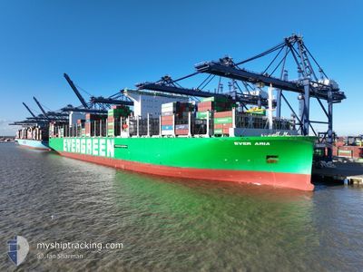
EVER ARIA
Cargo D
Current Trip
| Time Travelled | 22 days |
|---|---|
| Remaining Time | --- |
| Distance Travelled | 9926.09 nm |
| Remaining Distance | --- |
| AVG Speed | 18.5 Knots |
| MAX Speed | 23.6 Knots |
| AVG Wind | 13.1 knots |
| MAX Wind | 32.3 knots |
| MIN Temp | 15.3°C / 59.54°F |
| MAX Temp | 30.7°C / 87.26°F |
| Draught | 16.4 m |
| Position Received | 6 d ago |
Current Position
| Longitude | 17.51849° |
|---|---|
| Latitude | -34.21757° |
| Status | Under way using engine |
| Speed | 18.3 Knots |
| Course | 317.9° |
| Area | South Atlantic Ocean |
| Station | T-AIS |
| Position Received | 6 d ago |
Info
Information
The current position of EVER ARIA is in South Atlantic Ocean with coordinates -34.21757° / 17.51849° as reported on 2024-06-14 08:48 by AIS to our vessel tracker app. The vessel's current speed is 18.3 Knots and is heading at the port of MAASVLAKTE - ROTTERDAM. The estimated time of arrival as calculated by vessel tracking app is 2024-06-28 11:00 LT
The vessel EVER ARIA (IMO: 9909132, MMSI: 352001747) is a Cargo D It's sailing under the flag of [PA] Panama.
In this page you can find informations about the vessels current position, last detected port calls, and current voyage information. If the vessels is not in coverage by AIS you will find the latest position.
The current position of EVER ARIA is detected by our AIS receivers and we are not responsible for the reliability of the data. The last position was recorded while the vessel was in Coverage by the Ais receivers of our vessel tracking app.
The current draught of EVER ARIA as reported by AIS is 16.4 meters
Weather
| Temperature | 26.4°C / 79.52°F |
|---|---|
| Wind Speed | 16 knots |
| Direction | 193° SSW |
| Pressure | 1013.8 hPa |
| Humidity | 76.3 % |
| Cloud Coverage | 100 % |
Featured Company
Last Port Calls
| Port | Arrival | Departure | Time In Port |
|---|---|---|---|
| 2024-05-27 19:33 | 2024-05-29 07:18 | 1 d | |
| 2024-05-21 13:24 | 2024-05-23 13:52 | 2 d | |
| 2024-05-18 20:11 | 2024-05-20 16:22 | 1 d | |
| 2024-05-12 10:47 | 2024-05-14 20:22 | 2 d | |
| 2024-05-05 23:40 | 2024-05-06 19:12 | 19 h | |
| 2024-04-07 09:25 | 2024-04-11 09:26 | 4 d | |
| 2024-04-03 10:00 | 2024-04-05 18:53 | 2 d |
Most Visited Ports (Last year)
| Port | Arrivals | |
|---|---|---|
| 6 | ||
| 4 | ||
| 4 | ||
| 4 | ||
| 4 | ||
| 4 |
Last Trips
| Origin | Departure | Destination | Arrival | Distance | |
|---|---|---|---|---|---|
| 2024-05-23 21:52 | 2024-05-28 03:33 | 888.52 nm | |||
| 2024-05-21 00:22 | 2024-05-21 21:24 | 390.41 nm | |||
| 2024-05-15 04:22 | 2024-05-19 04:11 | 1832.72 nm | |||
| 2024-05-07 00:42 | 2024-05-12 18:47 | 1639.55 nm | |||
| 2024-04-11 11:26 | 2024-05-06 05:10 | 10626.15 nm | |||
| 2024-04-05 20:53 | 2024-04-07 11:25 | 325.51 nm | |||
| 2024-03-26 13:09 | 2024-04-03 12:00 | 527.57 nm |
Events
| Time | Event | Details | Position / Dest | Info |
|---|---|---|---|---|
| 2024-06-14 08:56 | Status Changed | Default Under way using engine |
-34.18774 / 17.48625
HKHKG>NLRDM
|
Speed: 18.3 kn Course: 317.9° |
| 2024-06-14 08:48 | OUT of Coverage |
-34.21757 / 17.51849
South Atlantic Ocean
HKHKG>NLRDM
|
Speed: 18.3 kn Course: 317.9° |
|
| 2024-06-14 04:57 | Status Changed | Under way using engine Default |
-34.81635 / 18.56223
HKHKG>NLRDM
|
Speed: 18.5 kn Course: 284° |
| 2024-06-14 04:42 | Status Changed | Default Under way using engine |
-34.83606 / 18.65778
HKHKG>NLRDM
|
Speed: 17.7 kn Course: 282.3° |
| 2024-06-14 04:36 | Status Changed | Under way using engine Default |
-34.84285 / 18.69106
HKHKG>NLRDM
|
Speed: 17.4 kn Course: 284° |
| 2024-06-14 04:31 | Status Changed | Default Under way using engine |
-34.84901 / 18.72007
HKHKG>NLRDM
|
Speed: 17.9 kn Course: 286.3° |
| 2024-06-14 03:45 | Status Changed | Under way using engine Default |
-34.90699 / 18.99363
HKHKG>NLRDM
|
Speed: 18.4 kn Course: 283° |
| 2024-06-14 03:41 | Status Changed | Default Under way using engine |
-34.91233 / 19.02113
HKHKG>NLRDM
|
Speed: 18.4 kn Course: 283.9° |
| 2024-06-14 03:27 | ETA Changed | 2024/06/28 11:00 2024/06/28 14:00 |
-34.92882 / 19.10319
HKHKG>NLRDM
|
Speed: 18.5 kn Course: 282.4° |
| 2024-06-14 03:04 | Status Changed | Under way using engine Default |
-34.95827 / 19.24647
HKHKG>NLRDM
|
Speed: 18.6 kn Course: 279° |