
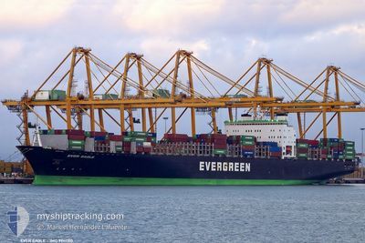
EVER EAGLE
Container Ship
Current Trip
| Time Travelled | --- |
|---|---|
| Remaining Time | 4 days |
| Distance Travelled | --- |
| Remaining Distance | 1927.15 nm |
| AVG Speed | --- |
| MAX Speed | --- |
| AVG Wind | --- |
| MAX Wind | --- |
| MIN Temp | --- |
| MAX Temp | --- |
| Draught | 13 m |
| Position Received | 4 d ago |
Current Position
| Longitude | 141.77578° |
|---|---|
| Latitude | 41.61399° |
| Status | Under way using engine |
| Speed | 20 Knots |
| Course | 87.7° |
| Area | North Pacific Ocean |
| Station | T-AIS |
| Position Received | 4 d ago |
Info
Information
The current position of EVER EAGLE is in North Pacific Ocean with coordinates 41.61399° / 141.77578° as reported on 2024-06-11 18:26 by AIS to our vessel tracker app. The vessel's current speed is 20 Knots and is heading at the port of TACOMA. The estimated time of arrival as calculated by vessel tracking app is 2024-06-20 06:38 LT
The vessel EVER EAGLE (IMO: 9241310, MMSI: 235335000) is a Container Ship that was built in 2001 ( 23 years old ). It's sailing under the flag of [GB] United Kingdom.
In this page you can find informations about the vessels current position, last detected port calls, and current voyage information. If the vessels is not in coverage by AIS you will find the latest position.
The current position of EVER EAGLE is detected by our AIS receivers and we are not responsible for the reliability of the data. The last position was recorded while the vessel was in Coverage by the Ais receivers of our vessel tracking app.
The current draught of EVER EAGLE as reported by AIS is 13 meters
Weather
| Temperature | 6.1°C / 42.98°F |
|---|---|
| Wind Speed | 16 knots |
| Direction | 104° ESE |
| Pressure | 1014.2 hPa |
| Humidity | 95.3 % |
| Cloud Coverage | 100 % |
Featured Company
Last Port Calls
| Port | Arrival | Departure | Time In Port |
|---|---|---|---|
| 2024-06-02 12:50 | 2024-06-03 07:41 | 18 h | |
| 2024-05-31 07:47 | 2024-06-01 01:06 | 17 h | |
| 2024-05-30 03:15 | 2024-05-31 02:59 | 23 h | |
| 2024-05-25 03:07 | 2024-05-25 08:38 | 5 h | |
| 2024-05-23 04:30 | 2024-05-24 03:35 | 23 h | |
| 2024-05-08 10:08 | 2024-05-10 13:47 | 2 d | |
| 2024-04-30 21:34 | 2024-05-03 10:57 | 2 d | |
| 2024-04-14 01:07 | 2024-04-14 17:05 | 15 h | |
| 2024-04-12 11:06 | 2024-04-13 02:22 | 15 h | |
| 2024-04-10 04:45 | 2024-04-10 16:37 | 11 h |
Last Trips
| Origin | Departure | Destination | Arrival | Distance | |
|---|---|---|---|---|---|
| 2024-06-01 09:06 | 2024-06-02 20:50 | 343.67 nm | |||
| 2024-05-31 10:59 | 2024-05-31 15:47 | 18.16 nm | |||
| 2024-05-25 17:38 | 2024-05-30 11:15 | 1191.59 nm | |||
| 2024-05-24 12:35 | 2024-05-25 12:07 | 364.10 nm | |||
| 2024-05-10 06:47 | 2024-05-23 13:30 | 4296.91 nm | |||
| 2024-05-03 03:57 | 2024-05-08 03:08 | 187.48 nm | |||
| 2024-04-15 01:05 | 2024-04-30 14:34 | 5973.55 nm | |||
| 2024-04-13 10:22 | 2024-04-14 09:07 | 345.16 nm | |||
| 2024-04-11 00:37 | 2024-04-12 19:06 | 689.39 nm | |||
| 2024-04-06 11:09 | 2024-04-10 12:45 | 1001.11 nm |
Events
| Time | Event | Details | Position / Dest | Info |
|---|---|---|---|---|
| 2024-06-11 18:30 | Status Changed | Default Under way using engine |
41.61468 / 141.80887
CN NGB>>US TIW
|
Speed: 20 kn Course: 87.7° |
| 2024-06-11 18:26 | OUT of Coverage |
41.61399 / 141.77578
North Pacific Ocean
CN NGB>>US TIW
|
Speed: 20 kn Course: 87.7° |
|
| 2024-06-11 18:06 | Status Changed | Under way using engine Default |
41.63376 / 141.62968
CN NGB>>US TIW
|
Speed: 21.1 kn Course: 98° |
| 2024-06-11 18:05 | Status Changed | Default Under way using engine |
41.63500 / 141.62125
CN NGB>>US TIW
|
Speed: 21.1 kn Course: 96.7° |
| 2024-06-11 18:05 | Status Changed | Under way using engine Default |
41.63516 / 141.61972
CN NGB>>US TIW
|
Speed: 21.1 kn Course: 94° |
| 2024-06-11 18:01 | Status Changed | Default Under way using engine |
41.63671 / 141.59172
CN NGB>>US TIW
|
Speed: 21.5 kn Course: 92.1° |
| 2024-06-11 17:23 | Change Sea Area | Japanese part of the North Pacific Ocean Japanese part of the Japan Sea |
41.63862 / 141.29318
North Pacific Ocean
CN NGB>>US TIW
|
Speed: 19.6 kn Course: 88° |
| 2024-06-11 16:21 | Status Changed | Under way using engine Default |
41.64366 / 140.82822
CN NGB>>US TIW
|
Speed: 21.2 kn Course: 48° |
| 2024-06-11 16:13 | Status Changed | Default Under way using engine |
41.61457 / 140.78330
CN NGB>>US TIW
|
Speed: 20.9 kn Course: 54.6° |
| 2024-06-11 15:52 | Status Changed | Under way using engine Default |
41.54674 / 140.65233
CN NGB>>US TIW
|
Speed: 21.7 kn Course: 46° |