
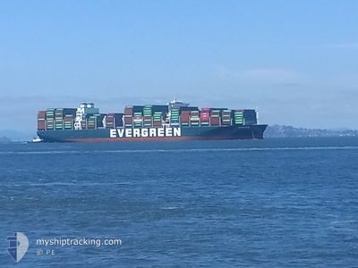
EVER FAR
Cargo
Current Trip
| Time Travelled | 5 days |
|---|---|
| Remaining Time | 7 days |
| Distance Travelled | 2655.75 nm |
| Remaining Distance | 3786.10 nm |
| AVG Speed | 19.3 Knots |
| MAX Speed | 22.9 Knots |
| AVG Wind | 16.8 knots |
| MAX Wind | 34 knots |
| MIN Temp | 10.1°C / 50.18°F |
| MAX Temp | 24.1°C / 75.38°F |
| Draught | 13.8 m |
| Position Received | 1 d ago |
Current Position
| Longitude | 141.79486° |
|---|---|
| Latitude | 35.62286° |
| Status | Under way using engine |
| Speed | 21.8 Knots |
| Course | 56° |
| Area | North Pacific Ocean |
| Station | T-AIS |
| Position Received | 1 d ago |
Info
Information
The current position of EVER FAR is in North Pacific Ocean with coordinates 35.62286° / 141.79486° as reported on 2024-05-17 04:27 by AIS to our vessel tracker app. The vessel's current speed is 21.8 Knots and is heading at the port of LOS ANGELES. The estimated time of arrival as calculated by vessel tracking app is 2024-05-26 22:18 LT
The vessel EVER FAR (IMO: 9850862, MMSI: 636020371) is a Cargo It's sailing under the flag of [LR] Liberia.
In this page you can find informations about the vessels current position, last detected port calls, and current voyage information. If the vessels is not in coverage by AIS you will find the latest position.
The current position of EVER FAR is detected by our AIS receivers and we are not responsible for the reliability of the data. The last position was recorded while the vessel was in Coverage by the Ais receivers of our vessel tracking app.
The current draught of EVER FAR as reported by AIS is 13.8 meters
Weather
| Temperature | 10.3°C / 50.54°F |
|---|---|
| Wind Speed | 15 knots |
| Direction | 229° SW |
| Pressure | 1017.4 hPa |
| Humidity | 85.3 % |
| Cloud Coverage | --- |
Featured Company
Last Port Calls
| Port | Arrival | Departure | Time In Port |
|---|---|---|---|
| 2024-05-12 06:20 | 2024-05-13 11:35 | 1 d | |
| 2024-05-09 12:11 | 2024-05-11 09:13 | 1 d | |
| 2024-05-06 15:25 | 2024-05-08 16:47 | 2 d | |
| 2024-04-21 19:00 | 2024-04-23 11:29 | 1 d | |
| 2024-04-20 21:26 | 2024-04-20 22:04 | 38 m | |
| 2024-04-15 22:35 | 2024-04-18 09:38 | 2 d | |
| 2024-04-11 10:34 | 2024-04-14 15:54 | 3 d | |
| 2024-03-26 13:17 | 2024-03-27 21:01 | 1 d | |
| 2024-03-24 07:08 | 2024-03-25 15:47 | 1 d | |
| 2024-03-23 02:13 | 2024-03-23 15:51 | 13 h |
Last Trips
| Origin | Departure | Destination | Arrival | Distance | |
|---|---|---|---|---|---|
| 2024-05-11 17:13 | 2024-05-12 14:20 | 349.69 nm | |||
| 2024-05-09 00:47 | 2024-05-09 20:11 | 46.57 nm | |||
| 2024-04-23 04:29 | 2024-05-06 23:25 | 5594.82 nm | |||
| 2024-04-20 15:04 | 2024-04-21 12:00 | 42.02 nm | |||
| 2024-04-18 02:38 | 2024-04-20 14:26 | 873.23 nm | |||
| 2024-04-14 08:54 | 2024-04-15 15:35 | 385.51 nm | |||
| 2024-03-28 05:01 | 2024-04-11 03:34 | 6418.51 nm | |||
| 2024-03-25 23:47 | 2024-03-26 21:17 | 348.63 nm | |||
| 2024-03-23 23:51 | 2024-03-24 15:08 | 219.11 nm | |||
| 2024-03-09 22:19 | 2024-03-14 17:00 | 1837.43 nm |
Events
| Time | Event | Details | Position / Dest | Info |
|---|---|---|---|---|
| 2024-05-17 04:36 | Status Changed | Default Under way using engine |
35.65580 / 141.85457
US LAX
|
Speed: 21.8 kn Course: 56° |
| 2024-05-17 04:27 | Status Changed | Under way using engine Default |
35.62286 / 141.79486
US LAX
|
Speed: 21.8 kn Course: 56° |
| 2024-05-17 04:27 | OUT of Coverage |
35.62286 / 141.79486
North Pacific Ocean
US LAX
|
Speed: 21.8 kn Course: 56° |
|
| 2024-05-17 04:21 | Status Changed | Default Under way using engine |
35.60222 / 141.75713
US LAX
|
Speed: 22 kn Course: 56.4° |
| 2024-05-16 22:56 | Change Sea Area | Japanese part of the North Pacific Ocean Japanese part of the Philippine Sea |
34.65125 / 139.65885
North Pacific Ocean
US LAX
|
Speed: 21.7 kn Course: 79.9° |
| 2024-05-16 22:27 | Status Changed | Under way using engine Default |
34.62326 / 139.44720
US LAX
|
Speed: 21.8 kn Course: 85° |
| 2024-05-16 22:13 | IN Coverage |
34.62405 / 139.46209
Philippine Sea
US LAX
|
Speed: 22 kn Course: 85.5° |
|
| 2024-05-16 21:00 | Status Changed | Default Under way using engine |
34.44987 / 138.87166
US LAX
|
Speed: 20.6 kn Course: 60.8° |
| 2024-05-16 20:53 | Change Sea Area | Japanese part of the Philippine Sea Chinese part of the Eastern China Sea |
34.42764 / 138.82367
Philippine Sea
US LAX
|
Speed: 20.6 kn Course: 60.8° |
| 2024-05-16 20:53 | OUT of Coverage |
34.42764 / 138.82367
Philippine Sea
US LAX
|
Speed: 20.6 kn Course: 60.8° |