
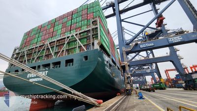
EVER FEAT
Cargo D
Current Trip
| Time Travelled | 5 days |
|---|---|
| Remaining Time | --- |
| Distance Travelled | 2529.87 nm |
| Remaining Distance | --- |
| AVG Speed | 18.1 Knots |
| MAX Speed | 20.8 Knots |
| AVG Wind | 8.2 knots |
| MAX Wind | 21.9 knots |
| MIN Temp | 3.3°C / 37.94°F |
| MAX Temp | 11°C / 51.8°F |
| Draught | 13.4 m |
| Position Received | 5 d ago |
Current Position
| Longitude | -127.52983° |
|---|---|
| Latitude | 49.31659° |
| Status | Under way using engine |
| Speed | 17.9 Knots |
| Course | 296° |
| Area | North Pacific Ocean |
| Station | T-AIS |
| Position Received | 5 d ago |
Info
Information
The current position of EVER FEAT is in North Pacific Ocean with coordinates 49.31659° / -127.52983° as reported on 2024-05-27 21:50 by AIS to our vessel tracker app. The vessel's current speed is 17.9 Knots and is heading at the port of KAOHSIUNG. The estimated time of arrival as calculated by vessel tracking app is 2024-06-09 22:00 LT
The vessel EVER FEAT (IMO: 9850898, MMSI: 636020684) is a Cargo D It's sailing under the flag of [LR] Liberia.
In this page you can find informations about the vessels current position, last detected port calls, and current voyage information. If the vessels is not in coverage by AIS you will find the latest position.
The current position of EVER FEAT is detected by our AIS receivers and we are not responsible for the reliability of the data. The last position was recorded while the vessel was in Coverage by the Ais receivers of our vessel tracking app.
The current draught of EVER FEAT as reported by AIS is 13.4 meters
Weather
| Temperature | 4.1°C / 39.38°F |
|---|---|
| Wind Speed | 16 knots |
| Direction | 359° N |
| Pressure | 1007.2 hPa |
| Humidity | 95.2 % |
| Cloud Coverage | 100 % |
Featured Company
Last Port Calls
| Port | Arrival | Departure | Time In Port |
|---|---|---|---|
| 2024-05-24 11:51 | 2024-05-27 06:26 | 2 d | |
| 2024-05-19 12:29 | 2024-05-21 02:23 | 1 d | |
| 2024-05-13 20:40 | 2024-05-17 13:14 | 3 d | |
| 2024-04-28 09:24 | 2024-04-29 16:56 | 1 d | |
| 2024-04-25 15:13 | 2024-04-27 03:13 | 1 d | |
| 2024-04-24 08:45 | 2024-04-24 23:12 | 14 h | |
| 2024-04-16 11:43 | 2024-04-17 15:41 | 1 d | |
| 2024-04-08 04:29 | 2024-04-09 22:35 | 1 d |
Last Trips
| Origin | Departure | Destination | Arrival | Distance | |
|---|---|---|---|---|---|
| 2024-05-20 19:23 | 2024-05-24 04:51 | 887.49 nm | |||
| 2024-05-17 06:14 | 2024-05-19 05:29 | 389.47 nm | |||
| 2024-04-30 00:56 | 2024-05-13 13:40 | 6407.60 nm | |||
| 2024-04-27 11:13 | 2024-04-28 17:24 | 347.97 nm | |||
| 2024-04-25 07:12 | 2024-04-25 23:13 | 226.89 nm | |||
| 2024-04-17 23:41 | 2024-04-24 16:45 | 2120.39 nm | |||
| 2024-04-10 06:35 | 2024-04-16 19:43 | 1824.06 nm | |||
| 2024-03-23 20:58 | 2024-04-08 12:29 | 5582.28 nm |
Events
| Time | Event | Details | Position / Dest | Info |
|---|---|---|---|---|
| 2024-05-27 21:53 | Status Changed | Default Under way using engine |
49.32486 / -127.55574
TW KHH
|
Speed: 17.9 kn Course: 296° |
| 2024-05-27 21:50 | Status Changed | Under way using engine Default |
49.31659 / -127.52983
TW KHH
|
Speed: 18.2 kn Course: 296° |
| 2024-05-27 21:50 | OUT of Coverage |
49.31659 / -127.52983
North Pacific Ocean
TW KHH
|
Speed: 17.9 kn Course: 296° |
|
| 2024-05-27 21:46 | Status Changed | Default Under way using engine |
49.30756 / -127.50169
TW KHH
|
Speed: 18.5 kn Course: 296.4° |
| 2024-05-27 21:41 | Status Changed | Under way using engine Default |
49.29689 / -127.46858
TW KHH
|
Speed: 18.5 kn Course: 296° |
| 2024-05-27 21:39 | Status Changed | Default Under way using engine |
49.29233 / -127.45457
TW KHH
|
Speed: 18.4 kn Course: 296.3° |
| 2024-05-27 14:57 | Change Sea Area | Canadian part of the North Pacific Ocean Canadian part of the The Coastal Waters of Southeast Alaska and British Columbia |
48.50967 / -124.72716
North Pacific Ocean
TW KHH
|
Speed: 17 kn Course: 285.6° |
| 2024-05-27 13:32 | Status Changed | Under way using engine Default |
48.35683 / -124.16846
TW KHH
|
Speed: 16.9 kn Course: 293° |
| 2024-05-27 13:31 | Status Changed | Default Under way using engine |
48.35519 / -124.16267
TW KHH
|
Speed: 16.9 kn Course: 292.1° |
| 2024-05-27 11:46 | Change Sea Area | Canadian part of the The Coastal Waters of Southeast Alaska and British Columbia United States part of the The Coastal Waters of Southeast Alaska and British Columbia |
48.23510 / -123.47360
The Coastal Waters of Southeast Alaska and British Columbia
TW KHH
|
Speed: 16.3 kn Course: 309.4° |