
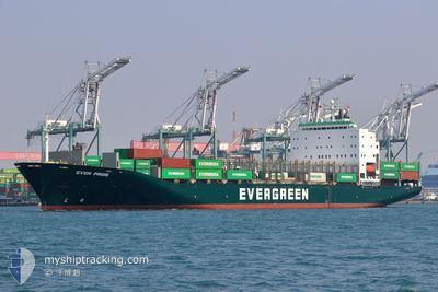
EVER PRIDE
Container Ship
Current Trip
BGVKN>TRBOP
| Time Travelled | 1 day |
|---|---|
| Remaining Time | --- |
| Distance Travelled | 299.75 nm |
| Remaining Distance | --- |
| AVG Speed | 12 Knots |
| MAX Speed | 19.6 Knots |
| AVG Wind | 10.9 knots |
| MAX Wind | 19.5 knots |
| MIN Temp | 19.1°C / 66.38°F |
| MAX Temp | 32.8°C / 91.04°F |
| Draught | 8.8 m |
| Position Received | 2 m ago |
Current Position
| Longitude | 26.35785° |
|---|---|
| Latitude | 40.11610° |
| Status | Under way using engine |
| Speed | 13.2 Knots |
| Course | 228° |
| Area | Sea of Marmara |
| Station | T-AIS |
| Position Received | 2 m ago |
Info
Information
The current position of EVER PRIDE is in Sea of Marmara with coordinates 40.11610° / 26.35785° as reported on 2024-06-18 12:59 by AIS to our vessel tracker app. The vessel's current speed is 13.2 Knots
The vessel EVER PRIDE (IMO: 9249233, MMSI: 235612000) is a Container Ship that was built in 2003 ( 21 years old ). It's sailing under the flag of [GB] United Kingdom.
In this page you can find informations about the vessels current position, last detected port calls, and current voyage information. If the vessels is not in coverage by AIS you will find the latest position.
The current position of EVER PRIDE is detected by our AIS receivers and we are not responsible for the reliability of the data. The last position was recorded while the vessel was in Coverage by the Ais receivers of our vessel tracking app.
The current draught of EVER PRIDE as reported by AIS is 8.8 meters
Weather
| Temperature | 33.8°C / 92.84°F |
|---|---|
| Wind Speed | 19 knots |
| Direction | 51° NE |
| Pressure | 1014.4 hPa |
| Humidity | 23.3 % |
| Cloud Coverage | --- |
Featured Company
Last Port Calls
| Port | Arrival | Departure | Time In Port |
|---|---|---|---|
| 2024-06-16 00:31 | 2024-06-17 07:05 | 1 d | |
| 2024-06-14 20:57 | 2024-06-15 15:16 | 18 h | |
| 2024-06-10 12:41 | 2024-06-12 02:53 | 1 d | |
| 2024-06-04 04:45 | 2024-06-05 20:12 | 1 d | |
| 2024-06-01 06:14 | 2024-06-02 02:22 | 20 h | |
| 2024-05-29 21:00 | 2024-05-30 07:12 | 10 h | |
| 2024-05-28 22:07 | |||
| 2024-05-28 04:52 | 2024-05-28 08:57 | 4 h | |
| 2024-05-27 12:00 | 2024-05-28 04:51 | 16 h | |
| 2024-05-25 13:58 | 2024-05-25 14:24 | 25 m |
Last Trips
| Origin | Departure | Destination | Arrival | Distance | |
|---|---|---|---|---|---|
| 2024-06-15 18:16 | 2024-06-16 03:31 | 98.15 nm | |||
| 2024-06-12 06:53 | 2024-06-14 23:57 | 590.07 nm | |||
| 2024-06-05 23:12 | 2024-06-10 16:41 | 1003.13 nm | |||
| 2024-06-02 05:22 | 2024-06-04 07:45 | 589.13 nm | |||
| 2024-05-30 10:12 | 2024-06-01 09:14 | 102.18 nm | |||
| 2024-05-28 11:57 | 2024-05-29 01:07 | 203.13 nm | |||
| 2024-05-28 07:51 | 2024-05-28 07:52 | 1.15 nm | |||
| 2024-05-25 17:24 | 2024-05-27 15:00 | 685.65 nm | |||
| 2024-05-25 14:23 | 2024-05-25 16:58 | 1.83 nm | |||
| 2024-05-25 14:23 | 2024-05-25 16:34 | 1.49 nm |
Events
| Time | Event | Details | Position / Dest | Info |
|---|---|---|---|---|
| 2024-06-18 11:44 | Status Changed | Under way using engine Default |
40.32740 / 26.61432
BGVKN>TRBOP
|
Speed: 13.9 kn Course: 215° |
| 2024-06-18 11:44 | IN Coverage |
40.32357 / 26.60850
Sea of Marmara
|
Speed: 15 kn Course: 229° |
|
| 2024-06-18 09:48 | Status Changed | Default Under way using engine |
40.52560 / 26.99052
BGVKN>TRBOP
|
Speed: 14.3 kn Course: 242° |
| 2024-06-18 09:34 | OUT of Coverage |
40.55060 / 27.05407
Sea of Marmara
|
Speed: 14.3 kn Course: 242° |
|
| 2024-06-18 09:08 | Status Changed | Under way using engine Default |
40.60042 / 27.17847
BGVKN>TRBOP
|
Speed: 14.5 kn Course: 242° |
| 2024-06-18 08:48 | Status Changed | Default Under way using engine |
40.63728 / 27.27332
BGVKN>TRBOP
|
Speed: 14.1 kn Course: 243° |
| 2024-06-18 01:19 | Change Sea Area | Turkish part of the Sea of Marmara Turkish part of the Black Sea |
41.23462 / 29.12648
Sea of Marmara
BGVKN>TRBOP
|
Speed: 8.4 kn Course: 172° |
| 2024-06-17 23:56 | ETA Changed | 2024/06/18 01:30 2024/06/17 16:00 |
41.39955 / 29.10855
BGVKN>TRBOP
|
Speed: 7.5 kn Course: 177° |
| 2024-06-17 23:08 | Status Changed | Under way using engine Default |
41.49870 / 29.09312
BGVKN>TRBOP
|
Speed: 8 kn Course: 166° |
| 2024-06-17 22:54 | IN Coverage |
41.49870 / 29.09312
Black Sea
|
Speed: 7.8 kn Course: 166° |