
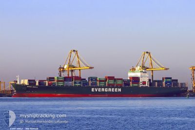
EVER SMILE
Container Ship
Current Trip
| Time Travelled | 1 day |
|---|---|
| Remaining Time | --- |
| Distance Travelled | 493.44 nm |
| Remaining Distance | --- |
| AVG Speed | 14.3 Knots |
| MAX Speed | 19.8 Knots |
| AVG Wind | 10.9 knots |
| MAX Wind | 17.5 knots |
| MIN Temp | 7.4°C / 45.32°F |
| MAX Temp | 14.7°C / 58.46°F |
| Draught | 12.9 m |
| Position Received | 18 h, 39 m ago |
Current Position
| Longitude | -127.12508° |
|---|---|
| Latitude | 49.05495° |
| Status | Under way using engine |
| Speed | 14.1 Knots |
| Course | 294° |
| Area | North Pacific Ocean |
| Station | T-AIS |
| Position Received | 18 h, 39 m ago |
Info
Information
The current position of EVER SMILE is in North Pacific Ocean with coordinates 49.05495° / -127.12508° as reported on 2024-06-12 20:28 by AIS to our vessel tracker app. The vessel's current speed is 14.1 Knots and is heading at the port of TOKYO. The estimated time of arrival as calculated by vessel tracking app is 2024-06-25 04:00 LT
The vessel EVER SMILE (IMO: 9300415, MMSI: 235010710) is a Container Ship that was built in 2006 ( 18 years old ). It's sailing under the flag of [GB] United Kingdom.
In this page you can find informations about the vessels current position, last detected port calls, and current voyage information. If the vessels is not in coverage by AIS you will find the latest position.
The current position of EVER SMILE is detected by our AIS receivers and we are not responsible for the reliability of the data. The last position was recorded while the vessel was in Coverage by the Ais receivers of our vessel tracking app.
The current draught of EVER SMILE as reported by AIS is 12.9 meters
Weather
| Temperature | 9.9°C / 49.82°F |
|---|---|
| Wind Speed | 16 knots |
| Direction | 158° SSE |
| Pressure | 1017.2 hPa |
| Humidity | 87.4 % |
| Cloud Coverage | 100 % |
Featured Company
Last Port Calls
| Port | Arrival | Departure | Time In Port |
|---|---|---|---|
| 2024-06-09 23:07 | 2024-06-12 03:28 | 2 d | |
| 2024-06-06 23:58 | 2024-06-09 11:39 | 2 d | |
| 2024-05-22 15:23 | 2024-05-23 02:44 | 11 h | |
| 2024-05-18 17:30 | 2024-05-19 05:49 | 12 h | |
| 2024-05-16 20:42 | 2024-05-17 14:53 | 18 h | |
| 2024-04-10 00:00 | 2024-04-10 15:18 | 15 h | |
| 2024-04-07 09:07 | 2024-04-08 03:53 | 18 h | |
| 2024-04-04 05:51 | 2024-04-04 12:06 | 6 h | |
| 2024-04-02 09:16 | 2024-04-03 06:26 | 21 h |
Last Trips
| Origin | Departure | Destination | Arrival | Distance | |
|---|---|---|---|---|---|
| 2024-06-09 04:39 | 2024-06-09 16:07 | 183.46 nm | |||
| 2024-05-23 10:44 | 2024-06-06 16:58 | 5375.41 nm | |||
| 2024-05-19 13:49 | 2024-05-22 23:23 | 950.62 nm | |||
| 2024-05-17 22:53 | 2024-05-19 01:30 | 346.78 nm | |||
| 2024-04-10 23:18 | 2024-05-17 04:42 | 810.80 nm | |||
| 2024-04-08 11:53 | 2024-04-10 08:00 | 592.17 nm | |||
| 2024-04-04 21:06 | 2024-04-07 17:07 | 1153.40 nm | |||
| 2024-04-03 15:26 | 2024-04-04 14:51 | 372.37 nm | |||
| 2024-03-19 14:55 | 2024-04-02 18:16 | 4363.02 nm |
Events
| Time | Event | Details | Position / Dest | Info |
|---|---|---|---|---|
| 2024-06-12 20:34 | Status Changed | Default Under way using engine |
49.06558 / -127.16112
CA VAN>>JP TYO
|
Speed: 14.1 kn Course: 294° |
| 2024-06-12 20:28 | OUT of Coverage |
49.05495 / -127.12508
North Pacific Ocean
CA VAN>>JP TYO
|
Speed: 14.1 kn Course: 294° |
|
| 2024-06-12 20:17 | Status Changed | Under way using engine Default |
49.03755 / -127.06528
CA VAN>>JP TYO
|
Speed: 14.1 kn Course: 293° |
| 2024-06-12 20:14 | Status Changed | Default Under way using engine |
49.03347 / -127.05125
CA VAN>>JP TYO
|
Speed: 14.2 kn Course: 294° |
| 2024-06-12 16:08 | ETA Changed | 2024/06/25 04:00 2024/06/25 06:00 |
48.66627 / -125.72648
CA VAN>>JP TYO
|
Speed: 13.5 kn Course: 293° |
| 2024-06-12 15:17 | ETA Changed | 2024/06/25 06:00 2024/06/25 04:00 |
48.59068 / -125.45797
CA VAN>>JP TYO
|
Speed: 13.9 kn Course: 294° |
| 2024-06-12 13:19 | Change Sea Area | Canadian part of the North Pacific Ocean Canadian part of the The Coastal Waters of Southeast Alaska and British Columbia |
48.51682 / -124.81275
North Pacific Ocean
CA VAN>>JP TYO
|
Speed: 13.2 kn Course: 270° |
| 2024-06-12 13:19 | IN Coverage |
48.51682 / -124.81275
North Pacific Ocean
CA VAN>>JP TYO
|
Speed: 13.2 kn Course: 270° |
|
| 2024-06-12 13:18 | Status Changed | Under way using engine Default |
48.51678 / -124.80537
CA VAN>>JP TYO
|
Speed: 12.9 kn Course: 270° |
| 2024-06-12 12:13 | OUT of Coverage |
48.44037 / -124.46840
The Coastal Waters of Southeast Alaska and British Columbia
CA VAN>>JP TYO
|
Speed: 13.2 kn Course: 290° |