
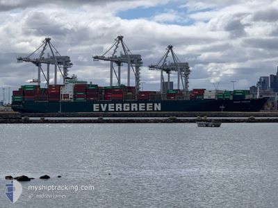
EVER URBAN
Container Ship
Current Trip
KR PUS > CN TAO
| Time Travelled | 8 h, 59 mins |
|---|---|
| Remaining Time | --- |
| Distance Travelled | 110.52 nm |
| Remaining Distance | --- |
| AVG Speed | 12.9 Knots |
| MAX Speed | 13.9 Knots |
| AVG Wind | 11.5 knots |
| MAX Wind | 15 knots |
| MIN Temp | 20.1°C / 68.18°F |
| MAX Temp | 22.1°C / 71.78°F |
| Draught | 11.1 m |
| Position Received | 6 h, 11 m ago |
Current Position
| Longitude | 120.88448° |
|---|---|
| Latitude | 35.66629° |
| Status | Under way using engine |
| Speed | 12.3 Knots |
| Course | 159.1° |
| Area | Yellow Sea |
| Station | T-AIS |
| Position Received | 6 h, 11 m ago |
Info
Information
The current position of EVER URBAN is in Yellow Sea with coordinates 35.66629° / 120.88448° as reported on 2024-06-09 20:12 by AIS to our vessel tracker app. The vessel's current speed is 12.3 Knots
The vessel EVER URBAN (IMO: 9169160, MMSI: 357939000) is a Container Ship that was built in 2000 ( 24 years old ). It's sailing under the flag of [PA] Panama.
In this page you can find informations about the vessels current position, last detected port calls, and current voyage information. If the vessels is not in coverage by AIS you will find the latest position.
The current position of EVER URBAN is detected by our AIS receivers and we are not responsible for the reliability of the data. The last position was recorded while the vessel was in Coverage by the Ais receivers of our vessel tracking app.
The current draught of EVER URBAN as reported by AIS is 11.1 meters
Weather
| Temperature | 21.6°C / 70.88°F |
|---|---|
| Wind Speed | 12 knots |
| Direction | 213° SSW |
| Pressure | 1007.4 hPa |
| Humidity | 82.5 % |
| Cloud Coverage | 57 % |
Featured Company
Last Port Calls
| Port | Arrival | Departure | Time In Port |
|---|---|---|---|
| 2024-06-08 20:12 | 2024-06-09 17:25 | 21 h | |
| 2024-06-04 22:51 | 2024-06-06 10:25 | 1 d | |
| 2024-05-23 11:18 | 2024-05-25 02:58 | 1 d | |
| 2024-05-16 19:00 | 2024-05-18 21:52 | 2 d | |
| 2024-05-11 23:30 | 2024-05-14 12:51 | 2 d | |
| 2024-04-28 07:08 | 2024-04-28 22:44 | 15 h | |
| 2024-04-23 16:50 | 2024-04-24 15:40 | 22 h | |
| 2024-04-20 14:36 | 2024-04-21 11:00 | 20 h | |
| 2024-04-16 00:03 | 2024-04-16 20:34 | 20 h | |
| 2024-04-02 11:47 |
Last Trips
| Origin | Departure | Destination | Arrival | Distance | |
|---|---|---|---|---|---|
| 2024-06-06 19:25 | 2024-06-09 04:12 | 498.65 nm | |||
| 2024-05-25 12:58 | 2024-06-05 07:51 | 4148.25 nm | |||
| 2024-05-19 07:52 | 2024-05-23 21:18 | 1119.11 nm | |||
| 2024-05-14 22:51 | 2024-05-17 05:00 | 598.10 nm | |||
| 2024-04-29 06:44 | 2024-05-12 09:30 | 4526.49 nm | |||
| 2024-04-24 23:40 | 2024-04-28 15:08 | 956.60 nm | |||
| 2024-04-21 19:00 | 2024-04-24 00:50 | 403.42 nm | |||
| 2024-04-17 05:34 | 2024-04-20 22:36 | 507.21 nm | |||
| 2024-04-02 22:47 | 2024-04-16 09:03 | 4619.18 nm |
Events
| Time | Event | Details | Position / Dest | Info |
|---|---|---|---|---|
| 2024-06-09 20:17 | Status Changed | Default Under way using engine |
35.65023 / 120.89198
KR PUS > CN TAO
|
Speed: 12.3 kn Course: 159.1° |
| 2024-06-09 20:12 | OUT of Coverage |
35.66629 / 120.88448
Yellow Sea
|
Speed: 12.3 kn Course: 159.1° |
|
| 2024-06-09 20:09 | Status Changed | Under way using engine Default |
35.67641 / 120.87974
KR PUS > CN TAO
|
Speed: 12.4 kn Course: 159° |
| 2024-06-09 19:25 | Status Changed | Default Under way using engine |
35.82040 / 120.81792
KR PUS > CN TAO
|
Speed: 12.6 kn Course: 157.4° |
| 2024-06-09 19:12 | Change Sea Area | Chinese part of the Yellow Sea South Korean part of the Japan Sea |
35.86175 / 120.79671
Yellow Sea
|
Speed: 12.7 kn Course: 158.1° |
| 2024-06-09 19:11 | Status Changed | Under way using engine Default |
35.86614 / 120.79448
KR PUS > CN TAO
|
Speed: 12.7 kn Course: 154° |
| 2024-06-09 18:53 | IN Coverage |
35.86175 / 120.79671
Yellow Sea
|
Speed: 12.7 kn Course: 158.1° |
|
| 2024-06-09 17:25 | PORT DEPARTURE |
|
36.01179 / 120.36573
KR PUS > CN TAO
|
Speed: 12.7 kn Course: 104° |
| 2024-06-09 16:48 | START Moving |
36.02018 / 120.23457
[CN] QINGDAO
|
Speed: 7.6 kn Course: 50° |
|
| 2024-06-08 21:16 | STOP Moving |
36.01427 / 120.23388
[CN] QINGDAO
|
Speed: 0.3 kn Course: 228° |