
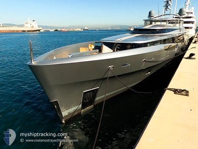
EXCELLENCE V
Yacht
Current Trip
GREENWICH
| Time Travelled | --- |
|---|---|
| Remaining Time | --- |
| Distance Travelled | --- |
| Remaining Distance | --- |
| AVG Speed | --- |
| MAX Speed | --- |
| AVG Wind | --- |
| MAX Wind | --- |
| MIN Temp | --- |
| MAX Temp | --- |
| Draught | 2.3 m |
| Position Received | 8 h, 16 m ago |
Current Position
| Longitude | -72.34525° |
|---|---|
| Latitude | 41.31510° |
| Status | Moored |
| Speed | |
| Course | 13° |
| Area | North Atlantic Ocean |
| Station | T-AIS |
| Position Received | 8 h, 16 m ago |
Info
Information
The current position of EXCELLENCE V is in North Atlantic Ocean with coordinates 41.31510° / -72.34525° as reported on 2024-06-03 08:58 by AIS to our vessel tracker app. The vessel's current speed is 0 Knots
The vessel EXCELLENCE V (IMO: 1012359, MMSI: 319059500) is a Yacht that was built in 2014 ( 10 years old ). It's sailing under the flag of [KY] Cayman Is.
In this page you can find informations about the vessels current position, last detected port calls, and current voyage information. If the vessels is not in coverage by AIS you will find the latest position.
The current position of EXCELLENCE V is detected by our AIS receivers and we are not responsible for the reliability of the data. The last position was recorded while the vessel was in Coverage by the Ais receivers of our vessel tracking app.
The current draught of EXCELLENCE V as reported by AIS is 2.3 meters
Weather
| Temperature | 16.8°C / 62.24°F |
|---|---|
| Wind Speed | 6 knots |
| Direction | 270° W |
| Pressure | 1012.4 hPa |
| Humidity | 89.4 % |
| Cloud Coverage | 100 % |
Featured Company
Last Port Calls
| Port | Arrival | Departure | Time In Port |
|---|---|---|---|
| 2024-05-15 04:04 | |||
| 2024-05-14 22:34 |
Most Visited Ports (Last year)
| Port | Arrivals | |
|---|---|---|
| 3 | ||
| 2 | ||
| 1 | ||
| 1 | ||
| 1 | ||
| 1 |
Last Trips
| Origin | Departure | Destination | Arrival | Distance | |
|---|---|---|---|---|---|
| 2024-05-14 18:34 | 2024-05-15 00:04 | 80.48 nm |
Events
| Time | Event | Details | Position / Dest | Info |
|---|---|---|---|---|
| 2024-06-03 08:58 | OUT of Coverage |
41.31510 / -72.34525
North Atlantic Ocean
|
Speed: Course: 325.8° |
|
| 2024-06-03 08:58 | IN Coverage |
41.31510 / -72.34525
North Atlantic Ocean
|
Speed: Course: 325.8° |
|
| 2024-06-03 06:46 | OUT of Coverage |
41.31510 / -72.34525
North Atlantic Ocean
|
Speed: Course: 318.5° |
|
| 2024-06-03 06:46 | IN Coverage |
41.31510 / -72.34525
North Atlantic Ocean
|
Speed: Course: 318.5° |
|
| 2024-06-02 20:14 | OUT of Coverage |
41.07442 / -73.17354
North Atlantic Ocean
|
Speed: 13.4 kn Course: 71.6° |
|
| 2024-06-02 19:02 | Draught Changed | 2.3 2.1 |
40.99750 / -73.51604
GREENWICH
|
Speed: 13.9 kn Course: 74.1° |
| 2024-06-02 18:39 | START Moving | 13.33 nm, North East of KINGS POINT |
41.00116 / -73.61127
GREENWICH
|
Speed: 7 kn Course: 117° |
| 2024-06-02 18:38 | Status Changed | Under way using engine At anchor |
41.00202 / -73.61308
GREENWICH
|
Speed: 0.5 kn Course: 221° |
| 2024-06-02 18:16 | Draught Changed | 2.1 2 |
41.00270 / -73.61287
GREENWICH
|
Speed: Course: 186° |
| 2024-06-02 18:16 | ETA Changed | 2025/05/31 18:50 |
41.00270 / -73.61287
GREENWICH
|
Speed: Course: 186° |