
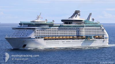
EXPLORER OF THE SEAS
Passengers Ship
Current Trip
| Time Travelled | 20 h, 46 mins |
|---|---|
| Remaining Time | --- |
| Distance Travelled | 340.53 nm |
| Remaining Distance | --- |
| AVG Speed | 16.8 Knots |
| MAX Speed | 17.9 Knots |
| AVG Wind | 8 knots |
| MAX Wind | 14.7 knots |
| MIN Temp | 25.2°C / 77.36°F |
| MAX Temp | 31.7°C / 89.06°F |
| Draught | 9.1 m |
| Position Received | 21 m ago |
Current Position
| Longitude | 19.76550° |
|---|---|
| Latitude | 38.79326° |
| Status | Under way using engine |
| Speed | 16.8 Knots |
| Course | 334.2° |
| Area | Ionian Sea |
| Station | T-AIS |
| Position Received | 21 m ago |
Info
Information
The current position of EXPLORER OF THE SEAS is in Ionian Sea with coordinates 38.79326° / 19.76550° as reported on 2024-06-26 12:33 by AIS to our vessel tracker app. The vessel's current speed is 16.8 Knots and is heading at the port of KOTOR. The estimated time of arrival as calculated by vessel tracking app is 2024-06-27 04:00 LT
The vessel EXPLORER OF THE SEAS (IMO: 9161728, MMSI: 311316000) is a Passengers Ship that was built in 2000 ( 24 years old ). It's sailing under the flag of [BS] Bahamas.
In this page you can find informations about the vessels current position, last detected port calls, and current voyage information. If the vessels is not in coverage by AIS you will find the latest position.
The current position of EXPLORER OF THE SEAS is detected by our AIS receivers and we are not responsible for the reliability of the data. The last position was recorded while the vessel was in Coverage by the Ais receivers of our vessel tracking app.
The current draught of EXPLORER OF THE SEAS as reported by AIS is 9.1 meters
Weather
| Temperature | 26.1°C / 78.98°F |
|---|---|
| Wind Speed | 9 knots |
| Direction | 190° S |
| Pressure | 1011.7 hPa |
| Humidity | 75.5 % |
| Cloud Coverage | 78 % |
Featured Company
Last Port Calls
| Port | Arrival | Departure | Time In Port |
|---|---|---|---|
| 2024-06-25 03:40 | 2024-06-25 16:08 | 12 h | |
| 2024-06-24 09:43 | 2024-06-24 20:23 | 10 h | |
| 2024-06-22 04:07 | 2024-06-22 15:29 | 11 h | |
| 2024-06-21 03:41 | 2024-06-21 14:16 | 10 h | |
| 2024-06-19 04:50 | 2024-06-19 17:45 | 12 h | |
| 2024-06-18 03:25 | 2024-06-18 16:05 | 12 h | |
| 2024-06-17 09:47 | 2024-06-17 20:28 | 10 h | |
| 2024-06-15 03:25 | 2024-06-15 15:22 | 11 h | |
| 2024-06-12 03:32 | 2024-06-12 17:12 | 13 h | |
| 2024-06-11 03:12 | 2024-06-11 16:18 | 13 h |
Last Trips
| Origin | Departure | Destination | Arrival | Distance | |
|---|---|---|---|---|---|
| 2024-06-24 23:23 | 2024-06-25 06:40 | 132.01 nm | |||
| 2024-06-22 17:29 | 2024-06-24 12:43 | 838.40 nm | |||
| 2024-06-21 16:16 | 2024-06-22 06:07 | 278.53 nm | |||
| 2024-06-19 20:45 | 2024-06-21 05:41 | 591.41 nm | |||
| 2024-06-18 19:05 | 2024-06-19 07:50 | 97.21 nm | |||
| 2024-06-17 23:28 | 2024-06-18 06:25 | 78.63 nm | |||
| 2024-06-15 17:22 | 2024-06-17 12:47 | 836.27 nm | |||
| 2024-06-12 20:12 | 2024-06-15 05:25 | 872.87 nm | |||
| 2024-06-11 19:18 | 2024-06-12 06:32 | 134.81 nm | |||
| 2024-06-09 19:13 | 2024-06-11 06:12 | 593.16 nm |
Events
| Time | Event | Details | Position / Dest | Info |
|---|---|---|---|---|
| 2024-06-26 12:36 | Status Changed | Default Under way using engine |
38.80745 / 19.75668
KOTOR,MONTENEGRO
|
Speed: 16.8 kn Course: 334.2° |
| 2024-06-26 12:16 | Status Changed | Under way using engine Default |
38.72468 / 19.80771
KOTOR,MONTENEGRO
|
Speed: 16.8 kn Course: 333° |
| 2024-06-26 12:02 | Status Changed | Default Under way using engine |
38.66372 / 19.84562
KOTOR,MONTENEGRO
|
Speed: 16.8 kn Course: 333° |
| 2024-06-26 12:01 | Status Changed | Under way using engine Default |
38.65919 / 19.84855
KOTOR,MONTENEGRO
|
Speed: 16.8 kn Course: 333° |
| 2024-06-26 11:34 | Status Changed | Default Under way using engine |
38.54813 / 19.92328
KOTOR,MONTENEGRO
|
Speed: 16.7 kn Course: 329.9° |
| 2024-06-26 11:30 | Status Changed | Under way using engine Default |
38.53326 / 19.93414
KOTOR,MONTENEGRO
|
Speed: 16.9 kn Course: 333° |
| 2024-06-26 11:17 | Status Changed | Default Under way using engine |
38.47759 / 19.97134
KOTOR,MONTENEGRO
|
Speed: 16.9 kn Course: 336.2° |
| 2024-06-26 11:09 | Status Changed | Under way using engine Default |
38.44210 / 19.99096
KOTOR,MONTENEGRO
|
Speed: 16.8 kn Course: 337° |
| 2024-06-26 11:02 | Status Changed | Default Under way using engine |
38.41577 / 20.00554
KOTOR,MONTENEGRO
|
Speed: 16.8 kn Course: 337.2° |
| 2024-06-26 09:02 | Status Changed | Under way using engine Default |
37.91400 / 20.31002
KOTOR,MONTENEGRO
|
Speed: 16.3 kn Course: 330° |