
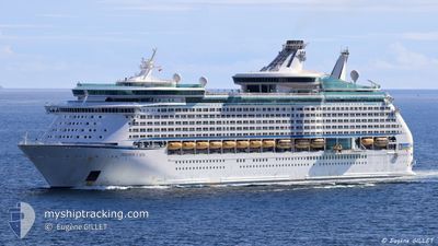
EXPLORER OF THE SEAS
Passengers Ship
Current Trip
| Time Travelled | 2 days |
|---|---|
| Remaining Time | --- |
| Distance Travelled | 581.71 nm |
| Remaining Distance | --- |
| AVG Speed | 15.5 Knots |
| MAX Speed | 18 Knots |
| AVG Wind | 7.3 knots |
| MAX Wind | 17 knots |
| MIN Temp | 11.8°C / 53.24°F |
| MAX Temp | 21.6°C / 70.88°F |
| Draught | 9.1 m |
| Position Received | 11 h, 30 m ago |
Current Position
| Longitude | 18.75937° |
|---|---|
| Latitude | 42.45005° |
| Status | At anchor |
| Speed | |
| Course | 175° |
| Area | Adriatic Sea |
| Station | T-AIS |
| Position Received | 11 h, 30 m ago |
Info
Information
The current position of EXPLORER OF THE SEAS is in Adriatic Sea with coordinates 42.45005° / 18.75937° as reported on 2024-05-30 08:58 by AIS to our vessel tracker app. The vessel's current speed is 0 Knots
The vessel EXPLORER OF THE SEAS (IMO: 9161728, MMSI: 311316000) is a Passengers Ship that was built in 2000 ( 24 years old ). It's sailing under the flag of [BS] Bahamas.
In this page you can find informations about the vessels current position, last detected port calls, and current voyage information. If the vessels is not in coverage by AIS you will find the latest position.
The current position of EXPLORER OF THE SEAS is detected by our AIS receivers and we are not responsible for the reliability of the data. The last position was recorded while the vessel was in Coverage by the Ais receivers of our vessel tracking app.
The current draught of EXPLORER OF THE SEAS as reported by AIS is 9.1 meters
Weather
| Temperature | 21.2°C / 70.16°F |
|---|---|
| Wind Speed | 19 knots |
| Direction | 125° SE |
| Pressure | 1009.2 hPa |
| Humidity | 77.2 % |
| Cloud Coverage | 100 % |
Featured Company
Last Port Calls
| Port | Arrival | Departure | Time In Port |
|---|---|---|---|
| 2024-05-28 03:26 | 2024-05-28 16:15 | 12 h | |
| 2024-05-27 10:00 | 2024-05-27 20:00 | 9 h | |
| 2024-05-25 03:16 | 2024-05-25 15:27 | 12 h | |
| 2024-05-22 03:11 | 2024-05-22 16:20 | 13 h | |
| 2024-05-21 03:54 | 2024-05-21 15:29 | 11 h | |
| 2024-05-20 09:51 | 2024-05-20 19:59 | 10 h | |
| 2024-05-18 03:18 | 2024-05-18 15:20 | 12 h | |
| 2024-05-17 07:36 | 2024-05-17 17:15 | 9 h | |
| 2024-05-15 07:15 | 2024-05-15 16:08 | 8 h | |
| 2024-05-14 04:56 | 2024-05-14 15:41 | 10 h |
Last Trips
| Origin | Departure | Destination | Arrival | Distance | |
|---|---|---|---|---|---|
| 2024-05-27 23:00 | 2024-05-28 06:26 | 133.70 nm | |||
| 2024-05-25 17:27 | 2024-05-27 13:00 | 834.47 nm | |||
| 2024-05-22 19:20 | 2024-05-25 05:16 | 863.54 nm | |||
| 2024-05-21 18:29 | 2024-05-22 06:11 | 125.64 nm | |||
| 2024-05-20 22:59 | 2024-05-21 06:54 | 80.43 nm | |||
| 2024-05-18 17:20 | 2024-05-20 12:51 | 837.16 nm | |||
| 2024-05-17 19:15 | 2024-05-18 05:18 | 157.82 nm | |||
| 2024-05-15 19:08 | 2024-05-17 09:36 | 466.45 nm | |||
| 2024-05-14 17:41 | 2024-05-15 10:15 | 276.36 nm | |||
| 2024-05-13 18:54 | 2024-05-14 06:56 | 180.74 nm |
Events
| Time | Event | Details | Position / Dest | Info |
|---|---|---|---|---|
| 2024-05-30 08:58 | OUT of Coverage |
42.45005 / 18.75937
Adriatic Sea
|
Speed: Course: 155.2° |
|
| 2024-05-30 07:31 | IN Coverage |
42.44987 / 18.75960
Adriatic Sea
ME KOT
|
Speed: Course: 272.6° |
|
| 2024-05-30 05:55 | OUT of Coverage |
42.44978 / 18.75966
Adriatic Sea
ME KOT
|
Speed: 0.2 kn Course: 261.5° |
|
| 2024-05-30 05:49 | Status Changed | At anchor Under way using engine |
42.44980 / 18.75965
ME KOT
|
Speed: 0.2 kn Course: 166° |
| 2024-05-30 05:30 | STOP Moving | 1.11 nm, North of KOTOR |
42.44915 / 18.75985
ME KOT
|
Speed: 0.1 kn Course: 167° |
| 2024-05-30 03:56 | Status Changed | Under way using engine Default |
42.42564 / 18.54169
ME KOT
|
Speed: 14 kn Course: 350° |
| 2024-05-30 03:21 | Status Changed | Default Under way using engine |
42.31833 / 18.56167
ME KOT
|
Speed: 14.2 kn Course: 349.4° |
| 2024-05-30 00:49 | Detected in Sea | Montenegrin part of the Adriatic Sea |
41.70228 / 18.72531
Adriatic Sea
ME KOT
|
Speed: 15.1 kn Course: 345.8° |
| 2024-05-30 00:49 | Status Changed | Under way using engine Default |
41.70228 / 18.72531
ME KOT
|
Speed: 15 kn Course: 349° |
| 2024-05-30 00:49 | IN Coverage |
41.70228 / 18.72531
Adriatic Sea
ME KOT
|
Speed: 15.1 kn Course: 345.8° |