
EXPRESS FRANCE
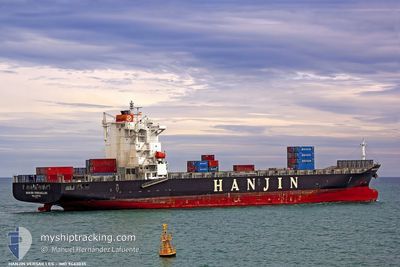
Container Ship
Current Trip
| Time Travelled | 6 days |
|---|---|
| Remaining Time | --- |
| Distance Travelled | 2376.10 nm |
| Remaining Distance | --- |
| AVG Speed | 13.9 Knots |
| MAX Speed | 17.1 Knots |
| AVG Wind | 13.1 knots |
| MAX Wind | 23.9 knots |
| MIN Temp | 23.4°C / 74.12°F |
| MAX Temp | 32°C / 89.6°F |
| Draught | 10.1 m |
| Position Received | 5 h, 6 m ago |
Current Position
| Longitude | -51.14038° |
|---|---|
| Latitude | -0.36700° |
| Status | Under way using engine |
| Speed | 14 Knots |
| Course | 231.7° |
| Area | South Atlantic Ocean |
| Station | T-AIS |
| Position Received | 5 h, 6 m ago |
Info
Information
The current position of EXPRESS FRANCE is in South Atlantic Ocean with coordinates -0.36700° / -51.14038° as reported on 2024-06-03 11:34 by AIS to our vessel tracker app. The vessel's current speed is 14 Knots and is heading at the port of MACAPA. The estimated time of arrival as calculated by vessel tracking app is 2024-06-03 09:30 LT
The vessel EXPRESS FRANCE (IMO: 9443035, MMSI: 248572000) is a Container Ship that was built in 2010 ( 14 years old ). It's sailing under the flag of [MT] Malta.
In this page you can find informations about the vessels current position, last detected port calls, and current voyage information. If the vessels is not in coverage by AIS you will find the latest position.
The current position of EXPRESS FRANCE is detected by our AIS receivers and we are not responsible for the reliability of the data. The last position was recorded while the vessel was in Coverage by the Ais receivers of our vessel tracking app.
The current draught of EXPRESS FRANCE as reported by AIS is 10.1 meters
Weather
| Temperature | 31.1°C / 87.98°F |
|---|---|
| Wind Speed | 4 knots |
| Direction | 117° ESE |
| Pressure | 1012.8 hPa |
| Humidity | 65.7 % |
| Cloud Coverage | 33 % |
Featured Company
Last Port Calls
| Port | Arrival | Departure | Time In Port |
|---|---|---|---|
| 2024-05-26 10:59 | 2024-05-27 20:18 | 1 d | |
| 2024-05-23 23:54 | 2024-05-24 16:14 | 16 h | |
| 2024-05-12 09:56 | 2024-05-14 10:36 | 2 d | |
| 2024-05-04 13:22 | 2024-05-04 20:28 | 7 h | |
| 2024-04-28 10:42 | 2024-04-30 06:29 | 1 d | |
| 2024-04-25 17:18 | 2024-04-26 22:26 | 1 d | |
| 2024-04-23 10:54 | 2024-04-24 13:22 | 1 d | |
| 2024-04-09 15:43 | 2024-04-10 03:10 | 11 h | |
| 2024-04-03 21:49 | 2024-04-06 13:18 | 2 d |
Most Visited Ports (Last year)
| Port | Arrivals | |
|---|---|---|
| 12 | ||
| 11 | ||
| 10 | ||
| 10 | ||
| 7 | ||
| 2 |
Last Trips
| Origin | Departure | Destination | Arrival | Distance | |
|---|---|---|---|---|---|
| 2024-05-24 11:14 | 2024-05-26 05:59 | 550.55 nm | |||
| 2024-05-14 06:36 | 2024-05-23 18:54 | 3020.43 nm | |||
| 2024-05-04 15:28 | 2024-05-12 05:56 | 2774.61 nm | |||
| 2024-04-30 01:29 | 2024-05-04 08:22 | 408.02 nm | |||
| 2024-04-26 17:26 | 2024-04-28 05:42 | 549.04 nm | |||
| 2024-04-24 08:22 | 2024-04-25 12:18 | 475.79 nm | |||
| 2024-04-10 00:10 | 2024-04-23 05:54 | 2530.07 nm | |||
| 2024-04-06 09:18 | 2024-04-09 12:43 | 1141.00 nm | |||
| 2024-03-25 18:35 | 2024-04-03 17:49 | 2994.08 nm |
Events
| Time | Event | Details | Position / Dest | Info |
|---|---|---|---|---|
| 2024-06-03 11:38 | Status Changed | Default Under way using engine |
-.37667 / -51.14834
BRMCP
|
Speed: 14 kn Course: 231.7° |
| 2024-06-03 11:34 | OUT of Coverage |
-.36700 / -51.14038
South Atlantic Ocean
BRMCP
|
Speed: 14 kn Course: 231.7° |
|
| 2024-06-03 11:32 | Status Changed | Under way using engine Default |
-.36358 / -51.13608
BRMCP
|
Speed: 13.9 kn Course: 231° |
| 2024-06-03 11:29 | Status Changed | Default Under way using engine |
-.35573 / -51.12630
BRMCP
|
Speed: 14.2 kn Course: 230.6° |
| 2024-06-03 09:52 | Change Sea Area | Brazilian part of the South Atlantic Ocean Brazilian part of the North Atlantic Ocean |
-.00698 / -51.01346
South Atlantic Ocean
BRMCP
|
Speed: 13.2 kn Course: 195.7° |
| 2024-06-03 07:50 | Draught Changed | 10.1 10.5 |
.17631 / -50.79140
BRMCP
|
Speed: 11.3 kn Course: 260.9° |
| 2024-06-03 07:50 | ETA Changed | 2024/06/03 09:30 2024/05/03 09:30 |
.17631 / -50.79140
BRMCP
|
Speed: 11.3 kn Course: 260.9° |
| 2024-06-03 07:24 | Change Sea Area | Brazilian part of the North Atlantic Ocean Colombian part of the Caribbean Sea |
.20015 / -50.71486
North Atlantic Ocean
|
Speed: 11.2 kn Course: 249.8° |
| 2024-06-03 07:24 | Status Changed | Under way using engine Default |
.20015 / -50.71486
BRMCP
|
Speed: 11.3 kn Course: 238° |
| 2024-06-03 07:24 | IN Coverage |
.20015 / -50.71486
North Atlantic Ocean
|
Speed: 11.2 kn Course: 249.8° |