
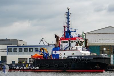
FAIRPLAY-31
Tug
Current Trip
| Time Travelled | 2 days |
|---|---|
| Remaining Time | 2 days |
| Distance Travelled | 328.16 nm |
| Remaining Distance | 359.62 nm |
| AVG Speed | 5 Knots |
| MAX Speed | 8.2 Knots |
| AVG Wind | 16.1 knots |
| MAX Wind | 20.8 knots |
| MIN Temp | 10.9°C / 51.62°F |
| MAX Temp | 14.6°C / 58.28°F |
| Draught | 6.3 m |
| Position Received | 1 m ago |
Current Position
| Longitude | -3.40757° |
|---|---|
| Latitude | 50.16455° |
| Status | Restricted manoeuverability |
| Speed | 5.6 Knots |
| Course | 88.2° |
| Area | English Channel |
| Station | T-AIS |
| Position Received | 1 m ago |
Info
Information
The current position of FAIRPLAY-31 is in English Channel with coordinates 50.16455° / -3.40757° as reported on 2024-06-01 04:12 by AIS to our vessel tracker app. The vessel's current speed is 5.6 Knots and is heading at the port of AMSTERDAM. The estimated time of arrival as calculated by vessel tracking app is 2024-06-03 18:47 LT
The vessel FAIRPLAY-31 (IMO: 9416575, MMSI: 218143000) is a Tug that was built in 2009 ( 15 years old ). It's sailing under the flag of [DE] Germany.
In this page you can find informations about the vessels current position, last detected port calls, and current voyage information. If the vessels is not in coverage by AIS you will find the latest position.
The current position of FAIRPLAY-31 is detected by our AIS receivers and we are not responsible for the reliability of the data. The last position was recorded while the vessel was in Coverage by the Ais receivers of our vessel tracking app.
The current draught of FAIRPLAY-31 as reported by AIS is 6.3 meters
Weather
| Temperature | 12.1°C / 53.78°F |
|---|---|
| Wind Speed | 10 knots |
| Direction | 1° N |
| Pressure | 1024.9 hPa |
| Humidity | 87.3 % |
| Cloud Coverage | --- |
Featured Company
Last Port Calls
| Port | Arrival | Departure | Time In Port |
|---|---|---|---|
| 2024-05-29 11:13 | 2024-05-29 16:06 | 4 h | |
| 2024-05-25 13:41 | 2024-05-25 16:45 | 3 h | |
| 2024-05-20 15:18 | 2024-05-22 18:28 | 2 d | |
| 2024-05-20 13:35 | 2024-05-20 15:05 | 1 h | |
| 2024-05-20 13:00 | 2024-05-20 13:24 | 23 m | |
| 2024-05-20 08:04 | 2024-05-20 11:15 | 3 h | |
| 2024-05-20 05:47 | 2024-05-20 07:49 | 2 h | |
| 2024-05-18 09:20 | 2024-05-20 05:08 | 1 d | |
| 2024-05-18 07:22 | 2024-05-18 07:46 | 23 m | |
| 2024-05-17 15:40 | 2024-05-18 07:16 | 15 h |
Last Trips
| Origin | Departure | Destination | Arrival | Distance | |
|---|---|---|---|---|---|
| 2024-05-25 17:45 | 2024-05-29 12:13 | 64.33 nm | |||
| 2024-05-22 20:28 | 2024-05-25 14:41 | 632.05 nm | |||
| 2024-05-20 17:05 | 2024-05-20 17:18 | 1.89 nm | |||
| 2024-05-20 15:24 | 2024-05-20 15:35 | 1.60 nm | |||
| 2024-05-20 13:15 | 2024-05-20 15:00 | 6.08 nm | |||
| 2024-05-20 09:49 | 2024-05-20 10:04 | 2.08 nm | |||
| 2024-05-20 07:08 | 2024-05-20 07:47 | 4.53 nm | |||
| 2024-05-18 09:46 | 2024-05-18 11:20 | 13.52 nm | |||
| 2024-05-18 09:16 | 2024-05-18 09:22 | 0.62 nm | |||
| 2024-05-17 17:21 | 2024-05-17 17:40 | 1.82 nm |
Events
| Time | Event | Details | Position / Dest | Info |
|---|---|---|---|---|
| 2024-05-31 18:58 | Status Changed | Restricted manoeuverability Default |
49.94499 / -4.65538
AMSTERDAM
|
Speed: 4.6 kn Course: 70° |
| 2024-05-31 18:56 | Status Changed | Default Restricted manoeuverability |
49.94448 / -4.65836
AMSTERDAM
|
Speed: 4.6 kn Course: 73° |
| 2024-05-31 18:49 | Status Changed | Restricted manoeuverability Default |
49.94203 / -4.67257
AMSTERDAM
|
Speed: 4.6 kn Course: 71° |
| 2024-05-31 18:44 | Status Changed | Default Restricted manoeuverability |
49.94050 / -4.68184
AMSTERDAM
|
Speed: 4.4 kn Course: 72° |
| 2024-05-31 18:39 | Status Changed | Restricted manoeuverability Default |
49.93890 / -4.69205
AMSTERDAM
|
Speed: 4.5 kn Course: 72° |
| 2024-05-31 18:36 | Status Changed | Default Restricted manoeuverability |
49.93808 / -4.69709
AMSTERDAM
|
Speed: 4.4 kn Course: 71° |
| 2024-05-31 14:59 | ETA Changed | 2024/06/04 09:00 2024/06/06 12:00 |
49.88575 / -5.11887
AMSTERDAM
|
Speed: 4.6 kn Course: 75° |
| 2024-05-31 14:22 | Change Sea Area | United Kingdom part of the English Channel Irish part of the Irish Sea and St. George's Channel |
49.87840 / -5.19824
English Channel
AMSTERDAM
|
Speed: 5.3 kn Course: 83.4° |
| 2024-05-31 14:21 | Status Changed | Restricted manoeuverability Default |
49.87819 / -5.20094
AMSTERDAM
|
Speed: 5.2 kn Course: 83° |
| 2024-05-31 14:12 | IN Coverage |
49.87840 / -5.19824
English Channel
AMSTERDAM
|
Speed: 5.3 kn Course: 83.4° |