
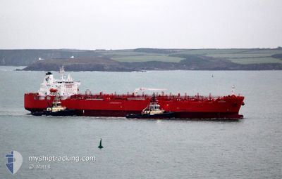
FATIMAH
Tanker
Current Trip
| Time Travelled | 6 days |
|---|---|
| Remaining Time | --- |
| Distance Travelled | 860.03 nm |
| Remaining Distance | 4.33 nm |
| AVG Speed | 10.9 Knots |
| MAX Speed | 16 Knots |
| AVG Wind | 9.2 knots |
| MAX Wind | 21 knots |
| MIN Temp | 25.7°C / 78.26°F |
| MAX Temp | 30°C / 86°F |
| Draught | 7.7 m |
| Position Received | 3 m ago |
Current Position
| Longitude | 110.39129° |
|---|---|
| Latitude | -6.86594° |
| Status | At anchor |
| Speed | |
| Course | 84° |
| Area | Java Sea |
| Station | T-AIS |
| Position Received | 3 m ago |
Info
Information
The current position of FATIMAH is in Java Sea with coordinates -6.86594° / 110.39129° as reported on 2024-06-25 06:53 by AIS to our vessel tracker app. The vessel's current speed is 0 Knots and is heading at the port of SEMARANG. The estimated time of arrival as calculated by vessel tracking app is 2024-06-24 14:30 LT
The vessel FATIMAH (IMO: 9917830, MMSI: 403641000) is a Tanker It's sailing under the flag of [SA] Saudi Arabia.
In this page you can find informations about the vessels current position, last detected port calls, and current voyage information. If the vessels is not in coverage by AIS you will find the latest position.
The current position of FATIMAH is detected by our AIS receivers and we are not responsible for the reliability of the data. The last position was recorded while the vessel was in Coverage by the Ais receivers of our vessel tracking app.
The current draught of FATIMAH as reported by AIS is 7.7 meters
Weather
| Temperature | 30°C / 86°F |
|---|---|
| Wind Speed | 6 knots |
| Direction | 40° NE |
| Pressure | 1007.7 hPa |
| Humidity | 67.8 % |
| Cloud Coverage | 85 % |
Featured Company
Last Port Calls
| Port | Arrival | Departure | Time In Port |
|---|---|---|---|
| 2024-06-16 19:29 | 2024-06-19 04:31 | 2 d | |
| 2024-06-12 08:49 | 2024-06-15 02:16 | 2 d | |
| 2024-05-13 03:09 | 2024-05-13 12:25 | 9 h | |
| 2024-05-06 06:17 | 2024-05-08 07:29 | 2 d | |
| 2024-04-30 15:06 | 2024-05-02 18:48 | 2 d | |
| 2024-04-30 11:38 | 2024-04-30 14:57 | 3 h | |
| 2024-04-28 10:03 | 2024-04-28 20:00 | 9 h | |
| 2024-04-25 18:23 | 2024-04-26 16:58 | 22 h | |
| 2024-04-22 08:44 | 2024-04-22 23:28 | 14 h | |
| 2024-04-20 21:02 | 2024-04-21 21:24 | 1 d |
Last Trips
| Origin | Departure | Destination | Arrival | Distance | |
|---|---|---|---|---|---|
| 2024-06-15 10:16 | 2024-06-17 03:29 | 37.48 nm | |||
| 2024-05-08 09:29 | 2024-06-12 16:49 | 6738.05 nm | |||
| 2024-05-08 09:29 | 2024-05-13 05:09 | 1408.09 nm | |||
| 2024-05-02 20:48 | 2024-05-06 08:17 | 401.96 nm | |||
| 2024-04-30 16:57 | 2024-04-30 17:06 | 2.40 nm | |||
| 2024-04-28 22:00 | 2024-04-30 13:38 | 531.65 nm | |||
| 2024-04-26 18:58 | 2024-04-28 12:03 | 512.61 nm | |||
| 2024-04-23 01:28 | 2024-04-25 20:23 | 781.83 nm | |||
| 2024-04-21 23:24 | 2024-04-22 10:44 | 115.94 nm | |||
| 2024-04-15 10:36 | 2024-04-20 23:02 | 1541.68 nm |
Events
| Time | Event | Details | Position / Dest | Info |
|---|---|---|---|---|
| 2024-06-25 03:23 | Status Changed | At anchor Default |
-6.86584 / 110.39131
IDSRG
|
Speed: Course: 86° |
| 2024-06-25 03:14 | Status Changed | Default At anchor |
-6.86590 / 110.39129
IDSRG
|
Speed: Course: 85° |
| 2024-06-24 15:20 | STOP Moving | 4.68 nm, North of SEMARANG |
-6.86522 / 110.39139
IDSRG
|
Speed: 0.1 kn Course: 115° |
| 2024-06-24 15:02 | Status Changed | At anchor Under way using engine |
-6.86744 / 110.39268
IDSRG
|
Speed: 0.7 kn Course: 357° |
| 2024-06-24 12:12 | Draught Changed | 7.7 8.4 |
-6.56356 / 110.04044
IDSRG
|
Speed: 13.1 kn Course: 123.9° |
| 2024-06-24 12:12 | Destination Changed | IDSRG INMRT |
-6.56356 / 110.04044
IDSRG
|
Speed: 13.1 kn Course: 123.9° |
| 2024-06-24 12:12 | ETA Changed | 2024/06/24 14:30 2024/06/22 02:30 |
-6.56356 / 110.04044
IDSRG
|
Speed: 13.1 kn Course: 123.9° |
| 2024-06-24 09:22 | Detected in Sea | Indonesian part of the Java Sea |
-6.37352 / 109.48163
Java Sea
|
Speed: 12.8 kn Course: 99.6° |
| 2024-06-24 09:22 | Status Changed | Under way using engine Default |
-6.37352 / 109.48163
INMRT
|
Speed: 12.9 kn Course: 111° |
| 2024-06-24 09:22 | IN Coverage |
-6.37352 / 109.48163
Java Sea
|
Speed: 12.8 kn Course: 99.6° |