
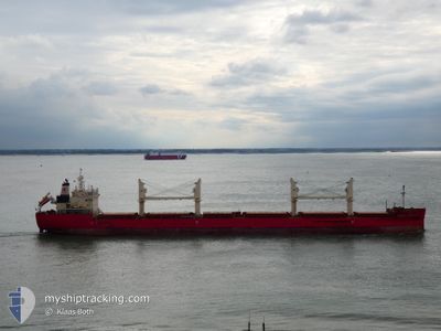
FEDERAL BRISTOL
Cargo
Current Trip
PANAMA
| Time Travelled | 7 days |
|---|---|
| Remaining Time | --- |
| Distance Travelled | 2560.93 nm |
| Remaining Distance | --- |
| AVG Speed | 13.9 Knots |
| MAX Speed | 16.1 Knots |
| AVG Wind | 9.9 knots |
| MAX Wind | 19.9 knots |
| MIN Temp | 13°C / 55.4°F |
| MAX Temp | 28.4°C / 83.12°F |
| Draught | 9.7 m |
| Position Received | 6 d ago |
Current Position
| Longitude | 122.10741° |
|---|---|
| Latitude | 25.51855° |
| Status | Under way using engine |
| Speed | 14.3 Knots |
| Course | 93.6° |
| Area | Eastern China Sea |
| Station | T-AIS |
| Position Received | 6 d ago |
Info
Information
The current position of FEDERAL BRISTOL is in Eastern China Sea with coordinates 25.51855° / 122.10741° as reported on 2024-05-31 11:06 by AIS to our vessel tracker app. The vessel's current speed is 14.3 Knots
The vessel FEDERAL BRISTOL (IMO: 9697844, MMSI: 538006433) is a Cargo It's sailing under the flag of [MH] Marshall Is.
In this page you can find informations about the vessels current position, last detected port calls, and current voyage information. If the vessels is not in coverage by AIS you will find the latest position.
The current position of FEDERAL BRISTOL is detected by our AIS receivers and we are not responsible for the reliability of the data. The last position was recorded while the vessel was in Coverage by the Ais receivers of our vessel tracking app.
The current draught of FEDERAL BRISTOL as reported by AIS is 9.7 meters
Weather
| Temperature | 13.1°C / 55.58°F |
|---|---|
| Wind Speed | 18 knots |
| Direction | 300° WNW |
| Pressure | 1018 hPa |
| Humidity | 70.3 % |
| Cloud Coverage | 49 % |
Featured Company
Last Port Calls
| Port | Arrival | Departure | Time In Port |
|---|---|---|---|
| 2024-05-27 11:33 | 2024-05-30 16:19 | 3 d | |
| 2024-05-20 01:48 | 2024-05-23 02:03 | 3 d | |
| 2024-05-12 01:52 | 2024-05-15 11:41 | 3 d | |
| 2024-04-29 22:49 | 2024-05-03 10:08 | 3 d | |
| 2024-04-22 07:15 | 2024-04-23 15:36 | 1 d | |
| 2024-04-20 09:11 | 2024-04-22 05:12 | 1 d | |
| 2024-04-15 13:06 |
Most Visited Ports (Last year)
| Port | Arrivals | |
|---|---|---|
| 4 | ||
| 4 | ||
| 3 | ||
| 2 | ||
| 2 | ||
| 2 |
Last Trips
| Origin | Departure | Destination | Arrival | Distance | |
|---|---|---|---|---|---|
| 2024-05-23 10:03 | 2024-05-27 19:33 | 1209.83 nm | |||
| 2024-05-15 19:41 | 2024-05-20 09:48 | 1218.10 nm | |||
| 2024-05-03 18:08 | 2024-05-12 09:52 | 1286.06 nm | |||
| 2024-04-23 23:36 | 2024-04-30 06:49 | 514.49 nm | |||
| 2024-04-22 13:12 | 2024-04-22 15:15 | 44.88 nm |
Events
| Time | Event | Details | Position / Dest | Info |
|---|---|---|---|---|
| 2024-05-31 11:13 | Status Changed | Default Under way using engine |
25.51636 / 122.14008
PANAMA
|
Speed: 14.3 kn Course: 93.6° |
| 2024-05-31 11:06 | OUT of Coverage |
25.51855 / 122.10741
Eastern China Sea
PANAMA
|
Speed: 14.3 kn Course: 93.6° |
|
| 2024-05-31 10:11 | Status Changed | Under way using engine Default |
25.54752 / 121.88092
PANAMA
|
Speed: 14.1 kn Course: 97° |
| 2024-05-31 10:02 | Status Changed | Default Under way using engine |
25.55306 / 121.84280
PANAMA
|
Speed: 14.1 kn Course: 90.3° |
| 2024-05-31 08:54 | Change Sea Area | Taiwanese part of the Eastern China Sea Taiwanese part of the South China Sea |
25.55786 / 121.54509
Eastern China Sea
PANAMA
|
Speed: 14.1 kn Course: 91.6° |
| 2024-05-31 08:48 | Status Changed | Under way using engine Default |
25.55874 / 121.51773
PANAMA
|
Speed: 14.1 kn Course: 91° |
| 2024-05-31 08:39 | IN Coverage |
25.55786 / 121.54509
Eastern China Sea
PANAMA
|
Speed: 14.1 kn Course: 91.6° |
|
| 2024-05-30 18:33 | Status Changed | Default Under way using engine |
22.89590 / 119.89566
PANAMA
|
Speed: 14.6 kn Course: 340.1° |
| 2024-05-30 18:29 | Status Changed | Under way using engine Default |
22.88278 / 119.90048
PANAMA
|
Speed: 14.6 kn Course: 341° |
| 2024-05-30 18:29 | OUT of Coverage |
22.88278 / 119.90048
South China Sea
PANAMA
|
Speed: 14.6 kn Course: 340.1° |