
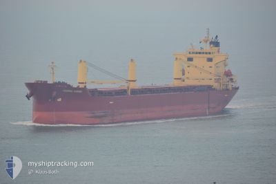
FEDERAL KUSHIRO
Bulk Carrier
Current Trip
| Time Travelled | 2 days |
|---|---|
| Remaining Time | 16 h, 46 mins |
| Distance Travelled | 839.11 nm |
| Remaining Distance | 240.73 nm |
| AVG Speed | 12.9 Knots |
| MAX Speed | 14.6 Knots |
| AVG Wind | 14.5 knots |
| MAX Wind | 23.9 knots |
| MIN Temp | 7.9°C / 46.22°F |
| MAX Temp | 12.8°C / 55.04°F |
| Draught | 6.5 m |
| Position Received | 38 m ago |
Current Position
| Longitude | 3.53209° |
|---|---|
| Latitude | 55.15242° |
| Status | Under way using engine |
| Speed | 13.9 Knots |
| Course | 182.6° |
| Area | North Sea |
| Station | T-AIS |
| Position Received | 38 m ago |
Info
Information
The current position of FEDERAL KUSHIRO is in North Sea with coordinates 55.15242° / 3.53209° as reported on 2024-05-20 12:58 by AIS to our vessel tracker app. The vessel's current speed is 13.9 Knots and is heading at the port of SLUISKIL. The estimated time of arrival as calculated by vessel tracking app is 2024-05-21 06:22 LT
The vessel FEDERAL KUSHIRO (IMO: 9284702, MMSI: 538004060) is a Bulk Carrier that was built in 2004 ( 20 years old ). It's sailing under the flag of [MH] Marshall Is.
In this page you can find informations about the vessels current position, last detected port calls, and current voyage information. If the vessels is not in coverage by AIS you will find the latest position.
The current position of FEDERAL KUSHIRO is detected by our AIS receivers and we are not responsible for the reliability of the data. The last position was recorded while the vessel was in Coverage by the Ais receivers of our vessel tracking app.
The current draught of FEDERAL KUSHIRO as reported by AIS is 6.5 meters
Weather
| Temperature | 12°C / 53.6°F |
|---|---|
| Wind Speed | 11 knots |
| Direction | 29° NNE |
| Pressure | 1015.2 hPa |
| Humidity | 79.8 % |
| Cloud Coverage | --- |
Featured Company
Last Port Calls
| Port | Arrival | Departure | Time In Port |
|---|---|---|---|
| 2024-05-07 13:57 | 2024-05-17 21:24 | 10 d | |
| 2024-04-27 11:56 | 2024-05-03 05:46 | 5 d | |
| 2024-04-13 00:47 | 2024-04-13 10:34 | 9 h | |
| 2024-04-11 16:25 | 2024-04-11 17:02 | 36 m | |
| 2024-04-09 12:09 | 2024-04-09 13:11 | 1 h | |
| 2024-04-06 15:08 | 2024-04-08 10:49 | 1 d | |
| 2024-04-01 17:06 | 2024-04-01 17:47 | 41 m | |
| 2024-03-30 00:58 | 2024-03-30 01:33 | 35 m | |
| 2024-03-28 13:41 | 2024-03-28 16:32 | 2 h | |
| 2024-03-23 02:08 | 2024-03-24 05:02 | 1 d |
Most Visited Ports (Last year)
| Port | Arrivals | |
|---|---|---|
| 4 | ||
| 4 | ||
| 3 | ||
| 1 | ||
| 1 | ||
| 1 |
Last Trips
| Origin | Departure | Destination | Arrival | Distance | |
|---|---|---|---|---|---|
| 2024-05-03 07:46 | 2024-05-07 15:57 | 1101.69 nm | |||
| 2024-04-13 06:34 | 2024-04-27 13:56 | 3393.99 nm | |||
| 2024-04-11 13:02 | 2024-04-12 20:47 | 296.41 nm | |||
| 2024-04-09 09:11 | 2024-04-11 12:25 | 522.16 nm | |||
| 2024-04-08 06:49 | 2024-04-09 08:09 | 240.80 nm | |||
| 2024-04-01 13:47 | 2024-04-06 11:08 | 237.80 nm | |||
| 2024-03-29 21:33 | 2024-04-01 13:06 | 522.58 nm | |||
| 2024-03-28 12:32 | 2024-03-29 20:58 | 298.00 nm | |||
| 2024-03-24 01:02 | 2024-03-28 09:41 | 74.24 nm | |||
| 2024-03-22 20:35 | 2024-03-22 22:08 | 8.02 nm |
Events
| Time | Event | Details | Position / Dest | Info |
|---|---|---|---|---|
| 2024-05-20 13:04 | Status Changed | Default Under way using engine |
55.12705 / 3.52968
NLSLU
|
Speed: 13.9 kn Course: 182.6° |
| 2024-05-20 12:46 | Status Changed | Under way using engine Default |
55.19737 / 3.53666
NLSLU
|
Speed: 13.8 kn Course: 184° |
| 2024-05-20 12:25 | Status Changed | Default Under way using engine |
55.27656 / 3.54642
NLSLU
|
Speed: 13.8 kn Course: 184.2° |
| 2024-05-20 12:15 | Change Sea Area | Dutch part of the North Sea German part of the North Sea |
55.31435 / 3.55151
North Sea
NLSLU
|
Speed: 13.9 kn Course: 184.1° |
| 2024-05-20 12:14 | Status Changed | Under way using engine Default |
55.31949 / 3.55219
NLSLU
|
Speed: 13.8 kn Course: 184° |
| 2024-05-20 12:01 | IN Coverage |
55.31435 / 3.55151
North Sea
NLSLU
|
Speed: 13.9 kn Course: 184.1° |
|
| 2024-05-20 10:17 | Status Changed | Default Under way using engine |
55.77194 / 3.62114
NLSLU
|
Speed: 14 kn Course: 184.6° |
| 2024-05-20 10:07 | OUT of Coverage |
55.80904 / 3.62630
North Sea
NLSLU
|
Speed: 14 kn Course: 184.6° |
|
| 2024-05-20 09:52 | Change Sea Area | German part of the North Sea Danish part of the North Sea |
55.86802 / 3.63444
North Sea
NLSLU
|
Speed: 14 kn Course: 184.3° |
| 2024-05-20 09:38 | Status Changed | Under way using engine Default |
55.92262 / 3.64191
NLSLU
|
Speed: 14 kn Course: 184° |