
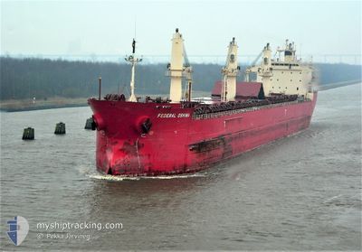
FEDERAL OSHIMA
Bulk Carrier
Current Trip
USDLH
| Time Travelled | 4 days |
|---|---|
| Remaining Time | --- |
| Distance Travelled | 837.27 nm |
| Remaining Distance | --- |
| AVG Speed | 10.1 Knots |
| MAX Speed | 13.5 Knots |
| AVG Wind | 8.7 knots |
| MAX Wind | 22 knots |
| MIN Temp | 12.6°C / 54.68°F |
| MAX Temp | 19.7°C / 67.46°F |
| Draught | 8.1 m |
| Position Received | 13 h, 15 m ago |
Current Position
| Longitude | 14.01055° |
|---|---|
| Latitude | 36.33474° |
| Status | Under way using engine |
| Speed | 9.2 Knots |
| Course | 292.9° |
| Area | Mediterranean Sea - Eastern Basin |
| Station | T-AIS |
| Position Received | 13 h, 15 m ago |
Info
Information
The current position of FEDERAL OSHIMA is in Mediterranean Sea - Eastern Basin with coordinates 36.33474° / 14.01055° as reported on 2024-05-09 03:45 by AIS to our vessel tracker app. The vessel's current speed is 9.2 Knots
The vessel FEDERAL OSHIMA (IMO: 9200330, MMSI: 538006783) is a Bulk Carrier that was built in 1999 ( 25 years old ). It's sailing under the flag of [MH] Marshall Is.
In this page you can find informations about the vessels current position, last detected port calls, and current voyage information. If the vessels is not in coverage by AIS you will find the latest position.
The current position of FEDERAL OSHIMA is detected by our AIS receivers and we are not responsible for the reliability of the data. The last position was recorded while the vessel was in Coverage by the Ais receivers of our vessel tracking app.
The current draught of FEDERAL OSHIMA as reported by AIS is 8.1 meters
Weather
| Temperature | 17.4°C / 63.32°F |
|---|---|
| Wind Speed | 9 knots |
| Direction | 353° N |
| Pressure | 1012.2 hPa |
| Humidity | 81.2 % |
| Cloud Coverage | 100 % |
Featured Company
Last Port Calls
| Port | Arrival | Departure | Time In Port |
|---|---|---|---|
| 2024-05-01 14:57 | 2024-05-05 14:03 | 3 d | |
| 2024-04-19 19:18 | 2024-04-22 23:22 | 3 d | |
| 2024-03-16 08:19 | 2024-03-20 01:25 | 3 d |
Most Visited Ports (Last year)
| Port | Arrivals | |
|---|---|---|
| 5 | ||
| 4 | ||
| 2 | ||
| 2 | ||
| 2 | ||
| 2 |
Last Trips
| Origin | Departure | Destination | Arrival | Distance | |
|---|---|---|---|---|---|
| 2024-04-23 00:22 | 2024-05-01 17:57 | 2164.31 nm | |||
| 2024-03-19 21:25 | 2024-04-19 20:18 | 3453.98 nm | |||
| 2024-02-17 11:47 | 2024-03-16 04:19 | 3985.13 nm |
Events
| Time | Event | Details | Position / Dest | Info |
|---|---|---|---|---|
| 2024-05-09 03:51 | Status Changed | Default Under way using engine |
36.34049 / 13.99410
USDLH
|
Speed: 9.2 kn Course: 292.9° |
| 2024-05-09 03:45 | OUT of Coverage |
36.33474 / 14.01055
Mediterranean Sea - Eastern Basin
USDLH
|
Speed: 9.2 kn Course: 292.9° |
|
| 2024-05-09 00:42 | Status Changed | Under way using engine Default |
36.06838 / 14.52054
USDLH
|
Speed: 10 kn Course: 313° |
| 2024-05-09 00:39 | Status Changed | Default Under way using engine |
36.06269 / 14.52817
USDLH
|
Speed: 10 kn Course: 313° |
| 2024-05-08 23:40 | Destination Changed | USDLH MTMLA |
35.93854 / 14.67281
USDLH
|
Speed: 10.1 kn Course: 315° |
| 2024-05-08 23:40 | ETA Changed | 2024/05/28 11:30 2024/05/08 11:30 |
35.93854 / 14.67281
USDLH
|
Speed: 10.1 kn Course: 315° |
| 2024-05-08 23:18 | Status Changed | Under way using engine Default |
35.89784 / 14.72323
MTMLA
|
Speed: 9 kn Course: 314° |
| 2024-05-08 23:12 | START Moving | 9.98 nm, North East of MARSAXLOKK |
35.88746 / 14.73600
MTMLA
|
Speed: 7.7 kn Course: 314° |
| 2024-05-08 23:12 | IN Coverage |
35.89784 / 14.72323
Mediterranean Sea - Eastern Basin
|
Speed: 9.4 kn Course: 313.5° |
|
| 2024-05-08 17:57 | OUT of Coverage |
35.88322 / 14.75446
Mediterranean Sea - Eastern Basin
|
Speed: 0.1 kn Course: 173.6° |