
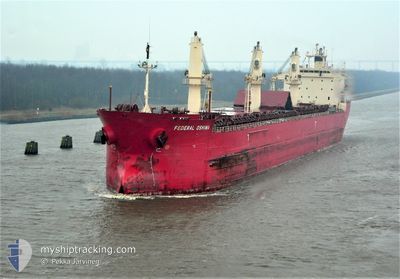
FEDERAL OSHIMA
Bulk Carrier
Current Trip
USDLH
| Time Travelled | 13 days |
|---|---|
| Remaining Time | --- |
| Distance Travelled | 3137.98 nm |
| Remaining Distance | --- |
| AVG Speed | 9.9 Knots |
| MAX Speed | 13.5 Knots |
| AVG Wind | 9.3 knots |
| MAX Wind | 22 knots |
| MIN Temp | 12.6°C / 54.68°F |
| MAX Temp | 19.7°C / 67.46°F |
| Draught | 8.1 m |
| Position Received | 1 d ago |
Current Position
| Longitude | -26.05213° |
|---|---|
| Latitude | 41.52261° |
| Status | Under way using engine |
| Speed | 11 Knots |
| Course | 280.5° |
| Area | North Atlantic Ocean |
| Station | T-AIS |
| Position Received | 1 d ago |
Info
Information
The current position of FEDERAL OSHIMA is in North Atlantic Ocean with coordinates 41.52261° / -26.05213° as reported on 2024-05-17 17:30 by AIS to our vessel tracker app. The vessel's current speed is 11 Knots
The vessel FEDERAL OSHIMA (IMO: 9200330, MMSI: 538006783) is a Bulk Carrier that was built in 1999 ( 25 years old ). It's sailing under the flag of [MH] Marshall Is.
In this page you can find informations about the vessels current position, last detected port calls, and current voyage information. If the vessels is not in coverage by AIS you will find the latest position.
The current position of FEDERAL OSHIMA is detected by our AIS receivers and we are not responsible for the reliability of the data. The last position was recorded while the vessel was in Coverage by the Ais receivers of our vessel tracking app.
The current draught of FEDERAL OSHIMA as reported by AIS is 8.1 meters
Weather
| Temperature | 17.2°C / 62.96°F |
|---|---|
| Wind Speed | 10 knots |
| Direction | 277° W |
| Pressure | 1017.9 hPa |
| Humidity | 86 % |
| Cloud Coverage | --- |
Featured Company
Last Port Calls
| Port | Arrival | Departure | Time In Port |
|---|---|---|---|
| 2024-05-01 14:57 | 2024-05-05 14:03 | 3 d | |
| 2024-04-19 19:18 | 2024-04-22 23:22 | 3 d | |
| 2024-03-16 08:19 | 2024-03-20 01:25 | 3 d |
Most Visited Ports (Last year)
| Port | Arrivals | |
|---|---|---|
| 4 | ||
| 3 | ||
| 2 | ||
| 2 | ||
| 2 | ||
| 1 |
Last Trips
| Origin | Departure | Destination | Arrival | Distance | |
|---|---|---|---|---|---|
| 2024-04-23 00:22 | 2024-05-01 17:57 | 2164.31 nm | |||
| 2024-03-19 21:25 | 2024-04-19 20:18 | 3453.98 nm | |||
| 2024-02-17 11:47 | 2024-03-16 04:19 | 3985.13 nm |
Events
| Time | Event | Details | Position / Dest | Info |
|---|---|---|---|---|
| 2024-05-17 17:39 | Status Changed | Default Under way using engine |
41.52845 / -26.08829
USDLH
|
Speed: 11 kn Course: 280.5° |
| 2024-05-17 17:30 | OUT of Coverage |
41.52261 / -26.05213
North Atlantic Ocean
USDLH
|
Speed: 11 kn Course: 280.5° |
|
| 2024-05-17 17:18 | Status Changed | Under way using engine Default |
41.51417 / -26.00436
USDLH
|
Speed: 11.1 kn Course: 282° |
| 2024-05-17 17:11 | IN Coverage |
41.51541 / -26.01097
North Atlantic Ocean
USDLH
|
Speed: 10.9 kn Course: 281.8° |
|
| 2024-05-17 11:35 | Status Changed | Default Under way using engine |
41.26903 / -24.67230
USDLH
|
Speed: 10 kn Course: 285.1° |
| 2024-05-17 11:21 | OUT of Coverage |
41.25778 / -24.61990
North Atlantic Ocean
USDLH
|
Speed: 10 kn Course: 285.1° |
|
| 2024-05-17 11:09 | Change Sea Area | Portuguese (Azores) part of the North Atlantic Ocean Portuguese part of the North Atlantic Ocean |
41.24866 / -24.57869
North Atlantic Ocean
USDLH
|
Speed: 9.8 kn Course: 283.9° |
| 2024-05-17 11:09 | Status Changed | Under way using engine Default |
41.24866 / -24.57869
USDLH
|
Speed: 10.1 kn Course: 285° |
| 2024-05-17 11:09 | IN Coverage |
41.24866 / -24.57869
North Atlantic Ocean
USDLH
|
Speed: 9.8 kn Course: 283.9° |
|
| 2024-05-14 05:42 | OUT of Coverage |
36.91220 / -10.66855
North Atlantic Ocean
USDLH
|
Speed: 9.8 kn Course: 298.1° |