
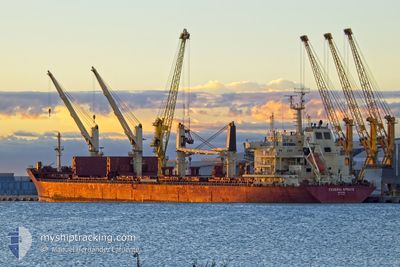
FEDERAL SPRUCE
Bulk Carrier
Current Trip
| Time Travelled | 2 days |
|---|---|
| Remaining Time | --- |
| Distance Travelled | 228.30 nm |
| Remaining Distance | --- |
| AVG Speed | 8.4 Knots |
| MAX Speed | 8.4 Knots |
| AVG Wind | 8.1 knots |
| MAX Wind | 13.9 knots |
| MIN Temp | 19.6°C / 67.28°F |
| MAX Temp | 26.3°C / 79.34°F |
| Draught | 10.3 m |
| Position Received | 1 m ago |
Current Position
| Longitude | 28.57621° |
|---|---|
| Latitude | 40.87375° |
| Status | Under way using engine |
| Speed | 10.3 Knots |
| Course | 253.9° |
| Area | Sea of Marmara |
| Station | T-AIS |
| Position Received | 1 m ago |
Info
Information
The current position of FEDERAL SPRUCE is in Sea of Marmara with coordinates 40.87375° / 28.57621° as reported on 2024-06-06 18:49 by AIS to our vessel tracker app. The vessel's current speed is 10.3 Knots and is heading at the port of TEES. The estimated time of arrival as calculated by vessel tracking app is 2024-06-20 17:00 LT
The vessel FEDERAL SPRUCE (IMO: 9610468, MMSI: 538004387) is a Bulk Carrier that was built in 2012 ( 12 years old ). It's sailing under the flag of [MH] Marshall Is.
In this page you can find informations about the vessels current position, last detected port calls, and current voyage information. If the vessels is not in coverage by AIS you will find the latest position.
The current position of FEDERAL SPRUCE is detected by our AIS receivers and we are not responsible for the reliability of the data. The last position was recorded while the vessel was in Coverage by the Ais receivers of our vessel tracking app.
The current draught of FEDERAL SPRUCE as reported by AIS is 10.3 meters
Weather
| Temperature | 22.4°C / 72.32°F |
|---|---|
| Wind Speed | 15 knots |
| Direction | 42° NE |
| Pressure | 1015.5 hPa |
| Humidity | 71.7 % |
| Cloud Coverage | 48 % |
Featured Company
Most Visited Ports (Last year)
| Port | Arrivals | |
|---|---|---|
| 1 | ||
| 1 | ||
| 1 | ||
| 1 | ||
| 1 | ||
| 1 |
Last Trips
Events
| Time | Event | Details | Position / Dest | Info |
|---|---|---|---|---|
| 2024-06-06 14:25 | Change Sea Area | Turkish part of the Sea of Marmara Turkish part of the Black Sea |
41.23062 / 29.12901
Sea of Marmara
GB TEE
|
Speed: 7.7 kn Course: 195.7° |
| 2024-06-06 12:59 | ETA Changed | 2024/06/20 17:00 2024/06/19 12:00 |
41.35163 / 29.15132
GB TEE
|
Speed: 3.5 kn Course: 190° |
| 2024-06-06 12:57 | START Moving | 7.52 nm, North of RUMELI FENERI |
41.35341 / 29.15142
GB TEE
|
Speed: 3.1 kn Course: 190° |
| 2024-06-06 11:30 | Status Changed | Under way using engine Default |
41.36023 / 29.14633
GB TEE
|
Speed: 0.1 kn Course: 177° |
| 2024-06-06 11:26 | Status Changed | Default Under way using engine |
41.36021 / 29.14596
GB TEE
|
Speed: 0.2 kn Course: 178° |
| 2024-06-06 11:24 | Status Changed | Under way using engine Default |
41.36020 / 29.14583
GB TEE
|
Speed: 0.4 kn Course: 177° |
| 2024-06-06 11:21 | Status Changed | Default Under way using engine |
41.36012 / 29.14549
GB TEE
|
Speed: 0.5 kn Course: 177° |
| 2024-06-06 08:15 | STOP Moving | 8.2 nm, North of RUMELI FENERI |
41.36605 / 29.14396
GB TEE
|
Speed: 0.3 kn Course: 283° |
| 2024-06-06 06:55 | START Moving | 8.71 nm, North East of RUMELI FENERI |
41.35514 / 29.21397
GB TEE
|
Speed: 3.1 kn Course: 99° |
| 2024-06-05 15:38 | STOP Moving | 10.05 nm, North of RUMELI FENERI |
41.39524 / 29.06694
GB TEE
|
Speed: 0.2 kn Course: 99° |