
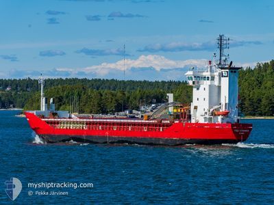
FEED STAVANGER
General Cargo
Current Trip
| Time Travelled | 3 days |
|---|---|
| Remaining Time | --- |
| Distance Travelled | 353.64 nm |
| Remaining Distance | 8.06 nm |
| AVG Speed | 10.3 Knots |
| MAX Speed | 12.5 Knots |
| AVG Wind | 8.7 knots |
| MAX Wind | 18.5 knots |
| MIN Temp | 10°C / 50°F |
| MAX Temp | 17.1°C / 62.78°F |
| Draught | 6.6 m |
| Position Received | 2 m ago |
Current Position
| Longitude | 5.81846° |
|---|---|
| Latitude | 59.06044° |
| Status | At anchor |
| Speed | 0.1 Knots |
| Course | 54° |
| Area | North Sea |
| Station | T-AIS |
| Position Received | 2 m ago |
Info
Information
The current position of FEED STAVANGER is in North Sea with coordinates 59.06044° / 5.81846° as reported on 2024-05-20 10:06 by AIS to our vessel tracker app. The vessel's current speed is 0.1 Knots and is heading at the port of FISKA. The estimated time of arrival as calculated by vessel tracking app is 2024-05-21 02:00 LT
The vessel FEED STAVANGER (IMO: 9155951, MMSI: 305224000) is a General Cargo that was built in 1997 ( 27 years old ). It's sailing under the flag of [AG] Antigua Barbuda.
In this page you can find informations about the vessels current position, last detected port calls, and current voyage information. If the vessels is not in coverage by AIS you will find the latest position.
The current position of FEED STAVANGER is detected by our AIS receivers and we are not responsible for the reliability of the data. The last position was recorded while the vessel was in Coverage by the Ais receivers of our vessel tracking app.
The current draught of FEED STAVANGER as reported by AIS is 6.6 meters
Weather
| Temperature | 10.4°C / 50.72°F |
|---|---|
| Wind Speed | 4 knots |
| Direction | 323° NW |
| Pressure | 1016.9 hPa |
| Humidity | 86 % |
| Cloud Coverage | 15 % |
Featured Company
Last Port Calls
| Port | Arrival | Departure | Time In Port |
|---|---|---|---|
| 2024-05-16 13:38 | 2024-05-17 09:16 | 19 h | |
| 2024-05-12 15:18 | 2024-05-13 17:42 | 1 d | |
| 2024-05-12 06:50 | 2024-05-12 08:18 | 1 h | |
| 2024-05-09 07:26 | 2024-05-10 09:47 | 1 d | |
| 2024-05-07 09:53 | 2024-05-07 19:09 | 9 h | |
| 2024-04-30 20:40 | 2024-05-02 22:38 | 2 d | |
| 2024-04-30 03:54 | 2024-04-30 20:11 | 16 h | |
| 2024-04-24 22:49 | 2024-04-26 22:08 | 1 d | |
| 2024-04-23 04:10 | 2024-04-24 19:00 | 1 d | |
| 2024-04-19 20:12 | 2024-04-21 14:25 | 1 d |
Last Trips
| Origin | Departure | Destination | Arrival | Distance | |
|---|---|---|---|---|---|
| 2024-05-13 20:42 | 2024-05-16 15:38 | 706.77 nm | |||
| 2024-05-12 11:18 | 2024-05-12 18:18 | 76.12 nm | |||
| 2024-05-10 11:47 | 2024-05-12 09:50 | 519.01 nm | |||
| 2024-05-07 21:09 | 2024-05-09 09:26 | 357.67 nm | |||
| 2024-05-03 00:38 | 2024-05-07 11:53 | 332.31 nm | |||
| 2024-04-30 22:11 | 2024-04-30 22:40 | 4.32 nm | |||
| 2024-04-27 00:08 | 2024-04-30 05:54 | 638.33 nm | |||
| 2024-04-24 21:00 | 2024-04-25 00:49 | 35.43 nm | |||
| 2024-04-21 16:25 | 2024-04-23 06:10 | 312.67 nm | |||
| 2024-04-17 06:25 | 2024-04-19 22:12 | 282.56 nm |
Events
| Time | Event | Details | Position / Dest | Info |
|---|---|---|---|---|
| 2024-05-20 08:42 | Status Changed | At anchor Default |
59.06033 / 5.81849
FISKAA
|
Speed: Course: 53° |
| 2024-05-20 08:38 | Status Changed | Default At anchor |
59.06037 / 5.81848
FISKAA
|
Speed: Course: 54° |
| 2024-05-20 06:42 | Status Changed | At anchor Default |
59.06090 / 5.81815
FISKAA
|
Speed: Course: 106° |
| 2024-05-20 06:38 | Status Changed | Default At anchor |
59.06093 / 5.81823
FISKAA
|
Speed: 0.1 kn Course: 108° |
| 2024-05-20 05:06 | Status Changed | At anchor Default |
59.06115 / 5.81853
FISKAA
|
Speed: Course: 123° |
| 2024-05-20 05:00 | Status Changed | Default At anchor |
59.06114 / 5.81853
FISKAA
|
Speed: Course: 123° |
| 2024-05-20 04:48 | Status Changed | At anchor Default |
59.06117 / 5.81848
FISKAA
|
Speed: Course: 127° |
| 2024-05-20 04:42 | Status Changed | Default At anchor |
59.06120 / 5.81851
FISKAA
|
Speed: Course: 128° |
| 2024-05-18 18:36 | Status Changed | At anchor Under way using engine |
59.05991 / 5.82141
FISKAA
|
Speed: 0.3 kn Course: 336° |
| 2024-05-18 18:29 | STOP Moving | 2.79 nm, West of TAU |
59.06084 / 5.82009
FISKAA
|
Speed: 0.1 kn Course: 305° |