
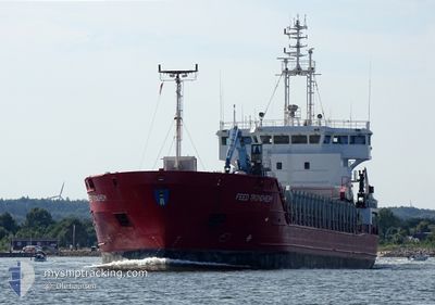
FEED TRONDHEIM
General Cargo
Current Trip
| Trip Time | 4 days |
|---|---|
| Trip Distance | 735.47 nm |
| AVG Speed | 9.8 Knots |
| MAX Speed | 12.3 Knots |
| Draught | 5.7 m |
| AVG Wind | 9.1 knots |
| MAX Wind | 24.6 knots |
| MIN Temp | 12.5°C / 54.5°F |
| MAX Temp | 17.5°C / 63.5°F |
| Position Received | 6 m ago |
Current Position
| Longitude | 11.45883° |
|---|---|
| Latitude | 53.90250° |
| Status | Moored |
| Speed | |
| Course | 278° |
| Area | Baltic Sea |
| Station | T-AIS |
| Position Received | 6 m ago |
Info
Information
The current position of FEED TRONDHEIM is in Baltic Sea with coordinates 53.90250° / 11.45883° as reported on 2024-05-28 23:20 by AIS to our vessel tracker app. The vessel's current speed is 0 Knots and is currently inside the port of WISMAR.
The vessel FEED TRONDHEIM (IMO: 9226798, MMSI: 305371000) is a General Cargo that was built in 2002 ( 22 years old ). It's sailing under the flag of [AG] Antigua Barbuda.
In this page you can find informations about the vessels current position, last detected port calls, and current voyage information. If the vessels is not in coverage by AIS you will find the latest position.
The current position of FEED TRONDHEIM is detected by our AIS receivers and we are not responsible for the reliability of the data. The last position was recorded while the vessel was in Coverage by the Ais receivers of our vessel tracking app.
The current draught of FEED TRONDHEIM as reported by AIS is 5.7 meters
Weather
| Temperature | 10.7°C / 51.26°F |
|---|---|
| Wind Speed | 8 knots |
| Direction | 163° SSE |
| Pressure | 1015.4 hPa |
| Humidity | 89.8 % |
| Cloud Coverage | 10 % |
Featured Company
Last Port Calls
| Port | Arrival | Departure | Time In Port |
|---|---|---|---|
| 2024-05-28 18:08 | |||
| 2024-05-22 13:51 | 2024-05-24 11:35 | 1 d | |
| 2024-05-19 18:05 | 2024-05-19 21:35 | 3 h | |
| 2024-05-14 14:25 | 2024-05-15 10:52 | 20 h | |
| 2024-05-07 18:44 | 2024-05-10 03:00 | 2 d | |
| 2024-05-05 09:11 | 2024-05-06 06:20 | 21 h | |
| 2024-05-03 03:21 | 2024-05-03 11:54 | 8 h | |
| 2024-04-30 12:04 | 2024-05-02 19:54 | 2 d | |
| 2024-04-27 01:22 | 2024-04-27 14:23 | 13 h | |
| 2024-04-25 07:01 | 2024-04-25 23:46 | 16 h |
Last Trips
| Origin | Departure | Destination | Arrival | Distance | |
|---|---|---|---|---|---|
| 2024-05-24 13:35 | 2024-05-28 20:08 | 735.47 nm | |||
| 2024-05-19 23:35 | 2024-05-22 15:51 | 531.79 nm | |||
| 2024-05-15 12:52 | 2024-05-19 20:05 | 562.56 nm | |||
| 2024-05-10 05:00 | 2024-05-14 16:25 | 1021.36 nm | |||
| 2024-05-06 08:20 | 2024-05-07 20:44 | 269.63 nm | |||
| 2024-05-03 13:54 | 2024-05-05 11:11 | 401.01 nm | |||
| 2024-05-02 21:54 | 2024-05-03 05:21 | 11.97 nm | |||
| 2024-04-27 17:23 | 2024-04-30 14:04 | 698.02 nm | |||
| 2024-04-26 01:46 | 2024-04-27 04:22 | 267.73 nm | |||
| 2024-04-24 03:00 | 2024-04-25 09:01 | 220.56 nm |
Events
| Time | Event | Details | Position / Dest | Info |
|---|---|---|---|---|
| 2024-05-28 18:43 | Status Changed | Moored Under way using engine |
53.90250 / 11.45883
[DE] WISMAR
|
Speed: Course: 278° |
| 2024-05-28 18:21 | STOP Moving |
53.90200 / 11.45217
[DE] WISMAR
|
Speed: Course: 18° |
|
| 2024-05-28 18:08 | PORT ARRIVAL |
|
53.91083 / 11.43883
[DE] WISMAR
|
Speed: 7 kn Course: 149° |
| 2024-05-28 11:35 | Change Sea Area | German part of the Baltic Sea Danish part of the Baltic Sea |
54.63700 / 11.03567
Baltic Sea
WISMAR
|
Speed: 9.8 kn Course: 124° |
| 2024-05-28 10:38 | Change Sea Area | Danish part of the Baltic Sea Danish part of the Kattegat |
54.73933 / 10.86867
Baltic Sea
WISMAR
|
Speed: 9.5 kn Course: 176° |
| 2024-05-27 13:46 | Change Sea Area | Danish part of the Kattegat Danish part of the Skaggerak |
57.76000 / 10.76550
Kattegat
WISMAR
|
Speed: 8.1 kn Course: 182° |
| 2024-05-27 08:25 | Change Sea Area | Danish part of the Skaggerak Norwegian part of the Skaggerak |
57.88083 / 9.20150
Skaggerak
WISMAR
|
Speed: 9.5 kn Course: 102° |
| 2024-05-27 01:52 | Draught Changed | 5.7 4.5 |
58.01234 / 7.49667
WISMAR
|
Speed: 7.2 kn Course: 191° |
| 2024-05-27 01:52 | Destination Changed | WISMAR MANDAL |
58.01234 / 7.49667
WISMAR
|
Speed: 7.2 kn Course: 191° |
| 2024-05-27 01:52 | ETA Changed | 2024/05/28 21:00 2024/05/25 22:00 |
58.01234 / 7.49667
WISMAR
|
Speed: 7.2 kn Course: 191° |