
FEHAR
Cargo
Current Trip
| Time Travelled | 21 h, 39 mins |
|---|---|
| Remaining Time | --- |
| Distance Travelled | 1.45 nm |
| Remaining Distance | --- |
| AVG Speed | 4 Knots |
| MAX Speed | 4 Knots |
| AVG Wind | 8.3 knots |
| MAX Wind | 8.8 knots |
| MIN Temp | 14.1°C / 57.38°F |
| MAX Temp | 16.8°C / 62.24°F |
| Draught | 0 m |
| Position Received | 4 m ago |
Current Position
| Longitude | 7.80223° |
|---|---|
| Latitude | 51.68130° |
| Status | Moored |
| Speed | |
| Course | --- |
| Area | North Sea |
| Station | T-AIS |
| Position Received | 4 m ago |
Info
info
Information
The current position of FEHAR is in North Sea with coordinates 51.68130° / 7.80223° as reported on 2024-06-01 13:45 by AIS to our vessel tracker app. The vessel's current speed is 0 Knots
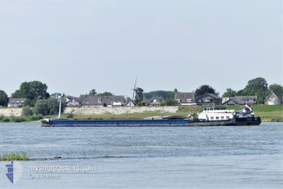
The vessel FEHAR (MMSI: 244377553) is a Cargo It's sailing under the flag of [NL] Netherlands.
In this page you can find informations about the vessels current position, last detected port calls, and current voyage information. If the vessels is not in coverage by AIS you will find the latest position.
The current position of FEHAR is detected by our AIS receivers and we are not responsible for the reliability of the data. The last position was recorded while the vessel was in Coverage by the Ais receivers of our vessel tracking app.
Weather
| Temperature | 19.4°C / 66.92°F |
|---|---|
| Wind Speed | 8 knots |
| Direction | 329° NNW |
| Pressure | 1015.1 hPa |
| Humidity | 83.2 % |
| Cloud Coverage | 100 % |
Featured Company
Limited time offer - Install a base station receiver to your area and list your company on Free forever!
Last Port Calls
| Port | Arrival | Departure | Time In Port |
|---|---|---|---|
| 2024-05-30 12:48 | 2024-05-31 16:10 | 1 d | |
| 2024-05-29 19:03 | 2024-05-30 05:24 | 10 h | |
| 2024-05-29 12:48 | 2024-05-29 16:12 | 3 h | |
| 2024-05-27 14:58 | 2024-05-29 10:06 | 1 d | |
| 2024-05-27 08:13 | 2024-05-27 09:24 | 1 h | |
| 2024-05-26 11:49 | 2024-05-26 12:32 | 42 m | |
| 2024-05-25 14:12 | 2024-05-26 11:38 | 21 h | |
| 2024-05-24 11:48 | 2024-05-24 11:59 | 10 m | |
| 2024-05-23 15:47 | 2024-05-24 08:22 | 16 h | |
| 2024-05-22 16:27 | 2024-05-23 15:00 | 22 h |
Most Visited Ports (Last year)
| Port | Arrivals | |
|---|---|---|
| 23 | ||
| 22 | ||
| 17 | ||
| 7 | ||
| 7 | ||
| 6 |
Last Trips
| Origin | Departure | Destination | Arrival | Distance | |
|---|---|---|---|---|---|
| 2024-05-30 07:24 | 2024-05-30 14:48 | 27.90 nm | |||
| 2024-05-29 18:12 | 2024-05-29 21:03 | 13.27 nm | |||
| 2024-05-29 12:06 | 2024-05-29 14:48 | 29.67 nm | |||
| 2024-05-27 11:24 | 2024-05-27 16:58 | 25.11 nm | |||
| 2024-05-26 14:32 | 2024-05-27 10:13 | 41.87 nm | |||
| 2024-05-26 13:38 | 2024-05-26 13:49 | 0.68 nm | |||
| 2024-05-24 13:59 | 2024-05-25 16:12 | 102.34 nm | |||
| 2024-05-24 10:22 | 2024-05-24 13:48 | 22.94 nm | |||
| 2024-05-23 17:00 | 2024-05-23 17:47 | 6.88 nm | |||
| 2024-05-22 15:42 | 2024-05-22 18:27 | 21.93 nm |
Events
| Time | Event | Details | Position / Dest | Info |
|---|---|---|---|---|
| 2024-05-31 18:12 | Status Changed | Moored Under way using engine |
51.68131 / 7.80221
VLOTHAVEN
|
Speed: Course: 511° |
| 2024-05-31 18:02 | Destination Changed | VLOTHAVEN HAFENGRUPPE UENTROP |
51.68131 / 7.80221
VLOTHAVEN
|
Speed: Course: 511° |
| 2024-05-31 18:02 | ETA Changed | 2024/06/03 10:59 2024/05/29 16:52 |
51.68131 / 7.80221
VLOTHAVEN
|
Speed: Course: 511° |
| 2024-05-31 17:52 | STOP Moving | 0.91 nm, East of HAMM |
51.68143 / 7.80230
HAFENGRUPPE UENTROP
|
Speed: 0.3 kn Course: 511° |
| 2024-05-31 17:49 | Status Changed | Under way using engine Default |
51.68171 / 7.80678
HAFENGRUPPE UENTROP
|
Speed: 4 kn Course: -1° |
| 2024-05-31 17:49 | IN Coverage |
51.68171 / 7.80678
North Sea
|
Speed: 1.7 kn Course: 155.1° |
|
| 2024-05-31 16:10 | PORT DEPARTURE |
|
51.69167 / 7.83667
HAFENGRUPPE UENTROP
|
Speed: Course: -1° |
| 2024-05-30 12:48 | PORT ARRIVAL |
|
51.68500 / 7.94167
[DE] UENTROPER
|
Speed: Course: -1° |
| 2024-05-30 11:33 | STOP Moving | 2.96 nm, West of UENTROPER |
51.69500 / 7.86500
HAFENGRUPPE UENTROP
|
Speed: Course: -1° |
| 2024-05-30 10:30 | OUT of Coverage |
51.68151 / 7.80360
North Sea
|
Speed: 3.5 kn Course: 82.3° |