
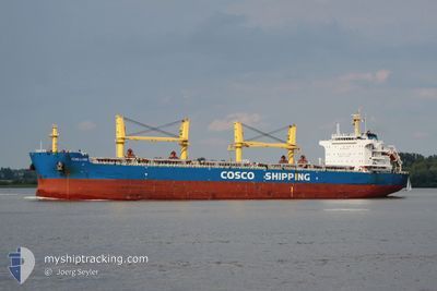
FENG LI HAI
Cargo
Current Trip
| Time Travelled | 13 days |
|---|---|
| Remaining Time | --- |
| Distance Travelled | 3165.79 nm |
| Remaining Distance | 22.61 nm |
| AVG Speed | 10.9 Knots |
| MAX Speed | 13.1 Knots |
| AVG Wind | 6.7 knots |
| MAX Wind | 17 knots |
| MIN Temp | 26.3°C / 79.34°F |
| MAX Temp | 30.8°C / 87.44°F |
| Draught | 13.5 m |
| Position Received | 6 d ago |
Current Position
| Longitude | 77.47543° |
|---|---|
| Latitude | 7.51302° |
| Status | Under way using engine |
| Speed | 12.6 Knots |
| Course | 124.5° |
| Area | Laccadive Sea |
| Station | T-AIS |
| Position Received | 6 d ago |
Info
Information
The current position of FENG LI HAI is in Laccadive Sea with coordinates 7.51302° / 77.47543° as reported on 2024-05-05 15:52 by AIS to our vessel tracker app. The vessel's current speed is 12.6 Knots and is heading at the port of CHITTAGONG. The estimated time of arrival as calculated by vessel tracking app is 2024-05-10 08:00 LT
The vessel FENG LI HAI (IMO: 9747534, MMSI: 477850200) is a Cargo It's sailing under the flag of [HK] Hong Kong.
In this page you can find informations about the vessels current position, last detected port calls, and current voyage information. If the vessels is not in coverage by AIS you will find the latest position.
The current position of FENG LI HAI is detected by our AIS receivers and we are not responsible for the reliability of the data. The last position was recorded while the vessel was in Coverage by the Ais receivers of our vessel tracking app.
The current draught of FENG LI HAI as reported by AIS is 13.5 meters
Weather
| Temperature | 27.4°C / 81.32°F |
|---|---|
| Wind Speed | 1 knots |
| Direction | 191° S |
| Pressure | 1012.2 hPa |
| Humidity | 78.7 % |
| Cloud Coverage | 13 % |
Featured Company
Events
| Time | Event | Details | Position / Dest | Info |
|---|---|---|---|---|
| 2024-05-10 21:08 | STOP Moving |
21.84736 / 91.79158
BD CGP
|
Speed: 0.2 kn Course: 351° |
|
| 2024-05-05 16:10 | Status Changed | Default Under way using engine |
7.47644 / 77.52698
BD CGP
|
Speed: 12.6 kn Course: 124.5° |
| 2024-05-05 15:52 | OUT of Coverage |
7.51302 / 77.47543
Laccadive Sea
BD CGP
|
Speed: 12.6 kn Course: 124.5° |
|
| 2024-05-05 11:51 | ETA Changed | 2024/05/10 08:00 2024/05/10 06:00 |
7.96913 / 76.79473
BD CGP
|
Speed: 12.1 kn Course: 123.4° |
| 2024-05-05 10:51 | Status Changed | Under way using engine Default |
8.07651 / 76.62608
BD CGP
|
Speed: 11.8 kn Course: 124° |
| 2024-05-05 10:43 | Status Changed | Default Under way using engine |
8.09184 / 76.60390
BD CGP
|
Speed: 11.9 kn Course: 127.2° |
| 2024-05-05 10:31 | Detected in Sea | Indian part of the Laccadive Sea |
8.11501 / 76.57036
Laccadive Sea
BD CGP
|
Speed: 11.9 kn Course: 127.2° |
| 2024-05-05 10:31 | Status Changed | Under way using engine Default |
8.11501 / 76.57036
BD CGP
|
Speed: 11.9 kn Course: 126° |
| 2024-05-05 10:31 | IN Coverage |
8.11501 / 76.57036
Laccadive Sea
BD CGP
|
Speed: 11.9 kn Course: 127.2° |