
FINNTIDE
Ro-Ro Cargo
Current Trip
| Time Travelled | 1 day |
|---|---|
| Remaining Time | 14 h, 26 mins |
| Distance Travelled | 362.45 nm |
| Remaining Distance | 220.18 nm |
| AVG Speed | 15 Knots |
| MAX Speed | 15.7 Knots |
| AVG Wind | 6.4 knots |
| MAX Wind | 10 knots |
| MIN Temp | 8.4°C / 47.12°F |
| MAX Temp | 11.4°C / 52.52°F |
| Draught | 7 m |
| Position Received | Now |
Current Position
| Longitude | 16.93919° |
|---|---|
| Latitude | 56.24904° |
| Status | Under way using engine |
| Speed | 14.8 Knots |
| Course | 232.4° |
| Area | Baltic Sea |
| Station | T-AIS |
| Position Received | Now |
Info
Information
The current position of FINNTIDE is in Baltic Sea with coordinates 56.24904° / 16.93919° as reported on 2024-05-18 18:07 by AIS to our vessel tracker app. The vessel's current speed is 14.8 Knots and is heading at the port of ROSTOCK. The estimated time of arrival as calculated by vessel tracking app is 2024-05-19 08:33 LT
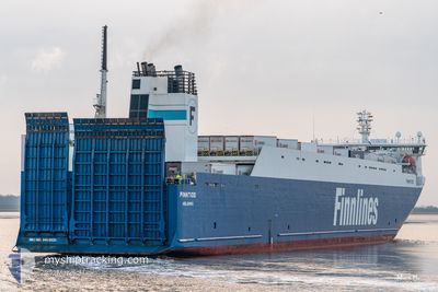
The vessel FINNTIDE (IMO: 9468920, MMSI: 230631000) is a Ro-Ro Cargo that was built in 2012 ( 12 years old ). It's sailing under the flag of [FI] Finland.
In this page you can find informations about the vessels current position, last detected port calls, and current voyage information. If the vessels is not in coverage by AIS you will find the latest position.
The current position of FINNTIDE is detected by our AIS receivers and we are not responsible for the reliability of the data. The last position was recorded while the vessel was in Coverage by the Ais receivers of our vessel tracking app.
The current draught of FINNTIDE as reported by AIS is 7 meters
Weather
| Temperature | 11.3°C / 52.34°F |
|---|---|
| Wind Speed | 10 knots |
| Direction | 75° ENE |
| Pressure | 1015.1 hPa |
| Humidity | 86.3 % |
| Cloud Coverage | --- |
Featured Company
Last Port Calls
| Port | Arrival | Departure | Time In Port |
|---|---|---|---|
| 2024-05-17 03:31 | 2024-05-17 17:39 | 14 h | |
| 2024-05-15 05:54 | 2024-05-15 16:13 | 10 h | |
| 2024-05-13 04:03 | 2024-05-14 16:15 | 1 d | |
| 2024-05-12 13:55 | 2024-05-12 17:37 | 3 h | |
| 2024-05-12 05:17 | 2024-05-12 11:01 | 5 h | |
| 2024-05-10 06:25 | 2024-05-10 19:16 | 12 h | |
| 2024-05-08 18:23 | 2024-05-09 00:25 | 6 h | |
| 2024-05-08 05:50 | 2024-05-08 15:34 | 9 h | |
| 2024-05-06 03:06 | 2024-05-06 20:38 | 17 h | |
| 2024-05-04 04:44 | 2024-05-04 13:20 | 8 h |
Last Trips
| Origin | Departure | Destination | Arrival | Distance | |
|---|---|---|---|---|---|
| 2024-05-15 18:13 | 2024-05-17 06:31 | 580.85 nm | |||
| 2024-05-14 18:15 | 2024-05-15 07:54 | 164.36 nm | |||
| 2024-05-12 19:37 | 2024-05-13 06:03 | 163.48 nm | |||
| 2024-05-12 13:01 | 2024-05-12 15:55 | 47.74 nm | |||
| 2024-05-10 22:16 | 2024-05-12 07:17 | 620.96 nm | |||
| 2024-05-09 02:25 | 2024-05-10 09:25 | 579.00 nm | |||
| 2024-05-08 17:34 | 2024-05-08 20:23 | 48.27 nm | |||
| 2024-05-06 23:38 | 2024-05-08 07:50 | 620.06 nm | |||
| 2024-05-04 15:20 | 2024-05-06 06:06 | 581.42 nm | |||
| 2024-05-03 18:59 | 2024-05-04 06:44 | 165.09 nm |
Events
| Time | Event | Details | Position / Dest | Info |
|---|---|---|---|---|
| 2024-05-18 15:10 | Status Changed | Under way using engine Default |
56.69551 / 17.99058
DE RSK
|
Speed: 14.9 kn Course: 233° |
| 2024-05-18 15:04 | IN Coverage |
56.69375 / 17.98640
Baltic Sea
DE RSK
|
Speed: 14.9 kn Course: 233.1° |
|
| 2024-05-18 07:49 | Status Changed | Default Under way using engine |
58.10527 / 20.12503
DE RSK
|
Speed: 15.2 kn Course: 218.1° |
| 2024-05-18 07:40 | OUT of Coverage |
58.13304 / 20.16460
Baltic Sea
DE RSK
|
Speed: 15.2 kn Course: 218.1° |
|
| 2024-05-18 07:33 | Status Changed | Under way using engine Default |
58.15657 / 20.19853
DE RSK
|
Speed: 15.2 kn Course: 217° |
| 2024-05-18 07:33 | Status Changed | Default Under way using engine |
58.15959 / 20.20287
DE RSK
|
Speed: 15.1 kn Course: 217.3° |
| 2024-05-18 06:53 | Change Sea Area | Swedish part of the Baltic Sea Estonian part of the Baltic Sea |
58.28884 / 20.39302
Baltic Sea
DE RSK
|
Speed: 15 kn Course: 218.6° |
| 2024-05-18 06:53 | Status Changed | Under way using engine Default |
58.28884 / 20.39302
DE RSK
|
Speed: 15 kn Course: 218° |
| 2024-05-18 06:53 | IN Coverage |
58.28884 / 20.39302
Baltic Sea
DE RSK
|
Speed: 15 kn Course: 218.6° |
|
| 2024-05-18 02:39 | OUT of Coverage |
59.12291 / 21.63691
Baltic Sea
DE RSK
|
Speed: 15 kn Course: 218.5° |