
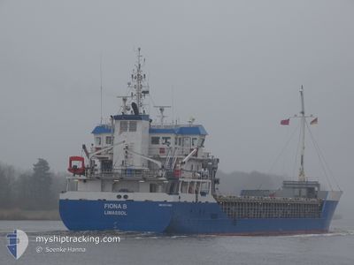
FIONA B
General Cargo
Current Trip
| Time Travelled | 1 day |
|---|---|
| Remaining Time | 3 days |
| Distance Travelled | 444.61 nm |
| Remaining Distance | 855.24 nm |
| AVG Speed | 10.3 Knots |
| MAX Speed | 11.3 Knots |
| AVG Wind | 13.8 knots |
| MAX Wind | 22.9 knots |
| MIN Temp | 7.8°C / 46.04°F |
| MAX Temp | 22.5°C / 72.5°F |
| Draught | 5.6 m |
| Position Received | 11 m ago |
Current Position
| Longitude | 16.55853° |
|---|---|
| Latitude | 56.09640° |
| Status | Under way using engine |
| Speed | 10.4 Knots |
| Course | 238.3° |
| Area | Baltic Sea |
| Station | T-AIS |
| Position Received | 11 m ago |
Info
Information
The current position of FIONA B is in Baltic Sea with coordinates 56.09640° / 16.55853° as reported on 2024-05-18 04:05 by AIS to our vessel tracker app. The vessel's current speed is 10.4 Knots and is heading at the port of SHEERNESS. The estimated time of arrival as calculated by vessel tracking app is 2024-05-21 13:38 LT
The vessel FIONA B (IMO: 9574303, MMSI: 210529000) is a General Cargo that was built in 2012 ( 12 years old ). It's sailing under the flag of [CY] Cyprus.
In this page you can find informations about the vessels current position, last detected port calls, and current voyage information. If the vessels is not in coverage by AIS you will find the latest position.
The current position of FIONA B is detected by our AIS receivers and we are not responsible for the reliability of the data. The last position was recorded while the vessel was in Coverage by the Ais receivers of our vessel tracking app.
The current draught of FIONA B as reported by AIS is 5.6 meters
Weather
| Temperature | 10.2°C / 50.36°F |
|---|---|
| Wind Speed | 11 knots |
| Direction | 94° E |
| Pressure | 1017.2 hPa |
| Humidity | 87 % |
| Cloud Coverage | 6 % |
Featured Company
Last Port Calls
| Port | Arrival | Departure | Time In Port |
|---|---|---|---|
| 2024-05-13 23:36 | 2024-05-16 10:24 | 2 d | |
| 2024-05-05 16:28 | 2024-05-08 16:50 | 3 d | |
| 2024-05-02 11:50 | 2024-05-03 13:46 | 1 d | |
| 2024-04-29 19:24 | 2024-04-30 15:14 | 19 h | |
| 2024-04-26 19:51 | 2024-04-27 13:39 | 17 h | |
| 2024-04-24 18:48 | 2024-04-26 12:38 | 1 d | |
| 2024-04-18 13:03 | 2024-04-20 15:22 | 2 d | |
| 2024-04-15 16:26 | 2024-04-16 16:19 | 23 h | |
| 2024-04-11 19:59 | 2024-04-12 20:59 | 1 d | |
| 2024-04-10 18:55 | 2024-04-10 19:38 | 43 m |
Most Visited Ports (Last year)
| Port | Arrivals | |
|---|---|---|
| 9 | ||
| 8 | ||
| 6 | ||
| 5 | ||
| 5 | ||
| 4 |
Last Trips
| Origin | Departure | Destination | Arrival | Distance | |
|---|---|---|---|---|---|
| 2024-05-08 18:50 | 2024-05-14 02:36 | 1051.66 nm | |||
| 2024-05-03 14:46 | 2024-05-05 18:28 | 222.42 nm | |||
| 2024-04-30 16:14 | 2024-05-02 12:50 | 246.84 nm | |||
| 2024-04-27 15:39 | 2024-04-29 20:24 | 525.29 nm | |||
| 2024-04-26 14:38 | 2024-04-26 21:51 | 91.66 nm | |||
| 2024-04-20 16:22 | 2024-04-24 20:48 | 1089.99 nm | |||
| 2024-04-16 17:19 | 2024-04-18 14:03 | 353.02 nm | |||
| 2024-04-12 21:59 | 2024-04-15 17:26 | 686.72 nm | |||
| 2024-04-10 20:38 | 2024-04-11 20:59 | 79.02 nm | |||
| 2024-04-04 19:08 | 2024-04-10 19:55 | 737.96 nm |
Events
| Time | Event | Details | Position / Dest | Info |
|---|---|---|---|---|
| 2024-05-17 23:16 | Detected in Sea | Swedish part of the Baltic Sea |
56.60444 / 17.78204
Baltic Sea
GBSHS
|
Speed: 10.6 kn Course: 232.2° |
| 2024-05-17 23:15 | Status Changed | Under way using engine Default |
56.60565 / 17.78489
GBSHS
|
Speed: 10.6 kn Course: 233° |
| 2024-05-17 23:09 | IN Coverage |
56.60444 / 17.78204
Baltic Sea
GBSHS
|
Speed: 10.6 kn Course: 232.2° |
|
| 2024-05-17 03:16 | OUT of Coverage |
59.33092 / 22.03487
Baltic Sea
GBSHS
|
Speed: 11 kn Course: 232.9° |
|
| 2024-05-17 03:07 | Detected in Sea | Estonian part of the Baltic Sea |
59.34773 / 22.07528
Baltic Sea
GBSHS
|
Speed: 11 kn Course: 230.8° |
| 2024-05-17 03:07 | Status Changed | Under way using engine Default |
59.34839 / 22.07684
GBSHS
|
Speed: 10.9 kn Course: 231° |
| 2024-05-17 03:07 | IN Coverage |
59.34773 / 22.07528
Baltic Sea
GBSHS
|
Speed: 11 kn Course: 230.8° |
|
| 2024-05-17 02:13 | Status Changed | Default Under way using engine |
59.45146 / 22.32854
GBSHS
|
Speed: 11 kn Course: 231.1° |
| 2024-05-17 02:00 | OUT of Coverage |
59.47836 / 22.39233
Baltic Sea
GBSHS
|
Speed: 11 kn Course: 231.1° |
|
| 2024-05-16 23:59 | Detected in Sea | Finnish part of the Baltic Sea |
59.60597 / 23.07845
Baltic Sea
GBSHS
|
Speed: 11.1 kn Course: 254.6° |