
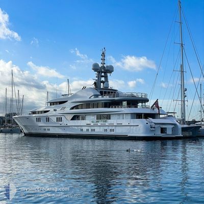
FIREBIRD
Yacht
Current Trip
| Time Travelled | 15 days |
|---|---|
| Remaining Time | --- |
| Distance Travelled | 274.84 nm |
| Remaining Distance | --- |
| AVG Speed | 11.2 Knots |
| MAX Speed | 14.3 Knots |
| AVG Wind | 7.6 knots |
| MAX Wind | 18.8 knots |
| MIN Temp | 20.6°C / 69.08°F |
| MAX Temp | 36.8°C / 98.24°F |
| Draught | 3.6 m |
| Position Received | 2 m ago |
Current Position
| Longitude | 22.97178° |
|---|---|
| Latitude | 37.97657° |
| Status | At anchor |
| Speed | |
| Course | 330° |
| Area | Ionian Sea |
| Station | T-AIS |
| Position Received | 2 m ago |
Info
Information
The current position of FIREBIRD is in Ionian Sea with coordinates 37.97657° / 22.97178° as reported on 2024-06-19 22:34 by AIS to our vessel tracker app. The vessel's current speed is 0 Knots
The vessel FIREBIRD (IMO: 1008994, MMSI: 319271000) is a Yacht that was built in 2007 ( 17 years old ). It's sailing under the flag of [KY] Cayman Is.
In this page you can find informations about the vessels current position, last detected port calls, and current voyage information. If the vessels is not in coverage by AIS you will find the latest position.
The current position of FIREBIRD is detected by our AIS receivers and we are not responsible for the reliability of the data. The last position was recorded while the vessel was in Coverage by the Ais receivers of our vessel tracking app.
The current draught of FIREBIRD as reported by AIS is 3.6 meters
Weather
| Temperature | 24.7°C / 76.46°F |
|---|---|
| Wind Speed | 2 knots |
| Direction | 4° N |
| Pressure | 1015.6 hPa |
| Humidity | 47.4 % |
| Cloud Coverage | --- |
Featured Company
Events
| Time | Event | Details | Position / Dest | Info |
|---|---|---|---|---|
| 2024-06-19 20:25 | IN Coverage |
37.97715 / 22.97113
Ionian Sea
|
Speed: 0.1 kn Course: 221.3° |
|
| 2024-06-19 18:46 | OUT of Coverage |
37.97681 / 22.97091
Ionian Sea
|
Speed: Course: 221.3° |
|
| 2024-06-19 17:01 | IN Coverage |
37.97709 / 22.97151
Ionian Sea
|
Speed: 0.1 kn Course: 266° |
|
| 2024-06-19 15:52 | OUT of Coverage |
37.97727 / 22.97163
Ionian Sea
|
Speed: 0.2 kn Course: 335.5° |
|
| 2024-06-19 12:31 | IN Coverage |
37.97606 / 22.97170
Ionian Sea
|
Speed: 0.1 kn Course: 124.9° |
|
| 2024-06-19 11:28 | OUT of Coverage |
37.97667 / 22.97163
Ionian Sea
|
Speed: 0.4 kn Course: 171° |
|
| 2024-06-17 16:07 | ETA Changed | 2024/06/15 13:00 2024/06/13 14:00 |
37.97757 / 22.97096
LOUTRAKI
|
Speed: Course: 164° |
| 2024-06-17 14:10 | IN Coverage |
37.97749 / 22.97150
Ionian Sea
|
Speed: Course: 165.3° |
|
| 2024-06-17 13:01 | OUT of Coverage |
37.97638 / 22.97204
Ionian Sea
|
Speed: 0.5 kn Course: 41.3° |
|
| 2024-06-17 11:24 | IN Coverage |
37.97669 / 22.97224
Ionian Sea
|
Speed: 0.5 kn Course: 15.5° |