
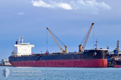
FLAG EVI
Bulk Carrier
Current Trip
| Time Travelled | 15 h, 42 mins |
|---|---|
| Remaining Time | 1 h, 54 mins |
| Distance Travelled | 141.69 nm |
| Remaining Distance | 17.64 nm |
| AVG Speed | 8.6 Knots |
| MAX Speed | 12.9 Knots |
| AVG Wind | 3.9 knots |
| MAX Wind | 7 knots |
| MIN Temp | 29.3°C / 84.74°F |
| MAX Temp | 32.4°C / 90.32°F |
| Draught | 14.4 m |
| Position Received | 2 m ago |
Current Position
| Longitude | 56.49613° |
|---|---|
| Latitude | 25.20561° |
| Status | At anchor |
| Speed | 0.1 Knots |
| Course | 161° |
| Area | Gulf of Oman |
| Station | T-AIS |
| Position Received | 2 m ago |
Info
Information
The current position of FLAG EVI is in Gulf of Oman with coordinates 25.20561° / 56.49613° as reported on 2024-05-17 18:58 by AIS to our vessel tracker app. The vessel's current speed is 0.1 Knots and is heading at the port of FUJAIRAH. The estimated time of arrival as calculated by vessel tracking app is 2024-05-17 20:55 LT
The vessel FLAG EVI (IMO: 9619799, MMSI: 373562000) is a Bulk Carrier that was built in 2014 ( 10 years old ). It's sailing under the flag of [PA] Panama.
In this page you can find informations about the vessels current position, last detected port calls, and current voyage information. If the vessels is not in coverage by AIS you will find the latest position.
The current position of FLAG EVI is detected by our AIS receivers and we are not responsible for the reliability of the data. The last position was recorded while the vessel was in Coverage by the Ais receivers of our vessel tracking app.
The current draught of FLAG EVI as reported by AIS is 14.4 meters
Weather
| Temperature | 31.5°C / 88.7°F |
|---|---|
| Wind Speed | 7 knots |
| Direction | 184° S |
| Pressure | 1007.5 hPa |
| Humidity | 57.2 % |
| Cloud Coverage | --- |
Featured Company
Last Trips
| Origin | Departure | Destination | Arrival | Distance | |
|---|---|---|---|---|---|
| 2024-03-14 07:02 | 2024-05-14 14:43 | 7099.08 nm | |||
| 2024-02-07 20:54 | 2024-03-10 15:50 | 491.58 nm |
Events
| Time | Event | Details | Position / Dest | Info |
|---|---|---|---|---|
| 2024-05-17 18:46 | Status Changed | At anchor Default |
25.20555 / 56.49613
AE FJR
|
Speed: 0.1 kn Course: 156° |
| 2024-05-17 18:43 | Status Changed | Default At anchor |
25.20556 / 56.49607
AE FJR
|
Speed: 0.2 kn Course: 155° |
| 2024-05-17 16:52 | Status Changed | At anchor Under way using engine |
25.20437 / 56.49838
AE FJR
|
Speed: 0.6 kn Course: 223° |
| 2024-05-17 16:49 | STOP Moving | 8.01 nm, North East of FUJAIRAH |
25.20398 / 56.49842
AE FJR
|
Speed: 0.3 kn Course: 219° |
| 2024-05-17 12:37 | Change Sea Area | United Arab Emirates part of the Gulf of Oman Omani part of the Gulf of Oman |
25.67054 / 56.68906
Gulf of Oman
AE FJR
|
Speed: 11.5 kn Course: 177.5° |
| 2024-05-17 11:20 | ETA Changed | 2024/05/17 16:00 2024/05/17 12:00 |
25.91738 / 56.66794
AE FJR
|
Speed: 11.2 kn Course: 171.4° |
| 2024-05-17 11:17 | Detected in Sea | Omani part of the Gulf of Oman |
25.92676 / 56.66663
Gulf of Oman
AE FJR
|
Speed: 11.3 kn Course: 179.1° |
| 2024-05-17 11:16 | Status Changed | Under way using engine Default |
25.93113 / 56.66658
AE FJR
|
Speed: 11.3 kn Course: 177° |
| 2024-05-17 11:13 | IN Coverage |
25.92676 / 56.66663
Gulf of Oman
AE FJR
|
Speed: 11.3 kn Course: 179.1° |
|
| 2024-05-17 04:26 | OUT of Coverage |
26.15109 / 56.00944
Persian Gulf
AE FJR
|
Speed: 11.4 kn Course: 4.5° |