
FLAG
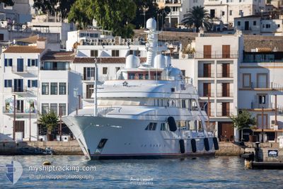
Yacht
Current Trip
TAORMINA
| Time Travelled | 8 days |
|---|---|
| Remaining Time | --- |
| Distance Travelled | 740.08 nm |
| Remaining Distance | --- |
| AVG Speed | 11.2 Knots |
| MAX Speed | 14.6 Knots |
| AVG Wind | 5.6 knots |
| MAX Wind | 17.9 knots |
| MIN Temp | 13.3°C / 55.94°F |
| MAX Temp | 27.1°C / 80.78°F |
| Draught | 3.3 m |
| Position Received | 1 m ago |
Current Position
| Longitude | 17.34158° |
|---|---|
| Latitude | 37.99443° |
| Status | Under way using engine |
| Speed | 14.3 Knots |
| Course | 81.1° |
| Area | Ionian Sea |
| Station | T-AIS |
| Position Received | 1 m ago |
Info
Information
The current position of FLAG is in Ionian Sea with coordinates 37.99443° / 17.34158° as reported on 2024-06-01 20:41 by AIS to our vessel tracker app. The vessel's current speed is 14.3 Knots
The vessel FLAG (IMO: 1006697, MMSI: 319571000) is a Yacht that was built in 2000 ( 24 years old ). It's sailing under the flag of [KY] Cayman Is.
In this page you can find informations about the vessels current position, last detected port calls, and current voyage information. If the vessels is not in coverage by AIS you will find the latest position.
The current position of FLAG is detected by our AIS receivers and we are not responsible for the reliability of the data. The last position was recorded while the vessel was in Coverage by the Ais receivers of our vessel tracking app.
The current draught of FLAG as reported by AIS is 3.3 meters
Weather
| Temperature | 21.9°C / 71.42°F |
|---|---|
| Wind Speed | 6 knots |
| Direction | 149° SSE |
| Pressure | 1017 hPa |
| Humidity | 78.9 % |
| Cloud Coverage | 13 % |
Featured Company
Most Visited Ports (Last year)
| Port | Arrivals | |
|---|---|---|
| 9 | ||
| 6 | ||
| 5 | ||
| 5 | ||
| 3 | ||
| 2 |
Events
| Time | Event | Details | Position / Dest | Info |
|---|---|---|---|---|
| 2024-06-01 19:37 | IN Coverage |
37.95725 / 17.02290
Ionian Sea
|
Speed: 14.4 kn Course: 81.5° |
|
| 2024-06-01 15:58 | OUT of Coverage |
37.83518 / 15.93633
Ionian Sea
|
Speed: 14.3 kn Course: 88.8° |
|
| 2024-06-01 13:59 | IN Coverage |
37.83947 / 15.35092
Ionian Sea
|
Speed: 13.8 kn Course: 88.6° |
|
| 2024-06-01 05:33 | OUT of Coverage |
37.85983 / 15.32978
Ionian Sea
TAORMINA
|
Speed: 12.2 kn Course: 219.1° |
|
| 2024-06-01 03:17 | Change Sea Area | Italian part of the Ionian Sea Italian part of the Tyrrhenian Sea |
38.25391 / 15.64263
Ionian Sea
TAORMINA
|
Speed: 14.5 kn Course: 240.6° |
| 2024-05-31 23:26 | Destination Changed | TAORMINA CAPRI |
38.95709 / 15.27509
TAORMINA
|
Speed: 12 kn Course: 157.3° |
| 2024-05-31 23:26 | ETA Changed | 2024/06/01 06:00 2024/05/28 10:00 |
38.95709 / 15.27509
TAORMINA
|
Speed: 12 kn Course: 157.3° |
| 2024-05-31 22:55 | IN Coverage |
39.04863 / 15.22055
Tyrrhenian Sea
|
Speed: 12 kn Course: 154.6° |
|
| 2024-05-31 14:52 | OUT of Coverage |
40.49916 / 14.34623
Tyrrhenian Sea
|
Speed: 12.2 kn Course: 152.5° |
|
| 2024-05-31 13:50 | START Moving | 0.53 nm, North East of SORRENTO |
40.63626 / 14.38500
CAPRI
|
Speed: 6.2 kn Course: 258.4° |