
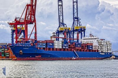
FLEUR N
Container Ship
Current Trip
| Time Travelled | 23 h, 42 mins |
|---|---|
| Remaining Time | 2 days |
| Distance Travelled | 329.84 nm |
| Remaining Distance | 918.96 nm |
| AVG Speed | 11.8 Knots |
| MAX Speed | 15.7 Knots |
| AVG Wind | 13.8 knots |
| MAX Wind | 22 knots |
| MIN Temp | 20.9°C / 69.62°F |
| MAX Temp | 22.7°C / 72.86°F |
| Draught | 11.3 m |
| Position Received | 1 h, 8 m ago |
Current Position
| Longitude | 6.20640° |
|---|---|
| Latitude | 38.48781° |
| Status | Under way using engine |
| Speed | 14.9 Knots |
| Course | 101° |
| Area | Mediterranean Sea - Western Basin |
| Station | T-AIS |
| Position Received | 1 h, 8 m ago |
Info
Information
The current position of FLEUR N is in Mediterranean Sea - Western Basin with coordinates 38.48781° / 6.20640° as reported on 2024-06-06 10:52 by AIS to our vessel tracker app. The vessel's current speed is 14.9 Knots and is heading at the port of PIRAEUS. The estimated time of arrival as calculated by vessel tracking app is 2024-06-09 02:06 LT
The vessel FLEUR N (IMO: 9509138, MMSI: 636019931) is a Container Ship that was built in 2012 ( 12 years old ). It's sailing under the flag of [LR] Liberia.
In this page you can find informations about the vessels current position, last detected port calls, and current voyage information. If the vessels is not in coverage by AIS you will find the latest position.
The current position of FLEUR N is detected by our AIS receivers and we are not responsible for the reliability of the data. The last position was recorded while the vessel was in Coverage by the Ais receivers of our vessel tracking app.
The current draught of FLEUR N as reported by AIS is 11.3 meters
Weather
| Temperature | 22.4°C / 72.32°F |
|---|---|
| Wind Speed | 10 knots |
| Direction | 100° E |
| Pressure | 1019.4 hPa |
| Humidity | 72.7 % |
| Cloud Coverage | 3 % |
Featured Company
Last Port Calls
| Port | Arrival | Departure | Time In Port |
|---|---|---|---|
| 2024-06-05 03:55 | 2024-06-05 12:19 | 8 h | |
| 2024-06-03 15:24 | 2024-06-05 03:49 | 1 d | |
| 2024-05-27 18:37 | 2024-05-29 00:33 | 1 d | |
| 2024-05-14 23:25 | 2024-05-16 12:28 | 1 d | |
| 2024-05-14 08:34 | 2024-05-14 17:48 | 9 h | |
| 2024-05-10 17:03 | 2024-05-11 17:26 | 1 d | |
| 2024-05-08 02:52 | 2024-05-08 12:12 | 9 h | |
| 2024-05-06 10:57 | 2024-05-07 18:01 | 1 d | |
| 2024-04-29 13:13 | 2024-04-30 03:56 | 14 h | |
| 2024-04-22 18:25 | 2024-04-23 16:31 | 22 h |
Most Visited Ports (Last year)
| Port | Arrivals | |
|---|---|---|
| 14 | ||
| 9 | ||
| 8 | ||
| 7 | ||
| 7 | ||
| 6 |
Last Trips
| Origin | Departure | Destination | Arrival | Distance | |
|---|---|---|---|---|---|
| 2024-06-05 05:49 | 2024-06-05 05:55 | 0.68 nm | |||
| 2024-05-29 02:33 | 2024-06-03 17:24 | 1830.70 nm | |||
| 2024-05-16 14:28 | 2024-05-27 20:37 | 3326.53 nm | |||
| 2024-05-11 20:26 | 2024-05-15 01:25 | 777.36 nm | |||
| 2024-05-11 20:26 | 2024-05-14 10:34 | 633.83 nm | |||
| 2024-05-07 20:01 | 2024-05-10 20:03 | 776.91 nm | |||
| 2024-05-07 20:01 | 2024-05-08 04:52 | 58.14 nm | |||
| 2024-04-30 05:56 | 2024-05-06 12:57 | 1663.99 nm | |||
| 2024-04-23 18:31 | 2024-04-29 15:13 | 1845.01 nm | |||
| 2024-04-08 10:37 | 2024-04-22 20:25 | 3330.47 nm |
Events
| Time | Event | Details | Position / Dest | Info |
|---|---|---|---|---|
| 2024-06-06 10:57 | Status Changed | Default Under way using engine |
38.48350 / 6.23448
ESVLC > GRPIR
|
Speed: 14.9 kn Course: 101° |
| 2024-06-06 10:52 | OUT of Coverage |
38.48781 / 6.20640
Mediterranean Sea - Western Basin
ESVLC > GRPIR
|
Speed: 14.9 kn Course: 101° |
|
| 2024-06-06 09:37 | ETA Changed | 2024/06/09 03:00 2024/06/08 23:00 |
38.54780 / 5.81763
ESVLC > GRPIR
|
Speed: 14.5 kn Course: 101.7° |
| 2024-06-06 08:55 | Change Sea Area | Algerian part of the Mediterranean Sea - Western Basin Spanish part of the Mediterranean Sea - Western Basin |
38.58003 / 5.60387
Mediterranean Sea - Western Basin
ESVLC > GRPIR
|
Speed: 14.6 kn Course: 96.8° |
| 2024-06-06 08:48 | Status Changed | Under way using engine Default |
38.58330 / 5.57028
ESVLC > GRPIR
|
Speed: 14.6 kn Course: 98° |
| 2024-06-06 08:45 | Status Changed | Default Under way using engine |
38.58485 / 5.55544
ESVLC > GRPIR
|
Speed: 14.6 kn Course: 98.8° |
| 2024-06-06 08:40 | Status Changed | Under way using engine Default |
38.58793 / 5.52855
ESVLC > GRPIR
|
Speed: 14.6 kn Course: 100° |
| 2024-06-06 08:37 | Status Changed | Default Under way using engine |
38.58956 / 5.51554
ESVLC > GRPIR
|
Speed: 14.6 kn Course: 101.2° |
| 2024-06-06 04:46 | IN Coverage |
38.77972 / 4.30742
Mediterranean Sea - Western Basin
ESVLC > GRPIR
|
Speed: 14.7 kn Course: 101.1° |
|
| 2024-06-06 03:43 | OUT of Coverage |
38.82977 / 3.98138
Mediterranean Sea - Western Basin
ESVLC > GRPIR
|
Speed: 14.8 kn Course: 101.2° |