
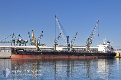
FLORA K
Cargo
Current Trip
| Time Travelled | 22 days |
|---|---|
| Remaining Time | --- |
| Distance Travelled | 4539.68 nm |
| Remaining Distance | --- |
| AVG Speed | 11.2 Knots |
| MAX Speed | 13.7 Knots |
| AVG Wind | 12.8 knots |
| MAX Wind | 22.8 knots |
| MIN Temp | 18.2°C / 64.76°F |
| MAX Temp | 28.6°C / 83.48°F |
| Draught | 8 m |
| Position Received | 1 d ago |
Current Position
| Longitude | -47.19508° |
|---|---|
| Latitude | -25.75385° |
| Status | Under way using engine |
| Speed | 11.3 Knots |
| Course | 274.9° |
| Area | South Atlantic Ocean |
| Station | T-AIS |
| Position Received | 1 d ago |
Info
Information
The current position of FLORA K is in South Atlantic Ocean with coordinates -25.75385° / -47.19508° as reported on 2024-06-14 14:54 by AIS to our vessel tracker app. The vessel's current speed is 11.3 Knots
The vessel FLORA K (IMO: 9708538, MMSI: 256740000) is a Cargo It's sailing under the flag of [MT] Malta.
In this page you can find informations about the vessels current position, last detected port calls, and current voyage information. If the vessels is not in coverage by AIS you will find the latest position.
The current position of FLORA K is detected by our AIS receivers and we are not responsible for the reliability of the data. The last position was recorded while the vessel was in Coverage by the Ais receivers of our vessel tracking app.
The current draught of FLORA K as reported by AIS is 8 meters
Weather
| Temperature | 22°C / 71.6°F |
|---|---|
| Wind Speed | 4 knots |
| Direction | 261° W |
| Pressure | 1016.7 hPa |
| Humidity | 81.8 % |
| Cloud Coverage | 6 % |
Featured Company
Last Port Calls
| Port | Arrival | Departure | Time In Port |
|---|---|---|---|
| 2024-05-22 12:21 | 2024-05-24 11:06 | 1 d | |
| 2024-05-18 15:06 | 2024-05-21 10:24 | 2 d | |
| 2024-05-01 11:36 | 2024-05-04 12:13 | 3 d | |
| 2024-04-28 05:43 | 2024-04-29 18:34 | 1 d | |
| 2024-04-21 07:07 | 2024-04-25 15:56 | 4 d | |
| 2024-04-09 11:55 | 2024-04-19 18:26 | 10 d |
Most Visited Ports (Last year)
| Port | Arrivals | |
|---|---|---|
| 2 | ||
| 2 | ||
| 1 | ||
| 1 | ||
| 1 | ||
| 1 |
Last Trips
| Origin | Departure | Destination | Arrival | Distance | |
|---|---|---|---|---|---|
| 2024-05-21 11:24 | 2024-05-22 13:21 | 8.66 nm | |||
| 2024-05-04 14:13 | 2024-05-18 16:06 | 1550.51 nm | |||
| 2024-04-29 20:34 | 2024-05-01 13:36 | 468.03 nm | |||
| 2024-04-25 17:56 | 2024-04-28 07:43 | 336.88 nm | |||
| 2024-04-19 19:26 | 2024-04-21 09:07 | 426.03 nm | |||
| 2024-03-22 09:41 | 2024-04-09 12:55 | 1760.89 nm |
Events
| Time | Event | Details | Position / Dest | Info |
|---|---|---|---|---|
| 2024-06-14 20:34 | STOP Moving | 7.59 nm, South East of PONTAL DO SUL |
-25.67833 / -48.29333
PARANAGUA BRAZIL
|
Speed: Course: -1° |
| 2024-06-14 14:58 | Status Changed | Default Under way using engine |
-25.75245 / -47.21141
PARANAGUA BRAZIL
|
Speed: 11.3 kn Course: 274.9° |
| 2024-06-14 14:54 | OUT of Coverage |
-25.75385 / -47.19508
South Atlantic Ocean
PARANAGUA BRAZIL
|
Speed: 11.3 kn Course: 274.9° |
|
| 2024-06-14 14:38 | Status Changed | Under way using engine Default |
-25.75794 / -47.14091
PARANAGUA BRAZIL
|
Speed: 11.2 kn Course: 274° |
| 2024-06-14 14:34 | Status Changed | Default Under way using engine |
-25.75901 / -47.12541
PARANAGUA BRAZIL
|
Speed: 11.2 kn Course: 270.9° |
| 2024-06-14 14:03 | Status Changed | Under way using engine Default |
-25.76130 / -47.02134
PARANAGUA BRAZIL
|
Speed: 11 kn Course: 271° |
| 2024-06-14 14:03 | IN Coverage |
-25.76130 / -47.02134
South Atlantic Ocean
PARANAGUA BRAZIL
|
Speed: 11 kn Course: 272.3° |
|
| 2024-06-13 22:25 | Status Changed | Default Under way using engine |
-25.05932 / -43.79151
PARANAGUA BRAZIL
|
Speed: 10.8 kn Course: 245.8° |
| 2024-06-13 22:20 | Status Changed | Under way using engine Default |
-25.05300 / -43.77641
PARANAGUA BRAZIL
|
Speed: 10.7 kn Course: 245° |
| 2024-06-13 22:20 | OUT of Coverage |
-25.05300 / -43.77641
South Atlantic Ocean
PARANAGUA BRAZIL
|
Speed: 10.8 kn Course: 245.8° |