
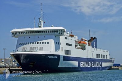
FLORENCIA
Ro-Ro/Passenger Ship
Current Trip
| Time Travelled | 4 h, 58 mins |
|---|---|
| Remaining Time | 15 h, 29 mins |
| Distance Travelled | 93.49 nm |
| Remaining Distance | 311.83 nm |
| AVG Speed | 19.7 Knots |
| MAX Speed | 20.5 Knots |
| AVG Wind | 6.1 knots |
| MAX Wind | 9.2 knots |
| MIN Temp | 24.2°C / 75.56°F |
| MAX Temp | 26.9°C / 80.42°F |
| Draught | 6.1 m |
| Position Received | Now |
Current Position
| Longitude | 18.66267° |
|---|---|
| Latitude | 40.41466° |
| Status | Under way using engine |
| Speed | 19.8 Knots |
| Course | 312° |
| Area | Adriatic Sea |
| Station | T-AIS |
| Position Received | Now |
Info
Information
The current position of FLORENCIA is in Adriatic Sea with coordinates 40.41466° / 18.66267° as reported on 2024-06-25 23:35 by AIS to our vessel tracker app. The vessel's current speed is 19.8 Knots and is heading at the port of ANCONA. The estimated time of arrival as calculated by vessel tracking app is 2024-06-26 15:04 LT
The vessel FLORENCIA (IMO: 9287584, MMSI: 247105900) is a Ro-Ro/Passenger Ship that was built in 2004 ( 20 years old ). It's sailing under the flag of [IT] Italy.
In this page you can find informations about the vessels current position, last detected port calls, and current voyage information. If the vessels is not in coverage by AIS you will find the latest position.
The current position of FLORENCIA is detected by our AIS receivers and we are not responsible for the reliability of the data. The last position was recorded while the vessel was in Coverage by the Ais receivers of our vessel tracking app.
The current draught of FLORENCIA as reported by AIS is 6.1 meters
Weather
| Temperature | 25.8°C / 78.44°F |
|---|---|
| Wind Speed | 7 knots |
| Direction | 30° NNE |
| Pressure | 1010.6 hPa |
| Humidity | 76.6 % |
| Cloud Coverage | 53 % |
Featured Company
Last Port Calls
| Port | Arrival | Departure | Time In Port |
|---|---|---|---|
| 2024-06-25 15:15 | 2024-06-25 18:37 | 3 h | |
| 2024-06-24 16:11 | 2024-06-24 18:53 | 2 h | |
| 2024-06-23 15:01 | 2024-06-23 18:41 | 3 h | |
| 2024-06-22 15:38 | 2024-06-22 18:42 | 3 h | |
| 2024-06-20 05:39 | 2024-06-21 18:45 | 1 d | |
| 2024-06-19 16:40 | 2024-06-19 19:32 | 2 h | |
| 2024-06-18 14:23 | 2024-06-19 09:38 | 19 h | |
| 2024-06-17 15:34 | 2024-06-17 18:03 | 2 h | |
| 2024-06-16 16:20 | 2024-06-16 18:44 | 2 h | |
| 2024-06-15 15:52 | 2024-06-15 19:06 | 3 h |
Most Visited Ports (Last year)
| Port | Arrivals | |
|---|---|---|
| 161 | ||
| 102 | ||
| 1 |
Last Trips
| Origin | Departure | Destination | Arrival | Distance | |
|---|---|---|---|---|---|
| 2024-06-24 20:53 | 2024-06-25 18:15 | 405.11 nm | |||
| 2024-06-23 21:41 | 2024-06-24 18:11 | 405.45 nm | |||
| 2024-06-22 20:42 | 2024-06-23 18:01 | 403.50 nm | |||
| 2024-06-21 21:45 | 2024-06-22 17:38 | 403.92 nm | |||
| 2024-06-19 21:32 | 2024-06-20 08:39 | 132.94 nm | |||
| 2024-06-19 12:38 | 2024-06-19 18:40 | 125.55 nm | |||
| 2024-06-17 20:03 | 2024-06-18 17:23 | 404.38 nm | |||
| 2024-06-16 21:44 | 2024-06-17 17:34 | 406.46 nm | |||
| 2024-06-15 21:06 | 2024-06-16 19:20 | 404.83 nm | |||
| 2024-06-14 21:44 | 2024-06-15 17:52 | 399.10 nm |
Events
| Time | Event | Details | Position / Dest | Info |
|---|---|---|---|---|
| 2024-06-25 22:59 | Change Sea Area | Italian part of the Adriatic Sea Albanian part of the Adriatic Sea |
40.30617 / 18.88250
Adriatic Sea
GRIGO>ITAOI
|
Speed: 20.3 kn Course: 295° |
| 2024-06-25 22:44 | Status Changed | Under way using engine Default |
40.27000 / 18.98083
GRIGO>ITAOI
|
Speed: 20.3 kn Course: 295° |
| 2024-06-25 22:38 | Status Changed | Default Under way using engine |
40.25483 / 19.02183
GRIGO>ITAOI
|
Speed: 20.2 kn Course: 295° |
| 2024-06-25 22:21 | Status Changed | Under way using engine Default |
40.21483 / 19.13033
GRIGO>ITAOI
|
Speed: 20.4 kn Course: 295° |
| 2024-06-25 21:34 | Status Changed | Default Under way using engine |
40.09833 / 19.44117
GRIGO>ITAOI
|
Speed: 20.1 kn Course: 295° |
| 2024-06-25 21:00 | Status Changed | Under way using engine Default |
40.01500 / 19.66350
GRIGO>ITAOI
|
Speed: 19.9 kn Course: 312° |
| 2024-06-25 20:54 | Status Changed | Default Under way using engine |
39.99883 / 19.69967
GRIGO>ITAOI
|
Speed: 19.9 kn Course: 312° |
| 2024-06-25 20:17 | Change Sea Area | Albanian part of the Adriatic Sea Greek part of the Adriatic Sea |
39.86017 / 19.89667
Adriatic Sea
GRIGO>ITAOI
|
Speed: 19.7 kn Course: 312° |
| 2024-06-25 20:05 | Change Sea Area | Greek part of the Adriatic Sea Albanian part of the Adriatic Sea |
39.81633 / 19.96000
Adriatic Sea
GRIGO>ITAOI
|
Speed: 19.6 kn Course: 311° |
| 2024-06-25 19:56 | Draught Changed | 6.1 6 |
39.77600 / 19.97300
GRIGO>ITAOI
|
Speed: 19.2 kn Course: 19° |