
FLORIDA HIGHWAY
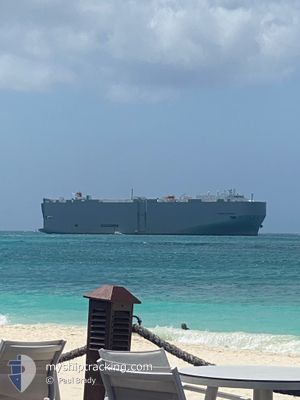
Vehicles Carrier
Current Trip
| Time Travelled | 2 days |
|---|---|
| Remaining Time | 1 day |
| Distance Travelled | 795.15 nm |
| Remaining Distance | 752.69 nm |
| AVG Speed | 14.6 Knots |
| MAX Speed | 18 Knots |
| AVG Wind | 7.3 knots |
| MAX Wind | 16 knots |
| MIN Temp | 12.8°C / 55.04°F |
| MAX Temp | 20.5°C / 68.9°F |
| Draught | 9.3 m |
| Position Received | 1 d ago |
Current Position
| Longitude | -54.03943° |
|---|---|
| Latitude | -34.85798° |
| Status | Under way using engine |
| Speed | 16.5 Knots |
| Course | 58° |
| Area | South Atlantic Ocean |
| Station | T-AIS |
| Position Received | 1 d ago |
Info
Information
The current position of FLORIDA HIGHWAY is in South Atlantic Ocean with coordinates -34.85798° / -54.03943° as reported on 2024-05-31 00:48 by AIS to our vessel tracker app. The vessel's current speed is 16.5 Knots and is heading at the port of BAIA DE VITORIA. The estimated time of arrival as calculated by vessel tracking app is 2024-06-02 23:43 LT
The vessel FLORIDA HIGHWAY (IMO: 9442861, MMSI: 372805000) is a Vehicles Carrier that was built in 2008 ( 16 years old ). It's sailing under the flag of [PA] Panama.
In this page you can find informations about the vessels current position, last detected port calls, and current voyage information. If the vessels is not in coverage by AIS you will find the latest position.
The current position of FLORIDA HIGHWAY is detected by our AIS receivers and we are not responsible for the reliability of the data. The last position was recorded while the vessel was in Coverage by the Ais receivers of our vessel tracking app.
The current draught of FLORIDA HIGHWAY as reported by AIS is 9.3 meters
Weather
| Temperature | 20.5°C / 68.9°F |
|---|---|
| Wind Speed | 15 knots |
| Direction | 23° NNE |
| Pressure | 1023.6 hPa |
| Humidity | 63.4 % |
| Cloud Coverage | 100 % |
Featured Company
Last Port Calls
| Port | Arrival | Departure | Time In Port |
|---|---|---|---|
| 2024-05-26 09:37 | 2024-05-29 16:23 | 3 d | |
| 2024-05-22 17:39 | 2024-05-22 23:24 | 5 h | |
| 2024-05-20 11:20 | 2024-05-22 02:28 | 1 d | |
| 2024-05-18 00:15 | 2024-05-19 12:16 | 1 d | |
| 2024-05-17 23:29 | 2024-05-17 23:35 | 6 m | |
| 2024-05-12 20:03 | 2024-05-13 11:52 | 15 h | |
| 2024-05-09 18:56 | 2024-05-10 14:41 | 19 h | |
| 2024-05-02 07:29 | 2024-05-04 20:15 | 2 d | |
| 2024-04-26 04:10 | 2024-04-27 01:31 | 21 h | |
| 2024-04-24 19:00 | 2024-04-25 18:51 | 23 h |
Most Visited Ports (Last year)
| Port | Arrivals | |
|---|---|---|
| 10 | ||
| 6 | ||
| 6 | ||
| 6 | ||
| 5 | ||
| 5 |
Last Trips
| Origin | Departure | Destination | Arrival | Distance | |
|---|---|---|---|---|---|
| 2024-05-22 20:24 | 2024-05-26 06:37 | 978.69 nm | |||
| 2024-05-21 23:28 | 2024-05-22 14:39 | 175.81 nm | |||
| 2024-05-19 09:16 | 2024-05-20 08:20 | 251.42 nm | |||
| 2024-05-17 20:35 | 2024-05-17 21:15 | 1.21 nm | |||
| 2024-05-13 08:52 | 2024-05-17 20:29 | 1182.07 nm | |||
| 2024-05-10 11:41 | 2024-05-12 17:03 | 825.79 nm | |||
| 2024-05-04 17:15 | 2024-05-09 15:56 | 1515.47 nm | |||
| 2024-04-26 22:31 | 2024-05-02 04:29 | 925.38 nm | |||
| 2024-04-25 15:51 | 2024-04-26 01:10 | 104.52 nm | |||
| 2024-04-23 10:55 | 2024-04-24 16:00 | 242.69 nm |
Events
| Time | Event | Details | Position / Dest | Info |
|---|---|---|---|---|
| 2024-05-31 00:52 | Status Changed | Default Under way using engine |
-34.84922 / -54.02230
ARZAE>BRVIX
|
Speed: 16.5 kn Course: 58° |
| 2024-05-31 00:48 | OUT of Coverage |
-34.85798 / -54.03943
South Atlantic Ocean
ARZAE>BRVIX
|
Speed: 16.5 kn Course: 58° |
|
| 2024-05-31 00:45 | Status Changed | Under way using engine Default |
-34.86417 / -54.05163
ARZAE>BRVIX
|
Speed: 16.1 kn Course: 57° |
| 2024-05-31 00:27 | Status Changed | Default Under way using engine |
-34.90840 / -54.13849
ARZAE>BRVIX
|
Speed: 16 kn Course: 63° |
| 2024-05-31 00:21 | Status Changed | Under way using engine Default |
-34.91992 / -54.16637
ARZAE>BRVIX
|
Speed: 15.9 kn Course: 62° |
| 2024-05-31 00:15 | Status Changed | Default Under way using engine |
-34.93288 / -54.19625
ARZAE>BRVIX
|
Speed: 15.7 kn Course: 63° |
| 2024-05-31 00:11 | Status Changed | Under way using engine Default |
-34.94072 / -54.21448
ARZAE>BRVIX
|
Speed: 15.6 kn Course: 62° |
| 2024-05-31 00:06 | Status Changed | Default Under way using engine |
-34.94937 / -54.23488
ARZAE>BRVIX
|
Speed: 15 kn Course: 62° |
| 2024-05-31 00:02 | Status Changed | Under way using engine Default |
-34.95713 / -54.25290
ARZAE>BRVIX
|
Speed: 15.2 kn Course: 62° |
| 2024-05-30 23:58 | Status Changed | Default Under way using engine |
-34.96472 / -54.27042
ARZAE>BRVIX
|
Speed: 15.5 kn Course: 62° |